
A Simple Olympic Sculpture Park Waterfront Walk
Follow Olympic Sculpture Park’s Z path to the shore, extend into Myrtle Edwards Park, and plan transit, accessibility and rain options.
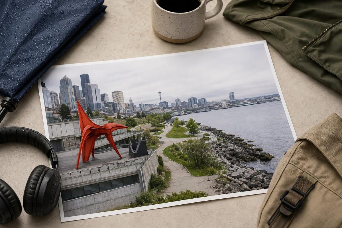
The most useful route is not a lap around the park. Start at the PACCAR Pavilion, follow the sculpture park’s Z-shaped path downhill to Elliott Bay, then continue north into Myrtle Edwards Park before retracing your steps. Allow about 60–90 minutes at an unhurried art-viewing pace; add more time if you want to linger at the beach coves.
The core sculpture-park path is 2,200 feet long. Seattle Art Museum’s map places major works including The Eagle, Wake, Echo and Seattle Cloud Cover along the route, so there is no need to build a complicated sculpture checklist (Seattle Art Museum park map).
The route, step by step
1. Begin at Western Avenue and Broad Street
Use the main address, 2901 Western Avenue, as your starting point. The PACCAR Pavilion is the useful orientation anchor rather than the finish: it has restrooms and a water fountain and is open daily from 9 a.m. to 4 p.m. The outdoor park opens 30 minutes before sunrise and closes 30 minutes after sunset (Seattle Art Museum).
Visit Seattle advises checking each museum’s own website ahead of time. For this park, no ticket or reservation is needed for a normal self-guided walk: it is free and open every day. Guided group visits are different—groups of 10 or more must send a reservation request at least three weeks ahead (Seattle Art Museum).
2. Follow the Z path rather than taking the quickest line downhill
The Z path is the walk. It threads together the park’s meadow, grove and valley landscapes while gradually moving from the city side toward the water. Use the official map on your phone and pause at whichever works hold your attention; The Eagle and Wake are useful visual anchors, but the route works better as a sequence than as a scavenger hunt.
Do not ride through the sculpture park. SAM requires bicycles, e-bikes and scooters to be walked, and asks visitors not to touch or climb on sculptures (Seattle Art Museum park map).
3. Cross toward the shore and pocket beach
Continue across the bridge section and descend to the waterfront pathways. This is where the park’s structure makes sense: the nine-acre site connects art, rail infrastructure, roadway and shoreline rather than hiding the working waterfront. At the shore, the pocket beach includes native planting and habitat intended to support salmon recovery (Seattle Art Museum).
4. Extend north into Myrtle Edwards Park
At the waterfront, turn north and continue directly into adjacent Myrtle Edwards Park. Its refreshed pedestrian paths and two expanded beach coves fully reopened on June 4, 2026; the city also lists seating, native planting and improved accessibility at the coves (Seattle Parks and Recreation).
Make the first or second cove your turnaround point. This extension adds open shoreline and a quieter walking rhythm without turning the outing into a long waterfront trek. Return south the same way, then climb the Z path back to Western Avenue.
If you would rather continue toward downtown, head south from the sculpture park onto the Alaskan Way greenway. The city says this bidirectional, multi-use connection runs between the Olympic Sculpture Park and Pier 62, with benches, lighting and planting along the way (Seattle Department of Transportation). That makes it possible to connect this walk with the broader Seattle Waterfront Park sequence, but it is a different, longer outing.
Accessibility and practical choices
The official map identifies both the Z path and waterfront pathways as wheelchair accessible. Because the main route descends and then climbs back, visitors who want the gentlest outing can turn around at the shore rather than adding Myrtle Edwards. ADA parking spaces in the on-site garage are first come, first served (Seattle Art Museum).
For car-free arrival, Sound Transit directs riders to take the 1 Line to Westlake Station and walk about a mile northwest to the park (Sound Transit). Check a live trip planner if that walk is not suitable, because bus service is more sensitive to routing and stop changes.
Do not plan around the Waterfront Shuttle for an autumn 2026 visit. Its 2026 season ran only through September 7, although its stops had included Olympic Sculpture Park (Waterfront Park Seattle).
What to do if it rains
Light rain need not cancel the route: shorten the Myrtle Edwards extension, keep the PACCAR Pavilion as the dry beginning and end, and wear a waterproof outer layer with shoes that handle wet pavement. The pavilion is a limited shelter rather than a full rainy-day substitute, and it closes earlier than the outdoor park.
In sustained rain or strong waterfront wind, save the sculpture walk for a better weather window and switch to an indoor cluster. The Seattle rainy-day neighborhood itinerary is the more useful plan when an exposed waterfront walk no longer sounds enjoyable.