
How to Explore the Waterfront Without Overplanning Your Day
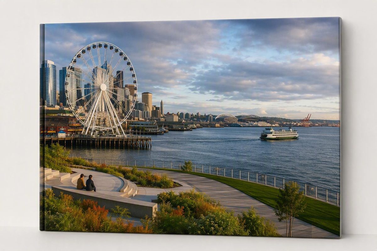
Seattle Waterfront Park is easiest to understand as a sequence of connected public spaces, not as one attraction. Choose a single anchor—Pike Place Market, a playground, a ferry sailing, public art, or Habitat Beach—then connect it to two or three nearby places. Keep one indoor or weather-ready alternative available.
That approach leaves room for changing weather, construction, events, elevator availability, and the separate operating hours of ferries and commercial attractions. It also prevents a waterfront outing from becoming a checklist of every pier.
Seattle Waterfront Park at a Glance
Waterfront Park is an approximately 20-acre network along Seattle’s central waterfront. It is not a conventional enclosed park with one entrance, one lawn, and clearly defined edges. Instead, promenades, piers, elevated walkways, habitat areas, play spaces, public art, and connections to downtown unfold along and above Alaskan Way.
Official descriptions frame its extent somewhat differently. The City describes the park as extending from Pioneer Square and the stadiums to Pier 62, while Friends of Waterfront Park describes a broader connection between Pioneer Square and Belltown. For first-time visitors, the practical point is that the park connects the stadium and Pioneer Square area in the south with Colman Dock, the central piers, Pike Place Market, and Pier 62 farther north.
The City lists general operating hours of 7 a.m. to 10 p.m. daily unless otherwise posted and gives 1401 Alaskan Way, Seattle, WA 98101 as a reference address. That address is useful for orientation, but it is not the park’s only entrance—or necessarily the best one for your plans. A linear park has several practical approaches, including Pike Place Market and Overlook Walk, Pier 62, Colman Dock, Pioneer Square, and Railroad Way South. The approximately 20-acre size, general hours, address, and southern-to-northern extent are documented on the City’s Waterfront Park page.
This guide focuses on six principal public spaces:
- Railroad Way South
- Pioneer Square Habitat Beach
- Park Promenade
- Pier 58
- Overlook Walk
- Pier 62
Together, these areas can support a compact downtown walk, a family play outing, a ferry connection, an art-focused route, a cycling trip, or a longer exploration toward Pioneer Square and the stadiums. Friends of Waterfront Park provides an overview of the six named park areas and their visitor features.
Do not assume the park’s general hours apply to every facility. Restrooms, elevators, cafes, concessions, events, ferries, cruises, and ticketed attractions may open later, close earlier, require reservations, or become temporarily unavailable.
It is also important to distinguish Waterfront Park from the broader Seattle waterfront. The wider district includes ferry and cruise terminals, restaurants, shops, commercial piers, marinas, and privately operated attractions. Those places may be next to the park without being free public park space.
Myrtle Edwards Park and Olympic Sculpture Park are separate destinations farther north. Likewise, the longer route sometimes called the Seattle Waterfront Pathway should not be treated as Waterfront Park’s official length or boundary.
For a first visit, use this rule:
- Pick one anchor.
- Add one connected waterfront segment.
- Keep one indoor or weather-ready alternative.
- Stop when the outing feels complete.
Choose a Starting Point and a Simple Direction
For visitors already downtown, the clearest starting combination is Pike Place Market and Overlook Walk. The market provides an obvious food and shopping anchor, while Overlook Walk turns the elevation change between downtown and Elliott Bay into part of the experience.
A compact central sequence is:
- Pike Place Market area
- Overlook Walk
- Pier 58
- Pier 62
Depending on where you reach the lower waterfront—and on temporary routing—you may find it more convenient to visit Pier 62 before Pier 58. Treat the sequence as flexible rather than as a fixed one-way itinerary.
A compact central route
Start near Pike Place Market’s MarketFront area and enter Overlook Walk. Its landscaped terraces, seating, steps, ramps, and elevator provide several ways to move toward the water.
Once you reach the lower waterfront, choose between Pier 58 and Pier 62 according to what your group wants next. Pier 58 is the stronger play stop, while Pier 62 offers a more flexible public pier with seating, recreation, and programmed activities.
There is no reliable universal completion time for this route. Families may remain at the playground, photographers may pause at the viewpoints, and an event can substantially change how long Pier 62 holds your attention.
An extended southbound route
For a broader introduction, begin at Overlook Walk or Pier 62 and use Park Promenade to continue south. Include Pier 58, pass through the Colman Dock area, then visit Pioneer Square Habitat Beach and finish at Railroad Way South.
This route brings together public piers, ferry activity, playgrounds, art, planted spaces, shoreline habitat, and the stadium connection. Railroad Way South is especially useful if your next destination is a game, concert, or another stop in the stadium district.
Construction, closures, and temporary detours can alter the cleanest line between these places. Review the City’s current Waterfront Seattle project information and maps before relying on a saved route or an older screenshot.
Starting from a ferry
Passengers arriving around Piers 50–52 can join the waterfront from the Colman Dock area. From there:
- Go north for Pier 58, the aquarium area, Overlook Walk, and Pier 62.
- Go south for Habitat Beach, Pioneer Square, and Railroad Way South.
- Keep the route short if you must return for a scheduled sailing.
Treat the sailing time as the fixed anchor. Everything in the park should remain optional around it. Avoid building a plan that depends on fitting several separately timed attractions between ferry departures unless you have verified boarding and admission requirements.
Choose direction by interest
Let the day’s purpose determine the route:
- Market, views, and downtown access: Start at Pike Place Market and use Overlook Walk.
- Family play: Focus on Bluff Walk, Pier 58, and nearby seating.
- Ferry access: Begin at Colman Dock and choose either a northbound or southbound segment.
- Public art and design: Follow Park Promenade and include Pier 62 and Railroad Way South.
- Habitat and shoreline features: Begin around Pioneer Square Habitat Beach.
- Stadium event: Use Railroad Way South as the transition between the park and stadium area.
What to See in the Park’s Six Principal Areas
The following sequence runs broadly from south to north. You can reverse it without losing the route’s logic.
Railroad Way South
Railroad Way South forms the park’s pedestrian connection toward the stadium district. It works well as a beginning or ending for visitors combining the waterfront with Lumen Field, T-Mobile Park, Pioneer Square, or a longer walk north.
The area also has a cultural role. Friends of Waterfront Park identifies it as a setting for rotating temporary Indigenous-art installations. Because those installations can change, approach Railroad Way South as an evolving art space rather than expecting a particular work to remain indefinitely.
This area is generally more useful as a connector than as a standalone destination. Pair it with Habitat Beach, Pioneer Square, a stadium event, or Park Promenade.
Pioneer Square Habitat Beach
Pioneer Square Habitat Beach provides seating beside a constructed shoreline environment. Its shallow-water conditions, rocks, and vegetation were designed to improve nearshore habitat and support juvenile salmon passage.
This is a place for observation rather than conventional beach recreation. Notice the water level, shoreline materials, vegetation, and transition between the engineered waterfront and Elliott Bay.
Follow posted barriers, operating conditions, and park rules.
Park Promenade
Park Promenade is the waterfront’s principal north-south spine, connecting Pioneer Square with Pier 62. It includes broad pedestrian areas, boardwalk sections, seating, plantings, public art, play elements, and a protected two-way bicycle facility.
Its character changes from block to block. Some sections function mainly as a walking route; others open into seating, play areas, ferry activity, art, or access to adjacent commercial piers.
Pedestrians should remain attentive where travel paths cross or converge. Cyclists should use designated facilities where available and moderate speed near playgrounds, ferry approaches, entrances, and event areas. A protected facility reduces some conflicts but does not eliminate busy crossing points or temporary detours.
Pier 58
Pier 58 is the park’s larger family-oriented play and gathering area. It includes a marine-themed playground, trees, turf, seating, open space, and the restored bronze FitzGerald Fountain.
The jellyfish-inspired climbing structure is its most prominent play feature. Published sources disagree about the structure’s exact height, so the useful planning point is simply that it is a substantial climbing-and-sliding element. Adults should supervise children according to their abilities and conditions at the site.
Pier 58 works well as a family anchor because children can move between play equipment and open space while other members of the group use nearby seating. It can also serve as a pause between Overlook Walk, the aquarium area, Pier 57, and Pier 62.
Overlook Walk
Overlook Walk creates the elevated public connection between Pike Place Market and the waterfront. Its principal features include Elliott Bay views, landscaped spaces, seating, gathering areas, the Salish Steps, the Bluff Walk play area, stairs, ramps, and an elevator.
The connection is not limited to one long staircase. The terraces allow visitors to pause, while ramps and the elevator provide alternatives to the steps. Anyone who depends on the elevator should verify its status and identify another waterfront approach before traveling.
For a first-time visitor, Overlook Walk serves three purposes:
- It makes the elevation change between downtown and the waterfront part of the visit.
- It provides a clear connection between Pike Place Market and Elliott Bay.
- It gives families a smaller play option before or after Pier 58.
Overlook Walk can function as a destination on its own, but it is most useful as the hinge between a market visit and the central waterfront.
Pier 62
Pier 62 is an open public pier designed for flexible use. It provides seating, games or recreation, gathering space, and room for scheduled programs and events. It also includes a floating dock.
The presence of the dock does not establish permission for unrestricted personal launching or water access.
Pier 62 may feel active during an organized event and comparatively open at other times. That flexibility makes it a useful final stop: stay if an activity interests you, or continue without feeling that you have skipped a conventional attraction.
Which area fits your purpose?
Purpose Best-fit park area Stadium connection Railroad Way South Quieter habitat-oriented stop Pioneer Square Habitat Beach Waterfront walking or protected cycling facility Park Promenade Larger free playground Pier 58 Pike Place Market connection and elevated views Overlook Walk Flexible gathering, games, or programmed events Pier 62
Build the Visit Around Your Main Anchor
The most manageable itineraries combine one primary reason to visit with two or three connected public spaces. Add a paid attraction only if it serves as a true anchor rather than another item on a crowded checklist.
Compact first-visit plan
Choose Overlook Walk as the downtown connection, Pier 58 as the active central stop, and Pier 62 as the flexible finish.
This combination provides:
- A direct market-to-waterfront connection
- Elevated views and landscaped terraces
- Two different play environments
- Seating and gathering space
- A simple introduction to the waterfront promenade
If weather deteriorates or energy runs low, end the outing after Pier 58. If conditions remain comfortable, continue to Pier 62. The southern park areas can wait for another day.
Family plan
Begin with the smaller Bluff Walk play features on Overlook Walk, then descend toward the waterfront. Pause at seating areas before continuing to the free marine-themed playground on Pier 58.
If the family wants an indoor anchor, add the separately ticketed Seattle Aquarium rather than stacking several commercial attractions. Its main entrance is at Pier 59. Confirm admission policies, entry arrangements, operating hours, and any sensory or supervision considerations directly with the aquarium.
A useful family rhythm is:
- Short walk
- Play stop
- Snack or seated break
- One additional public space
- Optional indoor attraction
That pattern is generally easier to adapt than expecting children to maintain an adult sightseeing pace along the entire waterfront.
Ferry-passenger plan
From the Colman Dock area, join Park Promenade and let the sailing schedule determine your route.
For a northbound segment, move toward Pier 58, the aquarium area, Overlook Walk, and Pier 62. For a southbound segment, explore Habitat Beach and Railroad Way South. Choose one direction instead of trying to complete both before boarding.
Check sailing and boarding information with the relevant ferry operator. Waterfront Park’s hours do not determine ferry schedules, terminal access, or required arrival buffers.
Art-and-design plan
Start at Railroad Way South for its rotating temporary Indigenous-art installations, then proceed through the planted and habitat-focused southern waterfront.
Follow Park Promenade for publicly sited works and changing activations. Include the restored FitzGerald Fountain at Pier 58, the landscaped terraces and structural design of Overlook Walk, and installations or temporary displays at Pier 62.
This route allows you to compare permanent art, temporary interventions, play design, planting, and the architecture of the waterfront’s newer public connections. Check current programming if one particular installation is important to your visit.
Ecology-focused plan
Make Pioneer Square Habitat Beach the anchor. Look at how shallow shoreline conditions, local rocks, vegetation, and seating have been integrated beside an urban seawall.
Continue through planted sections of Park Promenade, watching for rainwater-management and biofiltration features. The City describes these systems as intended to filter stormwater, improve water quality, and support nearshore habitat and salmon passage.
Those are design functions, not a promise that visitors will see salmon or observe measurable ecological results during a short visit.
Cycling-oriented plan
Use the protected two-way waterfront bicycle facility as the core of the route, with optional pauses near public art, Habitat Beach, Pier 58, or Pier 62.
Before riding, confirm:
- Current path connections
- Construction detours
- Posted bicycle and scooter rules
- Event-related restrictions
- Areas where pedestrians cross or gather
- Secure bicycle arrangements for any paid attraction
Slow down near ferry approaches, playgrounds, entrances, and event areas. The waterfront was designed to accommodate cycling, but changing routes and pedestrian activity still require caution.
Weather-adaptive plan
Much of the park is exposed to waterfront wind, rain, sun, and temperature changes. During wet, windy, hot, or crowded conditions, alternate short outdoor sections with a dry or indoor stop.
Possible combinations include:
- Pike Place Market and Overlook Walk
- A short promenade segment and the aquarium
- Pier 58 and a nearby indoor meal
- Habitat Beach and an indoor stop in Pioneer Square
Keep the indoor option flexible unless it is the day’s main anchor. That lets weather change the outing without forcing you to abandon it.
Free Park Experiences Versus Nearby Paid Attractions
A complete visit can be built around waterfront views, public art, playgrounds, seating, gathering spaces, Habitat Beach, Park Promenade, Overlook Walk, and Pier 62.
Free experiences include:
- Walking Park Promenade
- Using public seating and gathering areas
- Exploring Overlook Walk
- Visiting Bluff Walk and the Pier 58 playground
- Viewing permanent and temporary public art
- Observing the shoreline at Habitat Beach
- Spending time on Pier 62
- Joining many public programs presented by Friends of Waterfront Park
Programming may include performances, festivals, wellness activities, soccer, cultural events, and art activations. Schedules and participation requirements vary by date, season, weather, and event needs, so check the current Waterfront Park event calendar before making a program the focus of your visit.
Several prominent waterfront attractions are adjacent to or conveniently connected with the park but are not free park amenities:
- Seattle Aquarium at Pier 59
- Seattle Great Wheel and other Pier 57 attractions
- Harbor cruises
- Commercial rides, arcades, shops, restaurants, and tours
- Other independently operated waterfront activities
These operators set their own ticket prices, reservation systems, entry rules, operating hours, and age or height requirements. Do not apply Waterfront Park’s free-entry status or general hours to them.
ParentMap has reported that an exterior window at the Ocean Pavilion offers a free view into one aquarium habitat. Treat that as a small, potentially changeable feature—not as a replacement for full aquarium admission—and confirm current access with the aquarium.
The simplest choice is:
- Entirely free outing: Use the public views, art, habitat features, playgrounds, seating, promenade, and any scheduled free programming.
- One paid anchor: Use the park as the scenic public route to the aquarium, a ride, or a cruise.
Accessibility, Amenities, and Weather Comfort
Overlook Walk has documented ramps and an elevator as alternatives to its stairs. Seating is available in major park areas. A local travel writer also reported finding some covered seating along Overlook Walk, but that observation is anecdotal and does not establish continuous shelter or guaranteed availability; see the firsthand account of the Overlook Walk route.
The available evidence is not detailed enough to declare the entire park—or every route through it—fully accessible. It does not provide a comprehensive audit of:
- Grades and cross-slopes
- Curb cuts
- Accessible parking or loading areas
- Restroom accessibility
- Elevator reliability
- Surface transitions
- Temporary detour accessibility
- Event layouts
- Step-free continuity for every possible route
Wheelchair and stroller users should review the official Waterfront Park accessibility information shortly before traveling. If the Overlook Walk elevator is essential, verify its status and identify another approach to the waterfront. If no live elevator notice is available, contact the park rather than assuming it is operating.
Documented amenities across the park include:
- Seating
- Drinking fountains
- Fishing piers
- Public art
- Play spaces
- Bicycle facilities
- Plantings and gardens
- Gathering and event areas
- Elevated viewpoints
- A floating dock at Pier 62
A public restroom is associated with the Pier 58 area. However, the supplied City information refers to a March opening without identifying the year, so current availability and operating hours should be verified rather than assumed.
Planning for waterfront weather
Expect outdoor waterfront conditions.
Bring:
- A light weatherproof layer
- Comfortable footwear with useful traction
- Water
- Sun protection when appropriate
- A compact bag that leaves your hands free for stairs, ramps, or supervising children
Do not count on extensive shade or rain cover. Use seating and sheltered areas when available, and preserve an indoor fallback if anyone in the group is sensitive to cold, heat, wind, or prolonged rain.
Families should schedule breaks before children become tired. For separately operated rides or attractions, verify age, height, motion, sensory, and supervision requirements directly with the operator. Access to a public playground does not establish the rules for commercial attractions.
Public Art, Habitat, and the Story Behind the New Waterfront
The present waterfront redevelopment followed the removal of the elevated Alaskan Way Viaduct. The former viaduct was demolished in 2019, opening space for redesigned public areas and stronger connections between downtown and Elliott Bay, according to Visit Seattle’s waterfront redevelopment overview.
The resulting network includes walking and cycling space, rebuilt public piers, play areas, gathering spaces, plantings, public art, shoreline features, and new connections between downtown destinations and the water.
Art as part of the route
Art is distributed throughout the park rather than confined to one gallery-like area. Visitors may encounter permanent works, pavement or structural interventions, temporary displays, murals, and scheduled art activations.
Examples include:
- Rotating temporary Indigenous-art installations at Railroad Way South
- Publicly sited works along Park Promenade
- Changing art activations near promenade intersections
- Installations and murals at Pier 62
- The restored FitzGerald Fountain at Pier 58
- Landscaped and architectural design elements on Overlook Walk
Temporary works can rotate, move, or conclude. Confirm current status before traveling if a particular installation is central to your plans.
Habitat Beach and the urban shoreline
Habitat Beach demonstrates how an engineered urban waterfront can incorporate a more gradual shoreline edge. Shallow-water conditions, rocks, and vegetation were selected to create nearshore conditions intended to support habitat and juvenile salmon passage.
In practical terms, the design attempts to provide a more useful shoreline environment than a sheer seawall alone. It also gives visitors a place to observe the relationship among tidal water, vegetation, built infrastructure, and the city.
Plantings and stormwater
Plantings and biofiltration infrastructure were designed to capture and filter rainwater before it reaches Elliott Bay. The City describes these systems as supporting water-quality improvements and nearshore habitat.
These descriptions should be understood as City-reported design functions or projected capacity, not as independent proof of measured long-term performance. Visitors can observe the landscape systems, but evaluating ecological outcomes would require monitoring data beyond the scope of a visitor guide.
Cultural context
The City identifies the waterfront, Dzidzilalich, as standing on the lands and shared waters of Puget Sound Coast Salish people. That acknowledgment provides important context for the site and for the Indigenous art incorporated into the park.
Waterfront Park therefore tells several overlapping stories: removal of highway infrastructure, reconnection of downtown with Elliott Bay, the continuing operation of a working waterfront, Coast Salish relationships with the place, and attempts to improve habitat along a heavily engineered shoreline.
Check These Details Before You Go
Editorial review date: August 25, 2026. This date reflects a review of the supplied official and approved visitor sources; it does not mean elevators, restrooms, closures, or detours were inspected live that day.
Waterfront conditions can change. Check the following for your actual visit date:
- [ ] General park hours and special notices
- [ ] Construction and temporary path closures
- [ ] Overlook Walk elevator status if a step-free connection is essential
- [ ] Restroom availability and operating hours
- [ ] Weather, including wind and waterfront temperature
- [ ] Performances, classes, festivals, or event rentals
- [ ] Stadium games, concerts, cruise activity, or major downtown events
- [ ] Tickets and entry times for any paid attraction
- [ ] Current rules for bicycles, scooters, fishing, dogs, docks, or other regulated activities
- [ ] An alternative route if you need to shorten or reverse the outing
Friends of Waterfront Park publishes a dedicated visitor-updates page for access information and temporary changes. Its separate park-rules page is the appropriate place to check regulated activities rather than relying on assumptions or unofficial summaries. Not every facility has a dedicated live-status page, so contact the park when a restroom or elevator is essential to your visit.
The operating roles are complementary but different. Seattle Center leads City maintenance, operations, and public safety, while Friends of Waterfront Park is the principal nonprofit programming partner. Seattle Center says uniformed Emergency Services Unit officers patrol the park and respond to emergencies, first-aid needs, and visitor inquiries. Patrols and response services do not guarantee safety; use normal city awareness and follow posted guidance. The Seattle Center Waterfront Park page explains operating roles, public-safety services, and contact options.
For non-emergency questions, comments, or maintenance reports, use waterfrontpark@seattle.gov. The City-published park contact number is (206) 684-7623, as listed on the City’s Waterfront Park page. Use emergency services—not the general park contact—for an immediate threat or medical emergency.
Cruise arrivals, games, concerts, festivals, and other major events can increase demand around downtown streets, ferry approaches, restaurants, attractions, and the promenade. Crowd levels cannot be predicted reliably without checking schedules for the day of your visit.
Before leaving, carry:
- An appropriate weather layer
- Comfortable footwear
- Confirmed tickets for any paid anchor
- A current status check
- Enough flexibility to shorten, pause, or reverse the route
Frequently Asked Questions
Is Seattle Waterfront Park free?
Yes. The public park spaces are free to enter. That includes Park Promenade, public views and art, seating, Habitat Beach, the Pier 58 playground, Overlook Walk, and Pier 62.
Many public programs are also free, although schedules and participation requirements vary. Nearby attractions such as the Seattle Aquarium, Great Wheel, commercial rides, and cruises generally require separate tickets.
What are Seattle Waterfront Park’s hours?
The general official hours are 7 a.m. to 10 p.m. daily unless otherwise posted, according to the Seattle Center Waterfront Park operating information.
Restrooms, elevators, cafes, concessions, events, ferries, and adjacent attractions may follow different schedules. Check same-day information when visiting early, late, during construction, or around a major event.
How do I get from Pike Place Market to Waterfront Park?
Use Overlook Walk from the Pike Place Market and MarketFront area. It provides an elevated connection toward the waterfront with stairs, ramps, seating, landscaped spaces, play features, and an elevator.
If you require the elevator or a step-free route, check current accessibility information before departure. Once at the waterfront, continue toward Pier 58, Pier 62, or Park Promenade according to your interests and any temporary routing.
What are the best family-friendly features at Waterfront Park?
The principal free family features are the Bluff Walk play area on Overlook Walk and the larger marine-themed playground at Pier 58. Pier 62 may offer games, recreation, or programmed activities depending on the date.
Build in seating and snack breaks. The separately ticketed Seattle Aquarium can serve as an optional indoor anchor, but confirm its current admission arrangements and any relevant age, height, motion, or sensory considerations directly with the operator.
Is all of Seattle’s waterfront part of Waterfront Park?
No. Waterfront Park is a defined network of public spaces along the central waterfront. The broader Seattle waterfront also includes commercial piers, ferry and cruise terminals, restaurants, shops, attractions, marinas, and other public areas.
Pier 57 attractions and the Seattle Aquarium are adjacent options rather than free park amenities. Myrtle Edwards Park and Olympic Sculpture Park are separate destinations farther north, and the longer Seattle Waterfront Pathway is not Waterfront Park’s official length or boundary.
The simplest plan is still the most useful: choose Pike Place Market, a playground, a ferry, public art, or Habitat Beach as the day’s focus, connect it to a few nearby park spaces, and confirm live conditions before leaving. Waterfront Park can be a compact free walk or the public corridor joining a longer Seattle day—without requiring you to cover every pier at once.