
Pick the Park Region First, Then Choose Your Route
The short answer: choose a destination before choosing a route
The best way to get from Seattle to Olympic National Park depends on where in the park you intend to go. You can cross Puget Sound by ferry or drive south through Tacoma, but neither option is universally fastest.
Olympic National Park is not a compact destination with one main entrance. Hurricane Ridge, Lake Crescent, Sol Duc, Staircase, the Hoh Rain Forest, the Pacific beaches, and Quinault occupy widely separated parts of the Olympic Peninsula. Each requires a different combination of highways and park access roads.
For most road trips, Highway 101 is the principal route connecting peninsula communities and park access areas. It does not cross the park’s mountainous center. Many attractions sit at the end of spur roads, requiring visitors to drive in and return over the same road before continuing elsewhere.
Port Angeles or the Lake Crescent area can suit northern attractions, while the Forks area is a more practical base for the Hoh Rain Forest and northern coast, according to the National Park Service’s Olympic transportation guidance.
Published travel estimates commonly fall between about 2.5 and 3.5 hours for reaching the park generally or a northern destination under favorable conditions. Visit Seattle publishes a general estimate of 2.5 hours and places Hurricane Ridge at about three hours from Seattle; the National Park Foundation uses about 3.5 hours for its Seattle-to-Hurricane Ridge itinerary. Neither source specifies every possible origin, route, ferry wait, traffic delay, weather disruption, or final trailhead, so these are planning ranges rather than guarantees (Visit Seattle; National Park Foundation).
Use this decision sequence:
- Select one park region. Decide whether your priority is the mountains, northern lakes, Staircase, rain forest, coast, or Quinault.
- Identify your Seattle starting point. Downtown, north Seattle, Sea-Tac Airport, and the southern suburbs do not favor the same route.
- Compare the complete journeys. Include terminal access, waiting, crossing, unloading, peninsula driving, bridge exposure, and the final park road.
- Choose a backup. If a ferry is delayed or full, know whether driving through Tacoma remains practical.
- Limit the itinerary. A Seattle day trip should revolve around one northern anchor rather than a peninsula-wide checklist.
Quick recommendation
- Downtown Seattle to Port Angeles, Hurricane Ridge, or Lake Crescent: Start by comparing the Seattle–Bainbridge ferry with the Tacoma drive. Bainbridge is often convenient, but it is not automatically faster.
- North Seattle to the northern peninsula: Compare Edmonds–Kingston with Bainbridge and the all-land route.
- South Seattle or a southern park destination: Give the Tacoma route serious consideration.
- Staircase or Lake Cushman: Compare Seattle–Bremerton with an all-land approach toward Hoodsport.
- Hoh Rain Forest, Kalaloch, or Quinault: Plan around western or southern Highway 101 access rather than assuming a northern ferry is best.
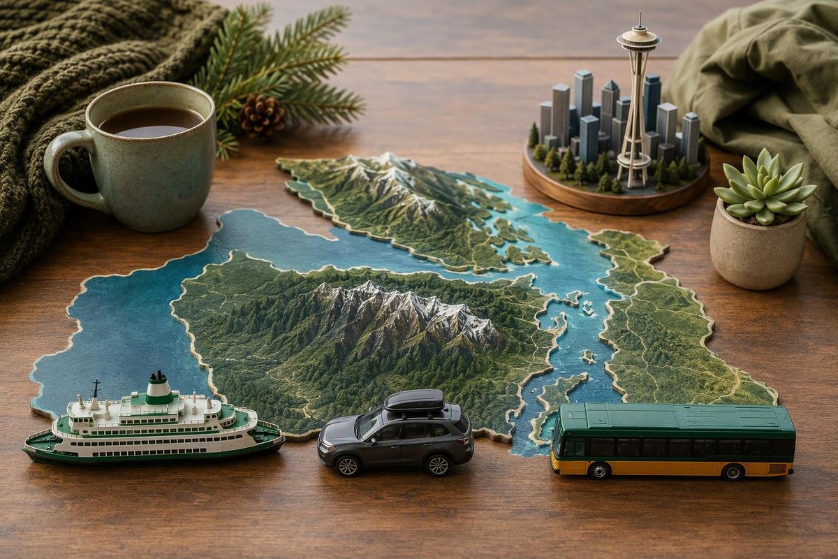
Why the map makes this trip look easier than it is
A map can make Olympic National Park appear to be one large green destination just across the water from Seattle. On the ground, it functions more like several separate travel regions connected by roads around the park’s perimeter.
There is no road directly across the mountainous center. Highway 101 makes the broad peninsula connection, while access roads lead away from it toward individual valleys, beaches, lakes, trailheads, and mountain areas. After visiting a destination at the end of one of those roads, you generally return to Highway 101 before continuing.
That layout creates two common planning errors.
The first is treating arrival in a gateway community as arrival at the attraction. Reaching Port Angeles does not mean you have reached Hurricane Ridge, Lake Crescent, or Sol Duc. It means you have reached the gateway from which those separate drives begin.
The second is assuming that attractions appearing close together on a regional map can be combined quickly. Straight-line distance is not useful when the available road must go around mountains, follow the coastline, or make an out-and-back detour.
A practical way to understand the park is to divide it into four broad clusters:
- Northern: Port Angeles, Hurricane Ridge, Lake Crescent, and Sol Duc
- Western: Forks, the Hoh Rain Forest, Rialto Beach, and other northern coastal areas
- Southeastern: Hoodsport, Lake Cushman, and Staircase
- Southwestern: Quinault, Kalaloch, and the southern coast
Port Angeles is the principal service and transportation gateway for the north. Hurricane Ridge requires an additional mountain-road segment south of town. Lake Crescent lies west along Highway 101, and Sol Duc requires continuing farther west before turning onto another spur road.
Forks is a practical base for the Hoh and northern coast because it reduces repeated cross-peninsula driving. It is not inside every attraction, but it places travelers closer to the west-side road network than Port Angeles or Seattle.
Staircase and Lake Cushman belong to a different route decision. They are generally approached through Hoodsport, not Port Angeles. Quinault and Kalaloch likewise favor southern or southwestern access and should not automatically be treated as extensions of a northern trip.
Lake Crescent illustrates the difference between a gateway and a final stop. It is roughly 30 minutes west of Port Angeles under the National Park Foundation’s itinerary assumptions. That itinerary then continues much farther to the Hoh Rain Forest and Pacific beaches, demonstrating how quickly a two-day trip becomes driving-intensive.
The Hoh and coast add substantial travel beyond Port Angeles. They are not sensible additions to a day already centered on Hurricane Ridge unless the primary objective is driving.
Avoid entering “Olympic National Park” as a generic navigation destination. Search for the exact endpoint, such as:
- Hurricane Ridge
- Lake Crescent Lodge
- Marymere Falls trailhead
- Sol Duc Falls trailhead
- Staircase Ranger Station
- Hoh Rain Forest Visitor Center
- Rialto Beach
- Kalaloch
- Lake Quinault
Confirm that the route uses the access road you expect. Similar names can refer to lodges, visitor areas, campgrounds, trailheads, or broad geographic areas with different endpoints.
Ferry or drive through Tacoma: a route-by-route comparison
A ferry can be both transportation and part of the experience. It can break up the drive and provide a convenient departure from downtown or north Seattle. It also introduces a sailing schedule, terminal waiting, vehicle-capacity constraints, and the risk of missing the intended departure.
Driving through Tacoma removes dependence on a ferry sailing. It does not remove traffic, road work, collisions, weather, or bridge delays. Depending on the destination, the all-land route may still cross the Hood Canal Bridge.
The crossing durations below are reported planning figures, not guaranteed operating times. Published figures commonly list approximately 35 minutes for Seattle–Bainbridge, 30 minutes for Edmonds–Kingston, about 60 minutes for Seattle–Bremerton, and about 45 minutes for Fauntleroy–Southworth. Verify the current timetable and operating status through Washington State Ferries before leaving; the comparative figures are documented in this Olympic Peninsula ferry overview.
| Route | Useful Seattle origin | Likely park region | Reported crossing time | Onward travel considerations | Principal sources of delay |
|---|---|---|---|---|---|
| Seattle–Bainbridge | Downtown and nearby central neighborhoods | Port Angeles, Hurricane Ridge, Lake Crescent, Sol Duc | About 35 minutes | Continue across Bainbridge toward Highway 101; northern routes commonly use the Hood Canal Bridge | Terminal access, vehicle queue, full sailing, delayed departure, unloading, traffic, bridge opening |
| Edmonds–Kingston | North Seattle, Shoreline, or areas near Edmonds | Port Angeles and the northern peninsula | About 30 minutes | Continue from Kingston toward Highway 101; compare the complete trip with Bainbridge and Tacoma | Vehicle queue, sailing delay, terminal congestion, onward traffic |
| Seattle–Bremerton | Downtown Seattle for selected trips | Lake Cushman, Staircase, southeastern peninsula | About 60 minutes | Longer crossing than Bainbridge, but the landing can align with travel toward Hoodsport | Terminal wait, longer crossing, unloading, local and highway traffic |
| Fauntleroy–Southworth | West Seattle or selected southern origins | Situational Kitsap or southeastern approaches | About 45 minutes | Useful only when the origin and onward route align; compare it with Tacoma | Seattle traffic, terminal queue, sailing schedule, onward driving |
| All-land via Tacoma | South Seattle, Sea-Tac area, southern suburbs, or travelers avoiding ferries | Staircase, Quinault, Kalaloch, and potentially any region | None | Uses highways through Tacoma and either Kitsap or the southern peninsula | Urban traffic, road work, collisions, weather, and possible bridge delays |
Seattle–Bainbridge
Seattle–Bainbridge is the standard ferry comparison for a traveler leaving downtown and heading toward Port Angeles. The terminal is on Seattle’s central waterfront, so it avoids beginning the trip with a drive north to Edmonds or south through Tacoma.
The scheduled crossing is only one component of the journey. Drivers must reach the terminal, join the vehicle queue, load, cross, unload, drive across Bainbridge Island, connect toward Highway 101, and continue to the selected gateway. Walk-on travelers must account for boarding, disembarkation, and the onward bus connection.
For Hurricane Ridge or Lake Crescent, Bainbridge is often convenient. It is not universally fastest because a long wait or missed sailing can erase its geographic advantage. Check the current Seattle–Bainbridge schedule rather than relying on a saved timetable.
Edmonds–Kingston
Edmonds–Kingston deserves consideration when the trip begins north of central Seattle. Driving south to the downtown ferry terminal may add unnecessary backtracking if Edmonds is already nearby.
Its reported crossing is shorter than Bainbridge, but the complete trip still depends on the vehicle line, sailing status, and drive after Kingston. Busy-period queues can materially change the result. Travelers with a fixed Port Angeles arrival should compare current terminal conditions with both Bainbridge and the all-land route.
Seattle–Bremerton
Seattle–Bremerton has a longer reported crossing than Seattle–Bainbridge. Its potential value is geographical rather than speed-based: the landing can align with selected trips toward Lake Cushman, Staircase, and the southeastern peninsula.
It is not the default route to every Olympic destination. Travelers headed to Hurricane Ridge or Lake Crescent should compare Bainbridge, while those going to the Hoh, Kalaloch, or Quinault should also evaluate a southern all-land route.
Fauntleroy–Southworth
Fauntleroy–Southworth is another situational crossing. It may fit a traveler already in West Seattle or someone whose onward route works through Southworth and the Kitsap Peninsula.
It should not be labeled the automatic best route from Sea-Tac Airport. Airport-area traffic, terminal access, sailing timing, and the final park destination can all change the comparison.
Driving through Tacoma
That can be attractive when you have a lodging check-in, tour, shuttle, or other fixed deadline.
Its weakness is exposure to highway conditions. Seattle and Tacoma traffic can be unpredictable, while road work or collisions can cause significant delays. Some all-land routes toward the northern peninsula still use the Hood Canal Bridge, so avoiding a ferry does not necessarily avoid bridge-opening risk.
Compare routes using five criteria:
- Starting point: Is the closest useful terminal downtown, Edmonds, or neither?
- Final destination: Are you going north, southeast, west, or southwest?
- Reliability needs: Can you absorb a missed sailing?
- Experience: Do you want the ferry crossing to be part of the trip?
- Current conditions: Which route works today, rather than under ideal assumptions?
Match the route to the part of the park you actually want to see
A destination-first comparison is more useful than a single route labeled “Seattle to Olympic National Park.”
| Destination | Best gateway or base | Routes to compare from Seattle | Travel after the gateway | Planning implication |
|---|---|---|---|---|
| Hurricane Ridge | Port Angeles | Bainbridge from downtown; Kingston from north Seattle; Tacoma as backup | Mountain-road drive south from Port Angeles | Can work as a focused northern day-trip anchor when access permits |
| Lake Crescent and Sol Duc | Port Angeles or Lake Crescent area | Bainbridge, Kingston, or Tacoma | Continue west on Highway 101; Sol Duc adds an out-and-back spur | An overnight is preferable when combining both with Hurricane Ridge |
| Staircase and Lake Cushman | Hoodsport area | Bremerton or all-land via Tacoma | Continue toward Lake Cushman and the Staircase access road | Do not route through Port Angeles by default |
| Hoh Rain Forest | Forks or west-side lodging | Compare southern all-land access with northern ferry routes | Highway 101 plus an out-and-back drive on the Hoh access road | Too far for a relaxed addition to a Seattle northern day trip |
| Rialto Beach | Forks | Northern ferry or all-land route, depending on origin | Continue west from Forks toward the coast | Pair with one west-side activity rather than a northern marathon |
| Kalaloch | Kalaloch, Quinault, or another southwest base | Give the southern all-land route priority in the comparison | Follow Highway 101 along the southwest peninsula | A northern ferry is not automatically advantageous |
| Quinault | Quinault or southwest lodging | Southern all-land route | Continue along Highway 101 and local access roads | Treat as a southern or southwestern trip |
Hurricane Ridge
Port Angeles is the gateway for Hurricane Ridge. From downtown Seattle, compare Seattle–Bainbridge with driving through Tacoma. From north Seattle, add Edmonds–Kingston to the comparison.
Reaching Port Angeles is not the end of the trip. You must still drive the mountain road, and access can be affected by weather, road conditions, seasonal operations, or park management measures. Review the current Olympic National Park alerts and conditions before departure.
If Hurricane Ridge is the main goal, make it the day’s anchor. Add another northern stop only if access, timing, and your planned return permit it.
Lake Crescent and Sol Duc
Lake Crescent lies west of Port Angeles along Highway 101, making Port Angeles or the lake area a practical overnight base. Sol Duc lies farther west and requires another out-and-back drive away from Highway 101.
A route that appears manageable when ending at Port Angeles becomes substantially longer once Lake Crescent, a waterfall trailhead, and Sol Duc are included. If the lake is the priority, staying near Lake Crescent may reduce backtracking compared with automatically returning to Port Angeles.
Staircase and Lake Cushman
Staircase belongs to a different routing decision. Hoodsport and Lake Cushman are the relevant approach points, not Port Angeles.
Compare the Seattle–Bremerton ferry with the all-land drive through Tacoma. The better choice depends on your Seattle origin, current ferry operations, and road conditions. If you begin south of downtown, driving around may prevent unnecessary backtracking.
Hoh Rain Forest
The Hoh is a western-peninsula destination. Forks is a practical service base for combining it with a nearby coastal area. Reaching Highway 101 is not the end of the journey: travelers must take the Hoh access road and later return over it.
An all-land route can be practical, particularly from a southern Seattle-area origin. A northern ferry can still make sense if the broader trip includes Port Angeles or Lake Crescent, but it should not be chosen solely because the ferry crossing appears shorter than the drive through Tacoma.
Rialto and Kalaloch
Rialto fits naturally into a Forks-based west-side trip. Kalaloch lies farther south and aligns more closely with southwestern Highway 101 travel.
Do not treat “the coast” as a single stop. Rialto, Kalaloch, and other beach areas have separate access points. Select one coastal area based on the rest of the itinerary rather than adding several detours because they look close together on a small map.
Quinault
Quinault is best treated as a southern or southwestern destination. For a direct visit from Seattle, compare routes that approach through the southern peninsula before assuming a northern ferry will help.
A northern ferry may fit a longer one-way or loop itinerary. If the trip includes both the northern and southwestern park regions, plan a multi-day progression instead of repeatedly commuting from Seattle.
Build a realistic travel-time budget
A broad published estimate of 2.5 hours may describe reaching the park generally. Published estimates for Hurricane Ridge range from about three hours to 3.5 hours, depending on the source and its unstated assumptions.
These figures are not necessarily contradictory. They may begin in different parts of Seattle, use different ferry or highway routes, assume different traffic conditions, and end at different places. “Olympic National Park” might mean a gateway, an entrance area, a lodge, or a distant trailhead.
Build the trip from five components:
- Travel to the terminal or highway route. Downtown access to the waterfront differs from a north Seattle drive to Edmonds or a southern departure toward Tacoma.
- Terminal buffer. Drivers may face a vehicle line or wait for a later sailing. Walk-on passengers still need time to reach the boarding area.
- Ferry crossing. This is the most visible number but only one part of the trip.
- Peninsula driving. After landing, you must connect with Highway 101 or another approach road.
- Final access-road travel. Hurricane Ridge, Sol Duc, Staircase, and the Hoh all require additional driving beyond the highway or gateway town.
A 30- to 60-minute ferry crossing is not the total journey from Seattle to the park.
For a vehicle ferry trip, allow for:
- terminal access;
- possible capacity waits;
- loading;
- the crossing;
- unloading;
- local traffic leaving the terminal;
- peninsula highway travel;
- the final park access road.
Routes toward Port Angeles from Bainbridge or Kingston commonly use the Hood Canal Bridge. The bridge periodically opens for marine traffic, creating a possible delay even after the ferry portion has gone smoothly. Check the official Hood Canal Bridge status before committing to the route.
Build a conservative buffer around any fixed tour, shuttle, lodging check-in, or important return connection. There is no universal buffer because the risk changes with the route, season, weather, ferry demand, and destination.
If arrival time matters more than the ferry experience, compare live ferry conditions with the all-land route shortly before leaving. The best choice that morning may differ from the route selected when the itinerary was first created.
What works as a day trip—and what needs an overnight
Olympic National Park can work as a Seattle day trip, but only when the itinerary is tightly focused.
A realistic day trip targets one northern anchor or a compact pairing. Hurricane Ridge, when accessible, can be the anchor. A Lake Crescent-area outing can be another. Trying to include Hurricane Ridge, the Hoh Rain Forest, and the Pacific coast creates a long chain of drives with little useful time at any stop.
A conservative northern day trip
Use this framework:
- Leave Seattle early.
- Choose the best route toward Port Angeles based on current conditions.
- Make Hurricane Ridge or Lake Crescent the primary objective.
- Add only a nearby, low-commitment stop if time remains.
- Establish a firm turnaround time based on the return route.
- Do not add the Hoh or coast as an improvisation.
Every access-dependent stop should remain conditional on current park alerts, road conditions, weather, and seasonal transportation. If Hurricane Ridge is unavailable, choose another northern attraction rather than attempting a cross-peninsula replacement.
A low-backtracking two-day plan
Day one: Travel from Seattle to Port Angeles. Visit Hurricane Ridge if the road, weather, and park operations permit. Stay in Port Angeles.
Day two: Travel west to Lake Crescent. Choose one principal lake-area walk or viewpoint, then return toward Seattle using the route that best fits current ferry and traffic conditions.
This keeps both days within the northern cluster and allows the activities to be reversed if mountain conditions are poor on the first day.
A west-side extension
With more time, continue from Lake Crescent toward Forks and stay on the west side. From there, choose the Hoh Rain Forest and one coastal area rather than attempting to return to Seattle that night.
A practical progression is:
- Port Angeles or Hurricane Ridge;
- Lake Crescent;
- Forks or nearby west-side lodging;
- Hoh Rain Forest;
- one beach;
- return through the southern peninsula.
The National Park Foundation presents a more ambitious sequence combining Hurricane Ridge, Lake Crescent, the Hoh, and a Pacific beach in two park days. It demonstrates that the combination is possible, but it requires early starts and substantial driving rather than providing a relaxed default.
An overnight improves more than sightseeing time. It creates room to respond to ferry delays, mountain weather, road restrictions, and changing park access.
How to make the trip without a car
A car offers the greatest flexibility, but a limited car-free northern trip is possible from downtown Seattle.
The principal independent chain is:
- Walk onto the Seattle–Bainbridge ferry.
- Connect on Bainbridge Island with Clallam Transit’s Strait Shot.
- Ride to Port Angeles.
- Use a verified seasonal shuttle, selected local transit, a prearranged trailhead shuttle, or a guided tour for the final segment.
The National Park Service identifies the Bainbridge-to-Port Angeles bus connection and notes that transit serves Port Angeles, Sequim, Forks, and selected destinations along northern Highway 101. That does not mean independent transit conveniently reaches every trailhead, valley, beach, or visitor area.
Port Angeles is a transportation gateway, not automatic park access. Arriving there still leaves the question of how to reach Hurricane Ridge, Lake Crescent, or another specific destination.
Onward options are limited and date-dependent. Seasonal Hurricane Ridge transportation may operate during part of the year, while private shuttles and tours depend on advance booking and operator schedules. Verify the current Strait Shot schedule directly with Clallam Transit, then confirm any onward service separately.
A commercial operator offers one example of how a long car-free day can be assembled: an early ferry, the Strait Shot to Port Angeles, a prearranged afternoon tour, and an evening return by bus and ferry. The sequence shows that one coordinated northern itinerary can fit into a long day, but its clock times, activities, prices, and connection assumptions are operator-specific and must be reconfirmed through the operator’s car-free day-trip itinerary.
Treat each transfer as a planned connection, not a guaranteed one.
Rideshare should not be the fallback. Service between peninsula destinations may be unavailable, and limited cell coverage can make last-minute improvisation difficult. For a more resilient car-free trip:
- travel to Port Angeles on day one;
- stay near the transit center or confirmed pickup point;
- use a verified shuttle or tour on day two;
- preserve enough time to use a later return if one connection fails.
Independent public transportation can support a focused northern visit. It does not provide easy, comprehensive access throughout Olympic National Park.
Departure-day checks and backup plans
Conditions can change after an itinerary is built. Complete a same-day check before leaving Seattle instead of relying on an old screenshot or saved schedule.
Same-day checklist
- Washington State Ferries: Confirm the current timetable, alerts, terminal conditions, and vehicle availability for your route.
- Fares and boarding policies: Verify current fares, boarding procedures, vehicle rules, and any reservation policy directly with the ferry operator.
- Clallam Transit: Confirm Strait Shot and local service times, stops, and alerts.
- Seasonal transportation: Verify operating dates, booking requirements, and pickup locations with the shuttle or tour provider.
- Hood Canal Bridge: Check the bridge’s current status for any route that uses it.
- National Park Service: Review current road, area, facility, and access notices.
- Road conditions: Check construction, collisions, closures, and restrictions on the chosen approach.
- Weather: Review the forecast for the actual destination, not only Seattle.
- Food and facilities: Confirm what is operating near remote stops.
- Offline navigation: Download maps, directions, addresses, and confirmation details before leaving reliable service.
Fares, timetables, operating hours, seasonal shuttle dates, and reservation policies can change. Third-party itineraries can explain the structure of the journey, but the responsible agency or operator should be the final authority on departure-day details.
If the ferry is delayed
Do not automatically wait through multiple sailings. Compare:
- the estimated time to board the next practical ferry;
- the all-land drive through Tacoma;
- the effect of either option on the day’s anchor activity;
- the available return options.
If driving around preserves the main activity, switch routes. If neither option leaves enough time, shorten the park plan instead of compressing every stop.
If you miss a bus or shuttle
Contact the relevant operator and determine whether a later service exists. Do not assume rideshare can bridge the gap.
Be prepared to:
- drop a secondary stop;
- move the activity to the next day;
- remain in Port Angeles overnight;
- return to Seattle without continuing into the park.
A missed connection becomes more consequential when it involves the final useful departure of the day. Avoid an itinerary that succeeds only if every independent operator runs exactly on time.
If a park road or destination is unavailable
Stay within the same geographic cluster. If Hurricane Ridge is inaccessible, choose a northern alternative rather than driving to the Hoh. If a west-side road is disrupted, substitute another west-side stop instead of attempting a long cross-peninsula rescue.
This preserves sightseeing time and prevents one closure from triggering hours of additional driving.
If communication becomes difficult
Keep offline copies of directions, return schedules, lodging details, and reservation confirmations. Cell service can be limited in parts of the peninsula, so offline preparation is more reliable than expecting to rebuild the itinerary remotely.
If food or facilities are limited
Carry what you need for the planned outing and verify services before departure. The National Park Foundation’s published itinerary specifically states that food is unavailable for purchase in the Hoh area it covers. Facility availability and operating hours can change, so do not assume every visitor area sells meals or supplies.
Finish planning with five decisions:
- One target region
- One primary route
- One backup route
- One anchor activity
- Enough return time to avoid relying on the final possible connection
Frequently asked questions
Is it faster to take the ferry or drive from Seattle to Olympic National Park?
Neither is always faster. The answer depends on your Seattle starting point, exact park destination, ferry queue, traffic, sailing delays, and whether the route uses the Hood Canal Bridge.
From downtown Seattle to Port Angeles or Hurricane Ridge, Seattle–Bainbridge is often convenient. For a southern origin or a trip toward Staircase, Quinault, or Kalaloch, driving through Tacoma may be more practical. If arrival time is fixed, compare current conditions immediately before departure rather than choosing by ferry crossing time alone.
Which ferry should I take from downtown Seattle to Olympic National Park?
For Port Angeles, Hurricane Ridge, Lake Crescent, or Sol Duc, begin by comparing Seattle–Bainbridge with the all-land route. Bainbridge is the most straightforward downtown ferry option for the northern peninsula.
Seattle–Bremerton is more situational and may fit a trip toward Lake Cushman or Staircase. There is no single ferry that is best for every part of Olympic National Park.
Can I visit Olympic National Park from Seattle without a car?
Yes, but the practical independent car-free area is limited. Walk onto the Seattle–Bainbridge ferry, connect with the Strait Shot bus to Port Angeles, and arrange a seasonal shuttle, local connection, prearranged transfer, or guided tour for the final segment.
Allow generous transfer time because separate ferry, bus, shuttle, and tour operators do not guarantee one another’s connections. An overnight in Port Angeles makes the plan more resilient. Do not expect public transportation or rideshare to provide convenient access throughout the park.
Is Olympic National Park worth visiting as a Seattle day trip?
Yes, if you want one focused northern experience and accept that much of the day will involve transportation. Hurricane Ridge, when accessible, or a Lake Crescent-area outing can justify the trip.
It is not a good one-day plan if the objective is to combine the mountains, Hoh Rain Forest, and Pacific coast. Stay overnight—and preferably allow more than one night—when the western peninsula is a priority.
Where should I stay for one night near Olympic National Park?
Stay in Port Angeles for Hurricane Ridge and general northern access, or consider the Lake Crescent area when the lake and nearby western attractions are the priority.
For the Hoh Rain Forest and northern Pacific coast, stay in Forks or another west-side lodging area. For Quinault and the southern coast, choose lodging in the southwestern peninsula rather than returning to Port Angeles.
The practical Seattle-to-Olympic plan starts with the part of the park that matters most. Compare Bainbridge, Kingston, another situational ferry, or the Tacoma drive using current conditions—not crossing time alone. Keep a day trip focused, stay overnight for multiple regions, and leave Seattle with both a primary route and a realistic backup.