
How to Plan the Right Ride or Walk Through Snoqualmie Valley
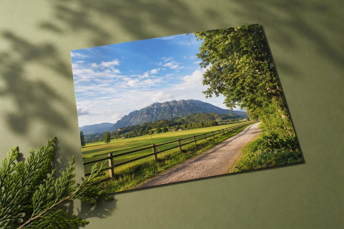
The Snoqualmie Valley Trail works best as a collection of flexible outings rather than an all-or-nothing challenge. You can take a short walk beside farmland, ride gravel between valley towns, travel from North Bend to Rattlesnake Lake, or plan an approximately 31- to 32-mile point-to-point journey along the full corridor.Rails-to-Trails Conservancy lists the route at 31.7 miles and describes it as a former Milwaukee Road rail-trail.
Start by choosing the section that fits your time, mobility needs, and comfort with gravel or road exposure. Then solve parking and transportation, download the route, and check temporary conditions shortly before leaving. The trail corridor is well established, but closures, detours, parking rules, transit schedules, and surface conditions can change.
Editorial review date: August 29, 2026. Temporary-condition information in this guide was compiled from the supplied official pages, dated reporting, and user-submitted trail reports; it was not confirmed through a firsthand inspection.
Snoqualmie Valley Trail at a Glance
The Snoqualmie Valley Trail is a regional rail-trail following a former Milwaukee Road railroad corridor between Duvall and Rattlesnake Lake. From north to south, it runs through or near Duvall, Carnation, Fall City, Snoqualmie, and North Bend before reaching the lake. Its point-to-point layout makes it useful both as a long route and as a series of shorter local outings.
Most of the corridor is not a paved urban pathway. Expect crushed rock, hard-packed gravel, and sections retaining original railroad ballast. Trestles, bridges, limited paved portions, road crossings, and localized steps interrupt that general pattern. The municipal trail map lists a 31.5-mile route, identifies crushed rock and original ballast as the surface, and shows an on-road detour in Snoqualmie.See the City of Duvall’s Snoqualmie Valley Regional Trail map.
Published measurements differ:
- Washington Trails Association lists 32 miles one way.
- The municipal map lists 31.5 miles.
- Rails-to-Trails Conservancy lists 31.7 miles.
- AllTrails maps one version at 30.7 miles.
- TrailLink maps a shorter 29.5-mile version.
For practical planning, treat the full Snoqualmie Valley Trail as approximately 31 to 32 miles. Differing endpoints, connectors, and route definitions likely explain at least part of the variation, although the available evidence does not establish one official reason. For a long trip, the important number is the distance shown by the exact route and access points you intend to use.
The corridor accommodates walking, hiking, running, cycling, and horseback riding. Birders and other wildlife observers also use it. Washington Trails Association and AllTrails report that dogs are allowed on leash. Mixed use means that passing speed and trail position matter, particularly on bridges, near trailheads, and where vegetation limits visibility.
Washington Trails Association lists no general trail-entry fee or parking pass. That does not mean every associated lot is free, unrestricted, or open at all hours. Municipal, school, park, wildlife-area, and recreation-area parking may have separate gates, time limits, capacity constraints, or use rules.
| Question | Practical answer |
|---|---|
| Route type | Point-to-point regional rail-trail |
| Broad endpoints | Duvall and Rattlesnake Lake |
| Planning distance | Approximately 31–32 miles for the full corridor |
| Primary surface | Crushed rock, hard-packed gravel, and railroad ballast |
| Overall grade | Generally gradual, with more noticeable climbing in southern sections |
| Common activities | Walking, running, cycling, hiking, horseback riding, and birding |
| Best planning method | Select a section or established itinerary first |
| Main logistical caution | Long one-way trips require transportation planning |
| Main route caution | Do not assume every mile is traffic-free or step-free |
| Final check | Verify closures, detours, parking, transit, and weather |
Choose a Route That Fits Your Day
Begin with the outing you actually want rather than treating the full corridor as the default. A gentle railroad grade does not make a 31- to 32-mile journey casual, and a shorter outing can provide many of the same landscapes with much simpler logistics.
For a short town-based out-and-back: Start at a confirmed access point in Duvall, Carnation, Fall City, North Bend, or Rattlesnake Lake. Travel until you have covered half your intended total distance, then return the same way. This removes shuttle uncertainty and gives you room to adjust for weather, trail conditions, fatigue, or limited daylight.
Avoid building a supposedly precise five- or ten-mile itinerary from an unverified map pin. The measured distance can change with the parking lot, connector, road detour, and turnaround point. If precision matters, save a current map and measure from the entrance you will actually use.
For a flatter northern-valley excursion: Use Duvall or Carnation as the anchor. This part of the corridor travels through an agricultural landscape associated with farm fields, wetlands, Stillwater, the Snoqualmie River valley, and the Tolt River area. It is a logical choice when open valley scenery and town stops matter more than reaching the forested southern climb.
Duvall offers several documented access choices, making it particularly flexible for an out-and-back. Carnation can serve as another practical anchor, with Tolt-MacDonald Park available as a possible addition. “Flatter,” however, does not mean paved, uniformly smooth, or free from road crossings.
For a longer Tokul-area-to-Duvall ride: Mountains to Sound Greenway Trust publishes an approximately 20-mile one-way cycling itinerary ending in Duvall. Although its title refers to a Snoqualmie-to-Duvall ride, the directions begin near Tokul Tunnel rather than in downtown Snoqualmie. The plan uses Depot Park in Duvall for a staged vehicle and includes Fall City, Carnation, Tolt-MacDonald Park, Stillwater, and the Tokul area.The published itinerary explains the approximately 20-mile route, stair access, and staged-car arrangement.
The described Tokul starting access requires descending stairs, so it is unsuitable for anyone who needs a step-free entrance. Before committing to the one-way itinerary, confirm that the starting access is usable, the route is continuous for your date, and the retrieval vehicle may remain at the destination lot.
For North Bend to Rattlesnake Lake: A published itinerary measures this outing at approximately 7.5 miles each way, or 15 miles round trip, with about 420 feet of reported elevation gain. It begins with flatter travel across the North Bend valley floor and then climbs gradually through the Boxley Creek drainage toward Rattlesnake Lake. The same itinerary places the Cedar River Watershed Education Center approximately half a mile along the lake’s east shore.See the North Bend–Rattlesnake Lake itinerary for its distance, elevation, route description, and lake approach.
The distance makes this a substantial walk and a meaningful gravel ride. The gradual grade may feel forgiving compared with a steep hiking trail, but the round-trip mileage still requires enough time, food, water, and daylight. To create a shorter version, start in North Bend and turn around at a predetermined time or distance.
For a one-way partial trip: Select two confirmed access points, measure the exact route between them, and arrange transportation before departure. This format avoids retracing your route but is less flexible than an out-and-back. A closure, locked gate, missed pickup, or transit problem can leave you far from your starting point.
For the complete corridor: Plan for approximately 31 to 32 miles rather than treating the route as a small extension of a neighborhood ride. The railroad alignment keeps much of the grade gradual, but loose surfaces, cumulative climbing, potential road travel, and point-to-point transportation make the full journey a serious undertaking.
Direction can influence how the day feels. A southbound trip moves from the flatter northern valley toward the more noticeable southern climbing. A northbound trip reverses that pattern, but current detours and access conditions may matter more than the elevation profile. Choose direction according to transportation, weather, and verified route conditions—not solely in expectation of an effortless downhill.
Access Points, Parking, and Trail Entry
Access is distributed along the corridor, so there is no need to begin at either endpoint. The following supported locations run broadly north to south:
- Duvall Park & Ride
- Duvall Village
- McCormick Park
- Taylor’s Landing Park
- Depot Park
- Stillwater Wildlife Recreation Area
- Nick Loutsis Park
- 356th Place SE in Fall City
- North Bend near NE 4th Street and Ballarat Avenue
- Rattlesnake Lake Recreation Area
These are potential entry areas, not guarantees of an available parking space, open gate, restroom, or unrestricted stay. Some are municipal facilities or parks; others may involve nearby rather than trail-dedicated parking.
Duvall has the clearest documented address group:
- Duvall Village: 14200 Railroad Way NE
- Duvall Park & Ride: 16011 Main St NE
- McCormick Park: 26200 NE Burhen Way
- Taylor’s Landing Park: 16201 Main St NE
The City of Duvall identifies all four as trail access locations.Check the municipal access page for the four Duvall locations and addresses. Confirm which entrance matches your intended direction and whether its parking rules suit the length of your outing.
Depot Park is especially relevant to the published Tokul-area-to-Duvall itinerary because that plan suggests leaving the retrieval vehicle there. Stillwater Wildlife Recreation Area provides access around the wetland and agricultural landscape, while Nick Loutsis Park is another cited access location around Carnation.
The entrance at 356th Place SE in Fall City is notable both as a recognized trail access and as the starting point for a reported wheelchair outing. Current surface and barrier conditions still need to be checked before relying on it.
North Bend access is identified near NE 4th Street and Ballarat Avenue. A municipal facility page also identifies weekend trail parking at Two Rivers Alternative School, but school access and parking rules can change.The City of North Bend describes the trail through town and identifies weekend school parking. Verify current permission, hours, and event restrictions before using school property.
Rattlesnake Lake Recreation Area forms the southern anchor. It is a logical starting point for an out-and-back toward North Bend and the connection point for the Palouse to Cascades State Park Trail. Because the lake is also a recreation destination, parking demand may be different from that at quieter town entrances.
Entrances with stairs require special attention. The Tokul-area itinerary requires a stair descent from its described parking access. Washington Trails Association also reports stairs at Tokul Road and Southeast 60th Street. None of those locations should be used as the basis for a wheelchair route, step-free plan, or trip involving a bicycle that cannot be carried on stairs.
The evidence does not consistently establish the following for every access point:
- Parking capacity
- Gates or closing times
- Individual lot fees
- Overnight-parking rules
- Restroom availability
- Potable-water availability
- Bicycle-repair services
- Food available at the trailhead
Check the municipality, park, school, wildlife area, or recreation operator responsible for your chosen entrance. If water or services cannot be confirmed, carry what you expect to need.
Save a screenshot of the entrance and the last few turns of the drive.
Surface, Grade, and What the Trail Feels Like
The dominant trail surface is crushed rock, hard-packed gravel, and original railroad ballast. Conditions can vary over short distances.
One AllTrails route maps 30.7 miles with 623 feet of elevation gain. Its surface breakdown is predominantly gravel, with small paved and unmapped portions and a very short amount of steps. Those numbers describe one platform’s mapped version, not an official measurement that applies to every itinerary. The same source reports that dogs are permitted on leash.See the mapped route, elevation estimate, surface breakdown, and dog rule reported by AllTrails.
The former railroad alignment explains why the grade is generally gradual. Instead of climbing abruptly like many hiking routes, the corridor tends to gain elevation over longer distances. That does not make every section feel the same.
Duvall toward Carnation is generally the flatter valley experience. Expect agricultural land, wetlands, and river-country scenery. Wind, exposed sun, soft material after rain, and cumulative distance can still shape the outing where climbing is limited.
Beyond Carnation and toward the Snoqualmie area, climbing becomes more noticeable. TrailLink describes a moderate climb after Carnation and another climb during the final miles toward Rattlesnake Lake.TrailLink summarizes the gravel surface, northern terrain, southern climbing, and reported road detour. Those descriptions belong to its mapped interpretation and should not be applied mechanically to every starting point or detour.
From North Bend toward Rattlesnake Lake, the transition is especially clear. The route begins across the flatter valley floor, then gradually ascends through the Boxley Creek drainage. The climb may not feel dramatic at any single point, but its accumulation matters during a long walk or on the return portion of a ride.
Distance may be more consequential than steepness. Someone comfortable walking a few miles on compact gravel should not assume the full corridor will feel equally manageable.
For cyclists, a gravel-oriented bicycle or another setup that handles uneven material may be more comfortable than equipment intended only for smooth pavement. There is no supported universal minimum tire width for this trail. Choose equipment suited to your experience and carry what you need for an ordinary flat tire or minor adjustment.
Walkers and runners should prepare for loose rock, puddles, and uneven edges. No single label such as “easy,” “moderate,” “strenuous,” “family-friendly,” or “safe” describes every possible outing. A short northern out-and-back and a full point-to-point journey are fundamentally different plans.
Weather also changes the trail’s character. Shade and exposure vary between forested foothill sections and the open valley. Check the forecast for the valley and foothills rather than assuming conditions will match Seattle.
What You Can See Along the Way
The trail’s appeal comes from changing scenery rather than one mandatory destination. The corridor passes farms, wetlands, river valleys, forests, town edges, bridges, and mountain-view openings. That variety makes sectional travel particularly effective.
Duvall is the northern town anchor and offers multiple access choices. It works well for combining a short trail outing with a town stop or beginning a longer ride through the open valley. Decide whether parking convenience, town access, or a quieter start matters most.
Stillwater Natural Area and the surrounding wetland landscape shift the emphasis toward habitat, water, and agricultural views. Wildlife may be present, but no particular sighting is guaranteed. Bird activity, vegetation, and water levels vary by season.
Carnation is another useful town anchor. The Tolt River area, farms, and nearby parks make it possible to combine trail mileage with a picnic or town break.
Tolt-MacDonald Park can expand an outing beyond the regional trail. Published descriptions identify hiking, picnicking, camping, and a suspension footbridge among its features. Verify current campground, bridge, restroom, event, and facility availability before making the park essential to your itinerary.
Fall City can serve as a turnaround, access point, or base for a shorter section. The 356th Place SE entrance is also associated with the potentially wheelchair-usable outing discussed below. A town detour or side trip may introduce road travel, so distinguish between being near a community and remaining on the separated trail.
The Tokul area contains one of the corridor’s best-known railroad landmarks: Tokul Trestle, a historic wooden railroad structure associated with the former rail line. Published descriptions disagree about its dimensions, so it is more accurate to treat it as a notable trestle crossing than to repeat a disputed height or span.
Snoqualmie and nearby attractions demand more careful route reading. Sources report an on-road detour in or near the city, and nearby destinations may not sit directly on the trail alignment. Inspect the detailed route and road exposure before taking children or less-confident riders through this portion.
Meadowbrook Farm is a nearby open-space addition between Snoqualmie and North Bend. Three Forks Natural Area is another nearby option around the meeting area of the Snoqualmie River’s forks. Both can add open-space, river, or mountain scenery when the goal is a varied day rather than maximum through-mileage.
North Bend is the major southern town anchor. The trail crosses the valley and passes near several town destinations, making it useful for an out-and-back, a stop during a longer ride, or the start of the Rattlesnake Lake section. Do not assume every service is immediately beside the corridor; save the route between the trail and any planned food or transportation stop.
Rattlesnake Lake is the southern anchor and the transition to another regional trail system. It provides a natural finish even if you do not continue beyond the lake. The Cedar River Watershed Education Center is described by the North Bend itinerary as approximately half a mile along the lake’s east shore, but its current opening arrangements should be confirmed separately.
Seasonal possibilities include wildflowers, fall foliage, wildlife, and salmon viewing. These are possibilities rather than scheduled attractions. Weather, habitat conditions, water levels, timing, and chance determine what appears on a particular day.
Plan Snoqualmie Falls as a separate side trip. Regional descriptions often group the falls with valley trail attractions, but the evidence does not establish a simple direct trail connection that avoids roads or additional navigation. Do not follow undesignated paths or cross private property in an attempt to improvise access. If the falls are a priority, plan the driving, parking, walking route, and time separately.
Point-to-Point Logistics, Detours, and Trail Connections
Transportation is the defining challenge of a long one-way trip. Unless everyone is prepared to return along the same corridor, use one of three arrangements:
- Two staged vehicles
- A confirmed private shuttle or pickup
- Public transportation verified for the date, time, group, and equipment involved
The two-vehicle method works only if both parking locations permit the planned stay. Leave one vehicle at the finish, carry everyone and their equipment to the start, and make sure the finish driver has the correct keys. The published Tokul-area-to-Duvall itinerary uses this model by staging a vehicle at Depot Park before driving to the Tokul starting access.
A private pickup can be simpler, provided the meeting point is obvious and reachable by road. Share a saved pin, identify a fallback location, and agree on what to do if mobile service fails.
Public transportation requires current verification. Washington Trails Association reports that King County Transit route 629 serves several trail locations. Check the current route, operating days, stops, schedule, fare method, and bicycle policy directly with the operator before relying on it. Service in the valley does not necessarily run when you expect to finish or have capacity for every bicycle in a group.
A North Bend itinerary revised in September 2021 used Sound Transit route 554, Metro route 208, and advance-arranged local dial-a-ride service between North Bend and Rattlesnake Lake.The dated itinerary documents that historical transit plan. It demonstrates that car-light planning has been attempted, but those details are too old to use as a current schedule without direct confirmation.
Do not assume the complete journey is traffic-free. Multiple sources report an on-road detour in or near Snoqualmie. One secondary directory describes an approximately 2.5-mile road alignment, but the supplied evidence does not confirm that this remains the official route or that the detour is currently active. The municipal map identifies an on-road detour without establishing its present operational status.Review the official municipal trail map before planning through Snoqualmie.
That uncertainty is particularly important for families, inexperienced cyclists, walkers expecting a separated path, and anyone choosing the trail specifically to avoid motor traffic. If the current road portion exceeds your comfort level, select an out-and-back entirely within a confirmed off-road section.
Road crossings elsewhere also require attention. A rail-trail can remain separated from traffic for long stretches while still crossing active streets or entering town environments. Slow before crossings, remain visible, and do not assume drivers have seen you.
At Rattlesnake Lake, the Snoqualmie Valley Trail connects with the Palouse to Cascades State Park Trail. Older pages may call the connecting corridor the John Wayne Pioneer Trail. This connection makes longer regional travel possible, but the Snoqualmie Valley Trail itself does not continue to Vantage. Beyond Rattlesnake Lake, you are entering a separate trail with its own route, management, surface, access, and planning requirements.
If you intend to continue beyond the lake, treat that extension as a new itinerary. Recheck distance, water, weather, access rules, surface, and return transportation rather than casually adding it to the Snoqualmie Valley plan.
Accessibility and Shared-Trail Expectations
The full Snoqualmie Valley Trail is not generally described as ADA compliant or readily accessible to wheelchair users. Crushed rock and ballast, variable surface conditions, stairs at some entrances, and localized barriers make a corridor-wide accessibility promise inappropriate.
That limitation does not mean every individual segment is unusable. Accessibility should be evaluated entrance by entrance and section by section, with attention to surface firmness, slope, gates, road crossings, parking, unloading space, and turnaround options.
Washington Trails Association reports that access from 356th Place in Fall City may allow a 4.5-mile wheelchair outing with approximately 104 feet of elevation gain on hard-packed dirt. It also reports stair access at Tokul Road and Southeast 60th Street.See WTA’s access, stair, and reported wheelchair-outing information. Treat the Fall City option as a possibility rather than a guarantee because rain, erosion, loose aggregate, vegetation, construction, or damaged infrastructure may alter its suitability.
Before relying on the Fall City option, verify:
- Whether the entrance is currently step-free
- Surface firmness and width
- Whether gates or barriers restrict passage
- The location of a suitable turnaround
- Parking proximity and unloading conditions
- Current construction or closure notices
Tokul Road, Southeast 60th Street, and the stair-based Tokul itinerary access should not be treated as step-free trailheads. A map pin beside the trail does not establish an accessible connection from the road or parking area.
The route is shared by walkers, runners, cyclists, equestrians, birders, and people with leashed dogs. These users move at different speeds and may react differently to sudden movement, noise, or close passing.
Practical shared-trail etiquette includes:
- Travel predictably and remain aware of people approaching from either direction.
- Keep dogs leashed and controlled so the leash does not cross the trail.
- Announce bicycle or running passes early and calmly.
- Pass only when there is sufficient room and visibility.
- Slow near bridges, intersections, bends, children, dogs, and congested trailheads.
- Give horses ample space and follow the rider’s instructions.
- Avoid stopping across the full width of the trail.
- Move off the primary travel line before checking a map or addressing a bicycle problem.
- Keep groups from blocking both directions.
The available evidence does not support corridor-wide conclusions about stroller suitability, adaptive cycles, e-bike rules, or horse-trailer facilities. Those questions require current regulations and segment-specific information.
Check Conditions Before You Leave
Planning review — August 29, 2026
Durable route facts: The Snoqualmie Valley Trail follows a former railroad corridor between Duvall and Rattlesnake Lake. It is predominantly gravel, crushed rock, or ballast; passes through several valley communities; includes stair-based entrances in some locations; and requires transportation planning for long one-way trips.
Not confirmed as current by the supplied evidence: The present status of the Rattlesnake Lake-area closure, reported damage near Ronette’s Bridge, the Snoqualmie road detour, individual parking restrictions, transit schedules, and facility availability.
This review date records when the evidence was assessed. It does not certify that every trail segment was officially confirmed open on that date.
A report published February 13, 2026 described a planned closure beginning as soon as February 16 between Rattlesnake Lake and SE Edgewick Road. The closure was expected to last approximately six to eight weeks while part of the trail served as temporary vehicle access during road repairs, and no pedestrian or bicycle detour was to be provided. That expected period has passed, but the report does not establish whether the segment subsequently reopened.Read the dated closure report and its quoted King County notice.
Two later user-submitted WTA reports provide localized snapshots rather than official corridor-wide updates. A report dated August 24, 2026 said access near Ronette’s Bridge was blocked by a damaged railing. Another dated August 22, 2026 described hard-packed gravel in excellent condition between Nick Loutsis Park and Tokul Tunnel.The dated observations appear in WTA’s user-report material for the trail. Neither report proves current conditions elsewhere, and either location may have changed since it was reported.
Before traveling, verify:
- Official closure notices: Check for construction, bridge restrictions, flood damage, and Rattlesnake Lake-area notices.
- The Snoqualmie road detour: Confirm whether it is active and obtain the current alignment.
- Parking: Check gates, time limits, fees, school restrictions, overnight rules, and whether the lot serves the intended entrance.
- Transit: Recheck routes, schedules, reservations, bicycle capacity, and the final return trip.
- Weather: Review rain, heat, wind, smoke, snow, and daylight for both the valley and foothills.
- Facilities: Confirm restrooms, water, campground availability, and attraction hours separately.
- Your turnaround: Set a time or distance that preserves enough energy and daylight for the return.
For practical verification, begin with the municipal trail map, the applicable Duvall or North Bend facility page, the current transit operator, and the operator responsible for your chosen park or recreation area. The evidence pack does not contain a current trail-manager status page confirming the entire corridor’s condition, so no corridor-wide opening claim can be made here.
Save the trail map, access instructions, parking location, and road-detour directions before driving into the valley. Washington Trails Association cautions that app-based driving directions may be inaccurate and that mobile data can be unreliable near trailheads. A downloaded map and entrance screenshot are more useful than a live pin that fails to load.
Do not declare the entire corridor open because of one recent report, and do not assume an old closure remains active without checking. Verify the specific segment, entrance, and date you intend to use.
Frequently Asked Questions
How long is the Snoqualmie Valley Trail?
Plan on approximately 31 to 32 miles for the full point-to-point corridor between Duvall and Rattlesnake Lake. Published measurements vary because sources map different endpoints or route definitions; several cluster around 31 to 32 miles.Rails-to-Trails Conservancy lists 31.7 miles and describes the corridor as nearly 32 miles.
For a partial outing, measure from the exact entrance you will use instead of subtracting town-to-town estimates from the full length.
Is the Snoqualmie Valley Trail paved?
Mostly no. The dominant surface is crushed rock, hard-packed gravel, and original railroad ballast. Limited paved areas, bridge decks, road segments, and steps can appear within a mapped route, but this is not a continuously paved urban path.
Cyclists may find a gravel-oriented setup more comfortable than equipment intended only for smooth pavement. Surface firmness varies with weather, maintenance, and location.
Can you walk or bike only part of the trail?
Yes. Partial outings are often the simplest way to use the Snoqualmie Valley Trail. Start at a confirmed entrance in Duvall, Carnation, Fall City, North Bend, or Rattlesnake Lake and make an out-and-back, turning around according to your time or distance goal.
Longer established options include the one-way Tokul-area-to-Duvall itinerary and the North Bend-to-Rattlesnake Lake outing. Any one-way plan requires a staged vehicle, confirmed pickup, or currently verified transit.
Is the Snoqualmie Valley Trail wheelchair accessible?
The full corridor is not generally described as ADA compliant or readily accessible to wheelchair users because of its crushed-rock or ballast surface and localized barriers. Some entrances also involve stairs.
A specific Fall City section beginning at 356th Place has been reported as a possible wheelchair outing, but its current entrance, surface, barriers, parking, and turnaround conditions must be verified before use.
Does the Snoqualmie Valley Trail go directly to Snoqualmie Falls?
Do not plan on a simple direct trail connection to Snoqualmie Falls. The falls are a nearby valley attraction, but combining them with the regional trail may require a separate drive, parking plan, road connection, or additional navigation.
Choose one town-based access point or established itinerary that matches your desired distance, save the route before leaving, and verify same-day closures, detours, parking, and transportation. The Snoqualmie Valley Trail’s value lies in its flexibility—from a short valley walk to an approximately 31- to 32-mile point-to-point journey—not in completing every mile.