
Find the Right Rainier Trail Without Overplanning the Park
Paradise puts Myrtle Falls, Nisqually Vista and Skyline options at one hub, letting you match available time, ability, scenery and conditions.
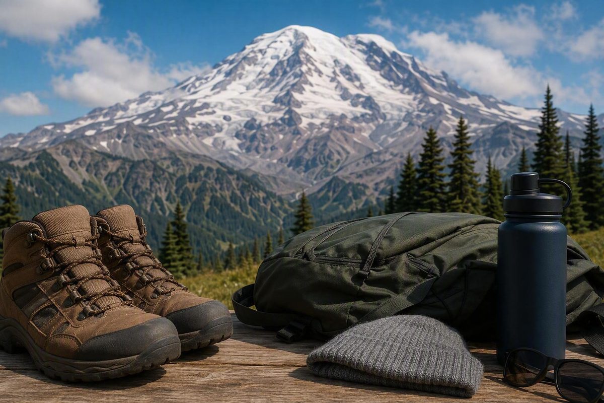
A successful Mount Rainier hike starts with one decision that has nothing to do with trail rankings: Which open park area will you use as your base? Once that is settled, choose a route that fits your available time, ability, preferred scenery, and the conditions you actually find.
That approach matters because Mount Rainier is not a compact attraction where you can casually move among trailheads. Paradise, Sunrise, Longmire, Ohanapecosh, Tipsoo Lake, White River, and Mowich serve different parts of the park. Driving between them can consume the hours you intended to spend hiking.
Choose your Mount Rainier hike by time, effort, and scenery
All distances, elevation figures, and times below are planning estimates—not guarantees. Current National Park Service road, area, and trail information overrides this table. Snow, construction, route variants, altitude, crowds, navigation, weather, and individual pace can substantially change an outing.
| Park area or access corridor | Route | Approximate distance | Planning time | Effort factors | Primary scenery | Likely seasonal concern |
|---|---|---|---|---|---|---|
| Longmire | Twin Firs Loop | 0.4 mile | About 20 minutes | Short forest loop; potentially wet or uneven surfaces | Old-growth forest | Mud, snow, storm debris |
| Longmire | Trail of the Shadows | 0.7-mile loop | About 20 minutes | Short developed-area loop; footing still matters | Forest, wetland, historic landscape | Snow, ice, standing water |
| Stevens Canyon | Box Canyon Loop | 0.5 mile | About 30 minutes | Low mileage does not guarantee accessible grades or surfaces | Canyon, forest, river landscape | Seasonal road access, wet surfaces |
| Paradise | Myrtle Falls | 1 mile round trip | About 35 minutes | Paved opening; grades and stairs near the viewpoint | Waterfall, meadows, Rainier when visible | Snow and ice |
| Paradise | Nisqually Vista | 1.2-mile loop | About 45 minutes | Paved route; grade, snow, and personal mobility still matter | Mountain and glacier viewpoints | Snow, ice, congestion |
| Sunrise | Sunrise Nature Trail | 1.5 miles | About 45 minutes | High-elevation walking from a seasonal hub | Meadows, ridges, mountain views | Road or area closure |
| Stevens Canyon | Bench and Snow Lakes | 2.4–2.5 miles round trip | About 2 hours | Rolling terrain; approximately 600 feet of gain | Forest, subalpine lakes | Small trailhead, snow, insects |
| Sunrise | Dege Peak via Sourdough Ridge | 3.4 miles round trip | About 2 hours | Ridge travel, altitude, sun and wind exposure | Broad ridge and volcano views | Seasonal access, snow, smoke |
| Tipsoo Lake and Chinook Pass | Naches Peak Loop | About 3.4–3.5 miles | About 1.5–2 hours | Approximately 600–669 feet of gain; mixed jurisdictions | Rainier views, tarns, meadows | Seasonal road access, snow, parking |
| Paradise | Skyline Loop | Roughly 5–6 miles | Commonly 3–5 hours | Approximately 1,300–1,800 feet of gain; steep grades, altitude, possible snowfields | Glaciers, waterfalls, meadows, broad views | Snow and ice near Panorama Point |
| Sunrise | Fremont Lookout | About 5.6–6 miles round trip | Allow a generous half-day | Rocky ridge, altitude, exposed sun and wind | Lookout, ridges, panoramic views | Sunrise access, lingering snow |
| White River | Summerland | 8.6 miles round trip | Full day | Approximately 2,100 feet of gain and a sustained climb | Forest, wildflower meadows, alpine terrain | Snow, heat, insects, parking |
| White River | Panhandle Gap | 11.4 miles round trip | Full day | Approximately 3,000 feet of gain, high point, long return | Alpine terrain, expansive views | Snow, abrupt weather, route demands |
Table sourcing: The short-route distances and times, including Twin Firs, Trail of the Shadows, Box Canyon, Myrtle Falls, Nisqually Vista, Sunrise Nature Trail, Bench and Snow Lakes, and Dege Peak, follow the NPS Mount Rainier day-hiking guide. Naches Peak measurements vary between 3.5 miles with 669 feet of gain and 3.4 miles with 600 feet of gain. Skyline variants include the Washington Trails Association’s 5.5-mile, 1,450-foot route, while other mapped versions fall on either side of those figures. Published longer-route figures list Summerland at 8.6 miles with 2,100 feet of gain and Panhandle Gap at 11.4 miles with 3,000 feet of gain.
Do not turn the table into a simple “easy, moderate, hard” ranking. Mileage is only one part of the outing. Elevation gain, grade, altitude, terrain, exposure, snow, weather, navigation, and individual pace all matter. A short trail can include slick stairs or steep-feeling grades. A longer route that feels manageable to a conditioned hiker in dry weather can become a poor choice when visibility drops or snow obscures the route.
Use this quick chooser:
- Choose Paradise for a first visit with several route lengths available from one hub.
- Choose Sunrise for seasonal alpine, meadow, and ridge hikes when the road and area are open.
- Choose Longmire for short, lower-elevation forest walks.
- Choose Ohanapecosh for forests, rivers, and waterfalls, subject to current construction and closures.
- Choose Tipsoo Lake when Naches Peak Loop is the day’s anchor.
- Choose White River for Summerland or Panhandle Gap only when your conditioning, schedule, daylight, and current conditions support a long day.
Pick one park area instead of crossing the mountain
The National Park Service identifies five developed areas: Longmire, Paradise, Ohanapecosh, Sunrise, and Carbon River/Mowich. Development ranges from major visitor hubs to more basic campground and trail access, and not every area is reachable throughout the year. Tipsoo Lake, Stevens Canyon, and White River are also useful hiking locations, but they are not additional members of that five-area list. Review the distinctions and current operating information through the official NPS park-planning page.
Paradise is the park’s most popular destination and offers the broadest route progression for many first-time visitors. From the same general hub, you can walk toward Myrtle Falls, take the Nisqually Vista loop, climb toward Glacier Vista or Panorama Point, use the Golden Gate shortcut, or attempt the full Skyline Loop.
That makes Paradise a practical editorial recommendation, not an objectively superior choice for everyone. A visitor who wants a ridge hike may prefer Sunrise. Someone seeking a short forest walk may be better served by Longmire.
Sunrise is a seasonal, high-elevation base for subalpine meadows and volcanic ridges. Options include Sunrise Nature Trail, Emmons Vista, Dege Peak, Fremont Lookout, and Burroughs Mountain. It works particularly well when the goal is a ridge or alpine hike rather than a waterfall or old-growth walk, but the plan is viable only if the road, facilities, and selected trail are open.
Longmire suits visitors looking for lower-elevation forest experiences. Trail of the Shadows begins in the developed Longmire area, while Twin Firs is a nearby old-growth option. A lower starting point can provide an alternative when upper routes are snowy, but it does not remove the need to check for ice, flooding, storm debris, or construction.
Ohanapecosh is characterized by forests, rivers, and waterfalls. Separate those enduring qualities from temporary access details. The forest remains part of the area’s appeal even when a campground trailhead, bridge, or connecting path is closed.
Carbon River/Mowich serves the park’s northwest side. Carbon River Road is closed to motor vehicles but open to hikers and bicycles. That is a road-specific exception; it does not permit bicycles on ordinary park trails.
A one-day visitor should normally remain in one region. Published estimates put Paradise and Sunrise about 90 minutes or more apart when connecting roads are open, while trips involving Mowich can take several hours. One travel account estimates Sunrise at approximately 1.5 hours from Paradise and Mowich at roughly 2.5 hours from Sunrise, but those times depend on the route, traffic, road status, entrance waits, and construction under the conditions described by its authors.
Build same-area combinations instead:
- Paradise: Use Skyline as the anchor, with Myrtle Falls as the short version or backup.
- Sunrise: Pair one ridge objective with Sunrise Nature Trail or Emmons Vista.
- Longmire: Combine Trail of the Shadows and Twin Firs if both are accessible and time allows.
- Tipsoo Lake: Make Naches Peak Loop the central hike rather than treating it as an add-on between Paradise and Sunrise.
The goal is not to collect park areas. It is to spend more of the day walking and less of it relocating.
Easy and lower-effort walks for short visits
“Short,” “paved,” “stroller-suitable,” and “wheelchair-accessible” describe different route characteristics. None means that a trail is appropriate for every child, senior, stroller, wheelchair, powered device, or other mobility aid.
Twin Firs Loop is a 0.4-mile old-growth forest loop with an NPS planning estimate of about 20 minutes. It can work as a brief stand-alone walk or a companion to a Longmire visit. Roots, moisture, snow, or storm debris can materially change the experience.
Trail of the Shadows is a 0.7-mile Longmire loop, also estimated by NPS at approximately 20 minutes. It suits a short forest and historic-landscape outing rather than a high-elevation viewpoint hike.
Box Canyon Loop is approximately 0.5 mile, with an NPS estimate of about 30 minutes. Low mileage should not be read as a universal accessibility statement. Current road status, surface conditions, grade, and footing still matter.
Myrtle Falls is approximately 1 mile round trip from Paradise, with an NPS estimate of about 35 minutes. The route follows the Skyline Trail and begins on pavement, but stairs are used near the waterfall viewpoint. Snow and ice can remain even where the underlying surface is paved.
Nisqually Vista is a 1.2-mile loop with an NPS estimate of about 45 minutes. NPS describes it as suitable for families with strollers, but that wording remains conditional. Snow, ice, grade, stroller design, the user’s strength, and the child’s needs can determine whether it is practical.
Sunrise Nature Trail is 1.5 miles with an estimated time of about 45 minutes. It provides a comparatively short introduction to the Sunrise landscape, but only when the Sunrise road and area are open and the trail surface fits the visitor’s needs.
The opening portion of Skyline toward Myrtle Falls has limited wheelchair accessibility and is commonly described as accessible with assistance. Steep grades may require physical help or significant powered-device battery capacity. The accessible portion does not reach every waterfall or glacier view associated with the larger route. Those limitations are detailed in the Washington Trails Association’s Skyline guidance.
Before relying on an accessibility description, reassess:
- Current snow and ice
- Pavement or trail-surface damage
- Grade in both directions
- Stairs and viewpoint access
- Required assistance
- Mobility-device range and braking
- Restroom and facility availability
- Whether the practical turnaround still provides the desired experience
A short route can be the right Mount Rainier hike without being effortless. Choose it because its specific characteristics fit your group—not because a broad label says it should.
Skyline Trail as a modular Paradise hike
Skyline is better understood as a network of choices than as one all-or-nothing loop. Starting at Paradise, hikers can adjust the outing at several logical points.
Continue uphill and the route becomes steeper before reaching Glacier Vista, at about 6,300 feet. Many visitors use Glacier Vista as an unofficial turnaround. Farther on, Panorama Point provides broad views when visibility permits. Connectors such as Golden Gate create additional loop options.
Published measurements differ because hikers use different connectors and mapping methods. A reasonable planning range for a complete Skyline outing is roughly 5–6 miles with approximately 1,300–1,800 feet of elevation gain. As one clearly defined measurement, the Washington Trails Association lists 5.5 miles and 1,450 feet of gain.
Potential scenery includes Mount Rainier, glaciers, waterfalls, subalpine meadows, wildflowers, and broad views from Panorama Point. Visibility, blooms, and wildlife are possibilities, not promises.
Clockwise or counterclockwise?
Clockwise travel begins with a steep climb. Some hikers prefer to complete much of the elevation work early and have prominent mountain views in front of them when the weather is clear.
Counterclockwise travel begins more gradually and reaches Myrtle Falls early. That progression may appeal to hikers who want to warm up before encountering steeper upper terrain.
Neither direction is a safety rule or universally better choice. Direction does not remove the elevation gain, altitude, snow, or weather exposure. Choose according to current trail guidance, your preferred climbing pattern, and whether you expect to turn around before completing the loop.
Golden Gate and other ways to shorten the route
The Golden Gate Trail can reduce the complete outing by approximately one mile, but it bypasses Sluiskin Falls and the Van Trump Monument. That may be a sensible exchange when energy, daylight, or weather is declining.
Turning around is also a complete route choice:
- Myrtle Falls: A short Paradise outing.
- Glacier Vista: A steeper partial Skyline hike without committing to the upper loop.
- Panorama Point: A condition-dependent destination before deciding whether to continue.
- Golden Gate: A shorter loop for hikers who want more than an out-and-back.
- Full Skyline: Appropriate only when time, fitness, daylight, weather, and trail conditions align.
Snow and ice near Panorama Point can create consequential terrain. The low Skyline route may cross a steep snowfield, and the upper alternative is not automatically suitable for an unprepared hiker. The route-specific snowfield and shortcut details are documented in the WTA guide cited above.
If continuing requires snow-travel skills or equipment you do not have, turn around or select a lower objective. Carrying traction does not by itself make steep or unfamiliar snow safe.
Paradise is listed with parking, restrooms, food, water, and visitor information. Hours and availability can change, so verify operating status rather than building the day around every service being open.
Moderate and strenuous alternatives beyond Skyline
Choose an alternative according to the landscape you want, not its position in a “best hikes” ranking.
For lakes: Bench and Snow Lakes
Bench and Snow Lakes is approximately 2.4–2.5 miles round trip. A published route measurement reports about 600 feet of elevation gain.
The practical constraint may be the trailhead rather than the trail. A first-timer hiking guide reports space for only approximately 12–15 cars, so availability is never assured in its Bench and Snow Lakes description. Have another legal, same-corridor objective ready rather than creating an improvised overflow space.
For a scenic loop: Naches Peak
Naches Peak Loop runs approximately 3.4–3.5 miles with about 600–669 feet of elevation gain. It circles the peak near Tipsoo Lake and can provide tarns, meadows, and forward-facing Rainier views when the weather cooperates.
Clockwise travel is a common author and reviewer preference, not an official requirement. Supporters of that direction like having Mount Rainier ahead during much of the second half. One detailed guide lists the loop at 3.4 miles with 600 feet of gain and explains the clockwise preference while noting that the route crosses National Park and National Forest land.
That mixed jurisdiction matters. Do not assume a single answer for dogs, fees, or parking from a generic trail label. Verify the rules for the complete route and the specific place where you intend to park.
For a shorter ridge: Dege Peak
Dege Peak via Sourdough Ridge is 3.4 miles round trip, with an NPS planning estimate of approximately two hours. It offers a defined ridge objective without the longer commitment of Fremont Lookout.
Altitude, exposure to sun and wind, and seasonal snow can still make Dege Peak more demanding than its mileage suggests. Clear views are not guaranteed.
For an alpine lookout: Fremont Lookout
Fremont Lookout is commonly measured at approximately 5.6–6 miles round trip. The route uses the Sunrise trail system before moving onto rockier ridge terrain toward the lookout. One published profile lists a 5.6-mile version with 1,200 feet of gain and an estimated 3–5 hours from Sunrise Visitor Center.
Allow a generous half-day instead of planning around the fastest estimate. The recommendation is entirely conditional on Sunrise access, weather, visibility, and current trail conditions. An exposed ridge is a poor choice in threatening weather.
For a waterfall: Carter Falls
Carter Falls is 2.2 miles round trip, with an NPS estimate of about two hours. Access depends on a log footbridge across the Nisqually River that can wash out in fall or winter, according to NPS day-hiking information.
Confirm the crossing before treating the route as available. If the bridge is absent, do not improvise a hazardous river crossing.
For a long wildflower and alpine day: Summerland or Panhandle Gap
Summerland is listed at 8.6 miles round trip with 2,100 feet of elevation gain. Continuing to Panhandle Gap increases the outing to approximately 11.4 miles with 3,000 feet of gain in this published collection of Mount Rainier day hikes.
These are strenuous full-day examples, not default recommendations for visitors who have never hiked at altitude or on lingering snow. The return distance, remaining daylight, weather, and energy reserve matter as much as reaching the destination.
This general first-timer guide deliberately does not present Camp Muir, High Rock Lookout, or similarly exposed snow and cliff objectives as routine alternatives. A famous viewpoint is not worth forcing when its terrain exceeds your preparation.
Plan for snow, wildflowers, weather, and changing access
Sunrise and Mowich are seasonal areas. Opening dates depend on snow removal, road damage, weather, fire, and operating conditions—not a guaranteed calendar date. Before departure, use the official NPS planning guidance to verify the park area, road, facilities, weather, and year-specific entry information relevant to your visit.
Late July through August is a common wildflower window, with late July to early August often highlighted for meadow blooms. Timing shifts with snowpack, temperature, storms, and elevation. Regional summer guidance likewise identifies July and August as the usual flowering period while advising visitors to check current bloom information before planning around wildflowers.
Snow can remain on high-elevation trails into summer, and Mount Rainier weather can change rapidly even during generally stable periods. A warm trailhead, a clear Seattle forecast, or a paved opening does not establish that an upper route is dry and safe.
Immediately before leaving, verify:
- Current NPS alerts and conditions
- Road and entrance status
- Park-area and facility status
- Current trail information
- The forecast for the route’s elevation
- Fire, smoke, and construction notices
- Entry, reservation, fee, and payment information for the current year
Do not treat an undated screenshot or old article alert as a current closure. The evidence available for this guide captured an alert concerning the Grand Park 2 Fire, but it does not establish that the alert remains active for your visit. Current NPS notices control.
Some access statements are more enduring but still deserve verification. Grove of the Patriarchs is closed to public entry in the supplied NPS information because flooding damaged the suspension bridge that provided its sole safe access. It should not be placed in an itinerary merely because an older guide describes it as a short old-growth walk.
There is also a specifically dated 2026 Ohanapecosh construction change. NPS says the Ohanapecosh Campground trailheads for the Hot Springs Nature Trail and Silver Falls are closed during construction. For 2026, NPS lists an alternate Silver Falls approach from the Grove of the Patriarchs parking lot: approximately 1 mile round trip via the Eastside Trail. Those dated details appear in the official NPS day-hiking guide.
Do not substitute an older 2.7-mile Silver Falls loop description for the 2026 alternate. With the campground connection closed, that older loop cannot be completed as described. Because construction schedules can change, this statement must be reviewed against current NPS information before publication and again before travel.
Use a conditions-first backup system:
- Upper trails snowy: Move to a lower forest walk.
- Rainier hidden by clouds: Favor forest, river, canyon, or waterfall scenery.
- Primary lot full: Use another legal trailhead in the same area.
- Weather deteriorating: Shorten the route at a known turnaround.
- Steep or unfamiliar snow encountered: Turn around unless your skills, equipment, and route knowledge genuinely match the terrain.
Traction is a tool, not a universal solution. It cannot replace snow-travel judgment, navigation, or the willingness to retreat.
Build a realistic Mount Rainier day trip from Seattle
Mount Rainier is a long but feasible day trip from Seattle when one hike serves as the anchor. It becomes much less realistic when the plan includes several distant park areas, multiple major viewpoints, and a fixed evening commitment back in the city.
A commercial tour operator estimates approximately 2.5–3 hours of driving each way from Seattle, depending on the destination and conditions in its Mount Rainier day-trip planning guide. Treat that as a planning allowance, not a guaranteed drive time. The entrance, traffic, construction, road status, congestion, and weather can all change the result.
The entrance is not the trailhead. Reaching the Nisqually entrance does not mean you have reached Paradise; the mountain road beyond the entrance adds substantial travel time.
Sample plan 1: Lower-effort Paradise day
- Leave Seattle with one Paradise route and one same-area backup.
- Make Nisqually Vista the anchor if you want a loop.
- Choose Myrtle Falls for the shortest recognizable Paradise outing.
- Allow time for slow park roads, parking, restrooms, and an unhurried return.
- If snow or mobility needs make the first choice unsuitable, reassess the backup rather than assuming it will be easier.
This plan succeeds without depending on a major summit-style objective.
Sample plan 2: Half-day Paradise hike
- Start on Skyline with Glacier Vista or Panorama Point as the initial objective.
- Reassess weather, snow, pace, energy, and daylight at the turnaround.
- Use Golden Gate only when the connector is appropriate under current conditions.
- Complete the full loop only if the remaining time and terrain still fit the group.
- Keep Myrtle Falls as the shortened version if parking or arrival delays compress the day.
The itinerary remains successful even when the full loop is not completed.
Sample plan 3: Seasonal Sunrise day
- Verify that the Sunrise road and area are open.
- Select one ridge hike: Dege Peak for a shorter objective or Fremont Lookout for a longer outing.
- Save Sunrise Nature Trail or Emmons Vista as the short same-area backup.
- If clouds eliminate the views or weather deteriorates, shorten the ridge objective rather than driving across the park.
Do not combine Paradise and Sunrise—or Paradise and Mowich—during a Seattle day trip. Even when the drives look technically possible, that plan leaves little resilience for entrance waits, full parking lots, construction, or a slower-than-expected hike.
NPS advises summer visitors to consider traveling midweek and entering before 10:00 a.m. or after 2:30 p.m. to reduce congestion delays. Those times do not guarantee parking. Parking is limited, and overflow parking that blocks or impedes traffic is prohibited.
If the desired trailhead is full, use the backup. Do not wait in a travel lane, invent a shoulder space, or block access.
Before leaving Seattle, confirm that you have:
- A full fuel tank
- A downloaded park and trail map
- Food and sufficient water
- Warm layers
- A rain shell
- Sun protection
- Footwear suited to current conditions
- One primary route
- One shorter same-area backup
- Current NPS information bookmarked or saved for offline use
If an early departure makes an overnight Seattle stay useful, choose a base that reduces backtracking rather than selecting one solely by its position on a regional map. This Seattle accommodation-planning guide explains that anchor-first approach.
Verify transportation options, entrance requirements, reservations, fees, and payment policies directly for your date. These systems can change by year, and an older article should not decide whether or how you can enter the park.
The useful pattern is simple: one anchor outing, minimal backtracking, room for weather, and a backup that does not require rebuilding the day.
Safety, trail rules, and the final pre-hike check
Carry the Ten Essentials, tell someone your route and expected return time, check current trail and backcountry conditions, avoid hiking alone when possible, and remain willing to change the plan. NPS pairs that preparation guidance with rules covering parking, party size, pets, bicycles, protected meadows, and wildlife in its official Mount Rainier day-hiking guidance.
Estimated distance and time do not fully account for:
- Your pace and conditioning
- Your response to altitude
- Snow or ice
- Heat, wind, rain, or poor visibility
- Construction and detours
- Route-finding mistakes
- Crowds and parking delays
- Food, photography, and rest stops
- A slower member of the group
Pets and bicycles are prohibited on ordinary park trails. Carbon River Road is the specific bicycle exception: it is closed to motor vehicles but open to hiking and bicycling. That exception does not authorize bicycles on trails branching from the road.
NPS recommends no more than 12 people in a day-hiking group. In the heavily used Paradise, Sunrise, and Tipsoo Lake meadows, hikers are legally required to remain on designated trails. Cutting switchbacks or stepping into a meadow for a photograph is not an acceptable response to congestion.
Do not feed wildlife. NPS warns that feeding can provoke aggressive behavior, contribute to vehicle collisions, and harm animals. Store food securely, keep your distance, and allow the animal to control the encounter rather than approaching for a photograph.
A practical day-hiking kit should cover the Ten Essentials and the conditions expected on the selected route. At minimum, plan for:
- Navigation and an offline map
- Extra food and water
- Insulation appropriate to the elevation
- Rain protection
- Sun protection
- A light source
- First-aid supplies
- Emergency protection appropriate to the trip
- Sturdy footwear suited to the surface
- Insect repellent when seasonally useful
Cellular service can be unreliable. Navigation, condition checks, communication, and emergency planning should not depend on having a live connection at the trailhead.
Before starting, make one final five-part go/no-go decision:
- Road and area: Are the entrance, road, trailhead, and park area open?
- Trail: Are the surface, snow, crossings, and exposure compatible with your skills?
- Weather: Is the forecast acceptable for the route and its elevation?
- Parking: Is legal parking available, or can you use your same-area backup?
- Time and supplies: Do you have enough daylight, food, water, clothing, and energy?
Frequently asked questions
What is the best Mount Rainier hike for a first-time visitor?
For many first-time visitors, Paradise is the most practical area because it provides several route lengths from one hub. Myrtle Falls and Nisqually Vista suit shorter plans, while the Skyline network lets prepared hikers continue toward Glacier Vista, Panorama Point, Golden Gate, or the full loop.
That is a planning recommendation, not a universal ranking. Choose Sunrise when it is open and ridge hiking is the priority. Choose Longmire when a lower forest walk better matches the weather, available time, or group.
Can I shorten the Skyline Trail instead of completing the full loop?
Yes. Skyline is modular. Turn around at Myrtle Falls for an approximately 1-mile outing, continue to Glacier Vista for a steeper partial hike, or use Panorama Point as a condition-dependent destination. Golden Gate can shorten the loop by about one mile, although it bypasses Sluiskin Falls and the Van Trump Monument.
Decide at each point according to snow, visibility, energy, time, and daylight. Completing a shorter planned version is preferable to forcing the full loop.
When is the best time for wildflowers and snow-free hiking?
Late July through August is a common wildflower period, but no date guarantees peak blooms or snow-free trails. Bloom timing changes with snowpack and weather, while high-elevation snow can persist into summer.
Check current trail information, road status, forecasts, and bloom reports immediately before departure. Sunrise and Mowich access is seasonal and should never be assumed from the month alone.
How early should I arrive for a Mount Rainier hike?
For summer congestion, NPS suggests entering before 10:00 a.m. or after 2:30 p.m. and traveling midweek when possible. An earlier arrival may provide more daylight and flexibility, but it does not guarantee parking.
If a lot is full, use a legal same-area backup. Do not rely on prohibited overflow parking or assume that waiting in or near a travel lane will create a space.
Are dogs allowed on Mount Rainier hiking trails?
Pets are prohibited on ordinary Mount Rainier National Park trails. A leash does not change that rule.
Naches Peak Loop requires extra attention because the route crosses National Park and National Forest land, where pet rules may differ by segment. Verify the entire route rather than applying the most permissive rule from only one jurisdiction.
Make four decisions before you leave
Make four decisions in order:
- Check current NPS conditions.
- Choose one open park area.
- Select a route that fits the day’s time, abilities, weather, and terrain.
- Save a shorter backup in the same area.
The successful Mount Rainier hike is not necessarily the longest or most famous route. It is the one you complete without forcing the weather, snow, parking, or schedule.