
How to Plan a Safe Walk or Ride Through the Cascades
The standard Hyak outing is 5.3 miles with two unlit tunnel crossings, plus seasonal access checks, lighting needs, and cold, wet conditions.
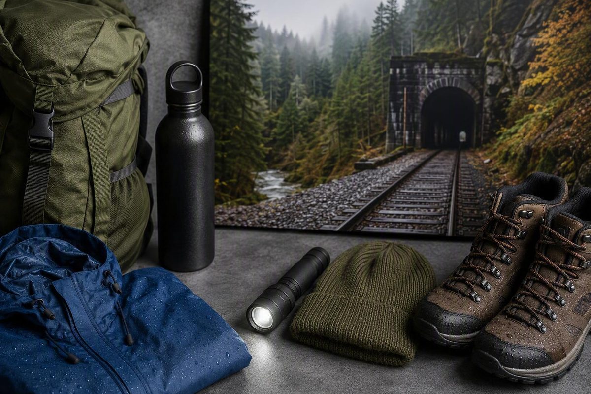
The Snoqualmie Tunnel is nearly level, but it is not an effortless trail. A standard visit from Hyak is about 5.3 miles round trip and includes two passages through an unlit railroad tunnel approximately 2.3 miles long. Darkness, cold, dripping water, puddles, uneven ground, and bicycle traffic can matter more here than climbing ability.
The simplest plan is to start at Hyak, travel through the tunnel to the west portal, and return the same way. Before committing, confirm that the tunnel is open, equip every person with dependable primary and backup lighting, and carry clothing suitable for a cold, damp interior.
Snoqualmie Tunnel at a Glance
The Snoqualmie Tunnel is a former railroad tunnel near Snoqualmie Pass. It now carries hikers, cyclists, equestrians, and other permitted non-motorized trail users through the Cascade Range as part of the Palouse to Cascades State Park Trail. Washington State Parks lists the tunnel at approximately 2.3 miles long and places Hyak at its eastern end. Washington State Parks describes the trail, permitted activities, and seasonal tunnel access.
The tunnel length is not the length of the complete visit. The standard Hyak out-and-back includes the approach from the parking area, one full crossing, and a return through the same tunnel. The Washington Trails Association route description lists this outing at about 5.3 miles round trip with nearly no elevation change.
“Nearly level” is more accurate than “effortless.” The route follows a former railroad grade, but visitors must still cover more than five miles, spend more than four miles underground, negotiate wet or rough areas, manage cold conditions, and share a dark corridor with bicycles.
Hyak is the most straightforward documented starting point for a tunnel-focused visit. It provides a short approach to the east portal and avoids the transportation planning required for a longer one-way ride.
Quick facts
Item What to expect Tunnel length Approximately 2.3 miles from portal to portal Standard Hyak outing About 5.3 miles round trip Route Out and back for a tunnel-only visit Grade Nearly level former railroad grade Surface Loose gravel outside; mostly packed dirt with gravel, puddles, and potholes inside Permitted users Hiking, cycling, and horseback riding Dogs Permitted on leash Lighting No installed lighting; natural light is not useful in the middle Season Seasonal, with a winter closure and weather-dependent reopening Parking WTA lists a Discover Pass; verify current requirements before departure
Older maps and trip reports may call the corridor the Iron Horse Trail, Iron Horse State Park Trail, or John Wayne Pioneer Trail. The current official name is the Palouse to Cascades State Park Trail. The older names generally refer to the same former railroad corridor and remain useful when interpreting older directions or signs.
Check Whether the Tunnel Is Open Before You Leave
Article information date — September 7, 2026: This guide does not confirm that the tunnel is open today. Check the Washington State Parks trail page and its alerts immediately before departure. Verify both the tunnel status and any notice affecting the particular section you intend to use.
Washington State Parks lists a seasonal closure from November 1 through May 1, with reopening dependent on weather. May 1 is therefore not a guaranteed opening date.
The 2026 season illustrates the distinction between the nominal schedule and actual access. The tunnel reopened on May 5, 2026, rather than May 1. A western trail section near the Mount Washington Trailhead then reopened on June 5, 2026, using a temporary bypass after storm damage. The State Parks reopening announcement documents both dates and explains the storm-repair context.
For a basic Hyak out-and-back, verify:
- The tunnel itself is open.
- The Hyak approach is accessible.
- The parking area is operating under the rules you expect.
- Any facilities you need are available.
- Recent weather has not caused a new closure or access problem.
For a longer ride west of the tunnel, also check for notices involving washouts, unstable slopes, trestle work, construction, and temporary detours. The broader Palouse to Cascades corridor is not uniformly improved or interruption-free. An open tunnel does not establish that every continuation is passable.
Separate stable planning facts from operational information. The tunnel’s darkness and approximate length are relatively durable facts. Opening status, parking arrangements, pay-station operation, restroom availability, construction, fees, and detours can change and require a fresh check.
Conditions can also affect trip suitability without closing the trail. Consult current official or public-safety information for wildfire smoke, air quality, and recent storm impacts. A dated visitor report about smoke, puddles, parking, or crowds is only a snapshot.
Hyak Access, Parking, and the Portal-to-Portal Plan
For the simplest tunnel trip, drive to the Hyak area from Interstate 90 Exit 54. Download directions or save a screenshot before leaving reliable service. App routing and cellular data can be unreliable near the trailhead, and GPS positioning will not work normally inside the mountain.
Use current road signs and official park information to identify the correct parking area rather than depending entirely on an app pin. Published estimates place the east portal roughly one-quarter to two-fifths of a mile from parking; about one-third of a mile is a practical planning estimate. WTA reports approximately one-third of a mile, while another documented trailhead sign has stated 0.4 mile.
The standard trip follows a simple sequence:
- Park at Hyak and organize equipment before leaving the vehicle.
- Follow the approach trail to the east portal.
- Stop outside the portal for a final lighting and clothing check.
- Travel approximately 2.3 miles through the tunnel.
- Exit at the west portal and pause if desired.
- Re-enter the tunnel and return to Hyak.
The crucial detail is step six. The west portal is the midpoint, not the finish, of the standard out-and-back. Anyone who reaches it must still cover the entire dark passage again. Budget light power, warmth, water, time, and patience for both crossings.
WTA lists a Discover Pass as the parking requirement at Hyak. Pass rules, prices, day-use alternatives, and pay-station operation can change, so verify them before driving rather than assuming that a machine will be available or accept a particular payment method.
WTA has documented bathrooms and an automated pay station at Hyak. Near the west portal, it reports picnic tables, a garbage can, a pit toilet, and mountain views. These are reported amenities, not guarantees: maintenance, weather, seasonal operations, or outages can affect availability.
Do not plan around an assumption that drinking water, showers, an open restroom, an empty parking space, or a particular payment option will be available. Bring your own drinking water, arrive with a parking plan, and meet essential needs before starting.
Anyone who becomes uncomfortable at the portal or shortly after entering can choose a shorter visit. Every step into the tunnel creates an equal return distance. Before entering, groups can agree on conservative reasons to reconsider the crossing, such as inadequate lighting, discomfort with the enclosed darkness, or a surface that exceeds someone’s mobility tolerance. This is a planning choice, not an official emergency procedure.
What the Tunnel Feels Like and What to Pack
The tunnel is completely unlit over a long distance. Daylight helps briefly near each portal, but visitors should not expect useful natural light in the middle. The distant opening may eventually appear as a small point without illuminating the ground immediately ahead.
The interior can remain cold and damp even when the parking area is warm. Water may drip from the ceiling, and puddles can form on the trail. The main surface is packed dirt with occasional gravel, small potholes, and locally uneven areas. These conditions turn a nearly level route into a sustained low-light navigation problem.
Lighting baseline
As a conservative baseline, each person should carry:
- One dependable, hands-free primary light
- A separate backup light or spare batteries
- Enough power for the entire outing, including the return
- Backup equipment stored where it can be reached in darkness
WTA advises visitors to check their lights before entering, carry spare batteries, wear warm clothing, and use reflective clothing or a rear light for visibility around cyclists. These recommendations support treating reliable primary lighting and accessible backup power as essential rather than optional.
A headlamp is generally the most practical primary light for walkers because it keeps both hands available. A handheld flashlight can serve as a backup or supplement. Do not make a phone flashlight the planned primary source: the available evidence does not establish that it provides suitable beam placement, durability, or battery life for two long crossings.
Cyclists need a dependable front light that reveals the trail surface far enough ahead for their speed, plus visible rear or reflective equipment. No evidence supports a universal lumen requirement. Beam pattern, mounting, charge, speed, and backup capacity all affect usefulness.
Keep lights operating inside the tunnel. It is an active shared-use trail rather than a controlled tour, and walkers, riders, dogs, puddles, or uneven ground may be nearby even when the corridor sounds empty.
Clothing and basic supplies
Pack for the tunnel rather than the temperature beside the car:
- A warm layer
- Water-resistant outerwear
- Sturdy walking shoes or bicycle tires suited to dirt and gravel
- Drinking water
- Snacks
- Reflective or otherwise visible clothing
- A small, accessible backup light
- Personal supplies needed to complete the return without relying on facilities
Cold and moisture can become more noticeable when moving slowly or stopping.
The pre-entry check
Before crossing the threshold:
- Turn on every primary light.
- Test every backup light.
- Confirm battery charge or install fresh batteries.
- Put spare power somewhere reachable without unpacking the entire bag.
- Add a warm or water-resistant layer before becoming cold.
- Make walkers visible from behind.
- Add visible equipment to bicycles.
- Shorten and control dog leashes.
- Confirm that everyone understands the distance and return plan.
Phone GPS, app mileage, and device elevation readings can become inaccurate inside the mountain. Use the known route structure—east portal, full crossing, west portal, return—rather than relying on an app for precise underground progress.
For example, the AllTrails route listing displays 2,942 feet of elevation gain while also warning that underground GPS and elevation readings may be inaccurate. That gain figure is inconsistent with the nearly level railroad grade and should not be used to assess the route. Precise-looking underground sensor data can still be wrong.
Sharing the Tunnel Safely on Foot or by Bicycle
Hikers, cyclists, and equestrians are permitted on the state trail, and dogs must be leashed. Darkness removes many of the visual cues people normally use to assess speed and distance, making visibility and predictable movement especially important. State Parks also identifies the corridor as day-use only and prohibits fires.
For walkers
Walkers should remain visible and avoid spreading across the full trail width. Reflective clothing, a rear-facing visible light, or both can help approaching riders identify a group sooner. Move predictably, look before changing sides to avoid a puddle, and do not stop abruptly in the main travel line.
Maintain enough awareness to hear pass announcements and group instructions. If stopping, move as far out of the travel line as conditions reasonably allow.
For cyclists
Cyclists should slow substantially before entering and ride at a speed appropriate to the portion of trail clearly illuminated ahead. Keep the front light operating, add rear visibility equipment, expect pedestrians and dogs around wet or rough areas, and announce passes before overtaking.
Do not assume another visitor has heard the bicycle merely because the tunnel amplifies sound. Echoes can obscure direction. Allow extra room, wait when a pass is uncertain, and expect a walker to alter course around a puddle or pothole.
WTA describes the tunnel as approximately 14 feet wide, but it can feel narrower.
Groups, children, and dogs
Count every group member before entering and after exiting. Avoid allowing the party to become widely separated, especially when children have different walking speeds or cyclists are passing through the group. Decide who will lead, who will remain at the rear, and how the group will communicate.
Dogs are allowed on leash, but a short, controlled leash is the prudent choice inside the tunnel. Darkness, bicycles, puddles, echoes, dripping water, and an unfamiliar enclosed space can lead to unpredictable movement. Keep both the handler and dog visible, and reconsider the crossing if the animal is distressed.
WTA identifies the route as good for children, but permission and suitability are different. Adults should consider whether a particular child can cover approximately five miles, tolerate cold and damp conditions, remain calm in prolonged enclosed darkness, follow directions around cyclists, and complete a second crossing after reaching the west portal.
Visitors with a serious fear of darkness or enclosed spaces may prefer to walk to the east portal, look inside, and turn around. A portal visit is a valid alternative to entering without adequate equipment, confidence, or capacity to return.
Difficulty and Practical Accessibility
The central accessibility distinction is simple: the route has almost no elevation change, but a gentle grade is not the same as verified universal accessibility.
Outside the tunnel, WTA describes loose gravel over a hard-packed base. Inside, the surface is mostly hard-packed dirt with small potholes and occasional gravel. WTA also reports that the first approximately 100 yards from the east end have more significant crowning and rougher potholes than much of the remaining tunnel.
Other documented barriers include puddles, a gate bypass that may collect water, local cross-slope, and a rough gravel path to the west-end toilet. Darkness can magnify each obstacle because a depression that is obvious outdoors may be harder to judge under a narrow or poorly positioned beam.
WTA reports accessible bathrooms at the trailhead and an accessible pit toilet near the west end. That description applies to the facilities themselves; it does not eliminate possible barriers along the route to them. Gravel, puddles, cross-slope, or the total travel distance may still determine whether a particular visitor can reach and use a facility comfortably.
For these reasons, the route should not be labeled broadly as ADA-compliant, wheelchair-accessible, stroller-friendly, or appropriate for every adaptive bicycle. The available trail descriptions do not establish that level of universal suitability.
Mobility-device users should evaluate:
- Tolerance for loose gravel, potholes, crowning, and puddles
- Wheel or tire size and traction
- Battery range in cold conditions, if applicable
- Lighting placement and the amount of surface it reveals
- Space needed to turn or allow others to pass
- Ability to reverse course from any point
- Capacity to complete more than four underground miles on an out-and-back
- Whether the route to a required restroom is workable
Stroller users face similar questions involving wheel size, vibration, steering over crowned surfaces, visibility, and the child’s warmth. “Flat” does not answer those questions.
Adaptive cyclists considering a commercial shuttle should separate state-trail access from vehicle-transport restrictions. A shuttle operator may be unable to carry certain adaptive, recumbent, wide-tire, or fender-equipped bicycles because of trailer design. That does not establish a park-wide prohibition. Confirm trail rules with State Parks and transport compatibility directly with the operator.
For cyclists and mobility-device users, speed should match the ground clearly revealed by the light. Position the beam to show potholes and surface changes, test it before entry, and avoid following so closely that another person blocks the view ahead.
Choose a Tunnel Walk, Round-Trip Ride, or Longer One-Way Ride
There are three substantially different ways to plan a Snoqualmie Tunnel outing. Their distances, return logistics, and exposure to closures west of the tunnel are not interchangeable.
| Trip shape | Approximate distance | Return logistics | Best reason to choose it | Main tradeoff |
|---|---|---|---|---|
| Hyak tunnel out and back | About 5.3 miles | Return to the same vehicle at Hyak | Simplest independent plan | Requires two complete tunnel passages |
| Hyak to Homestead Valley | About 16 miles one way | Second vehicle or arranged shuttle | Longer gravel ride with a generally downhill western leg | More route checking and vehicle coordination |
| Summit/Hyak to Rattlesnake Lake commercial option | Approximately 21 miles | Commercial rental or shuttle service | Longer, mostly downhill supported ride | Schedules, capacity, prices, age rules, and equipment limits apply |
Tunnel-only walk or ride
The tunnel-only outing is the cleanest plan for a first visit. Park at Hyak, use the short east-side approach, cross to the west portal, and return. It avoids vehicle coordination and limits exposure to potential closures farther west.
The tradeoff is repetition. Walkers and cyclists spend approximately 4.6 miles underground across the two passages. A bicycle reduces travel time, but effective lighting, controlled speed, and careful passing become even more important.
If you ride farther west and then return to Hyak, remember the grade direction. Travel west beyond the tunnel is generally downhill, making the return toward Hyak gradually uphill. It is not a steep climb, but it can feel different late in the outing.
Hyak to Homestead Valley
A published route description of the Hyak-to-Homestead Valley ride places it at about 16 miles one way on gravel. The route requires a vehicle shuttle or another dependable return arrangement; it is not simply an extended version of the same-car tunnel visit.
Check the entire route rather than only the tunnel. A closure beyond the west portal can invalidate the through-plan even when the tunnel is operating. Download an official map, identify access points, and confirm where vehicles may legally park.
Commercial Summit-to-Rattlesnake Lake ride
The Summit at Snoqualmie markets an approximately 21-mile, mostly downhill ride through the tunnel to Rattlesnake Lake, with rental and shuttle options. Check the operator’s current scenic bicycle service details for operating dates, schedules, availability, prices, minimum ages, and bicycle-transport restrictions.
Commercial terms are not state-trail rules. If the operator prohibits dogs on its ride or cannot transport a particular adaptive, recumbent, wide-tire, or fender-equipped bicycle, that restriction applies to the service. It should not be generalized into a prohibition on the Palouse to Cascades State Park Trail.
How 2026 storm repairs fit into longer rides
Following storm damage, Washington State Parks constructed a 350-foot-long, 36-inch-wide temporary bypass near the Mount Washington Trailhead and reopened it on June 5, 2026, for pedestrians, cyclists, and equestrians. At the time of the notice, cyclists were asked to dismount on the bypass.
The location is relevant to longer western itineraries rather than the standard Hyak tunnel out-and-back. Even so, compare your exact route with an official map and current alerts before depending on that interpretation.
A 2026 announcement provides historical context, not proof that the bypass or any other detour remains in the same operating condition today. Recheck immediately before departure.
From Milwaukee Road Tunnel to State Park Trail
The Milwaukee Road constructed the single-track, standard-gauge Snoqualmie Tunnel through the Cascade Range from 1912 to 1914, replacing a temporary surface railroad route over Snoqualmie Pass. Railroad electrification followed in 1917, addressing smoke-dissipation problems associated with operating locomotives through the long enclosed passage.
The final Milwaukee Road train passed through on March 15, 1980.
The tunnel later required substantial rehabilitation. Work completed before its July 5, 2011, reopening included concrete work, structural reinforcement, and installation of a crushed-rock trail surface. A historical summary of the Snoqualmie Tunnel reports a more precise tunnel length of 11,894 feet, or approximately 2.25 miles.
The railroad heritage explains both the route’s advantages and its limitations. Yet the corridor remains a long, unlit piece of transportation infrastructure rather than a purpose-built indoor attraction.
Its names changed as the corridor evolved. John Wayne Pioneer Trail and Iron Horse Trail appear frequently in older guides, while Palouse to Cascades State Park Trail is the current official name. Recognizing all three names makes it easier to reconcile older directions with present park information.
Frequently Asked Questions
Is the Snoqualmie Tunnel open today?
Do not infer today’s status from the normal season or from this article. Washington State Parks lists a closure from November 1 through May 1, but reopening depends on weather and may occur later. In 2026, for example, the tunnel reopened on May 5. Check the current State Parks trail page and alerts immediately before leaving.
How long is the Snoqualmie Tunnel hike from Hyak?
WTA lists the standard Hyak out-and-back at about 5.3 miles. The tunnel itself is approximately 2.3 miles from portal to portal, and the approach from parking adds distance. Exact recordings vary with the starting point and unreliable underground GPS, but the standard outing requires two complete tunnel crossings.
Do I need a Discover Pass to park at the Snoqualmie Tunnel?
WTA lists a Discover Pass for the Hyak trailhead. Verify current State Parks parking requirements, day-use alternatives, prices, and pay-station operation before arrival. Do not assume a pass can be purchased on site or that a particular payment method will work.
Can children and dogs go through the Snoqualmie Tunnel?
Children may use the route, and dogs are allowed on leash. Suitability depends on the individual child or dog rather than permission alone. Consider the roughly five-mile distance, prolonged darkness, cold and damp conditions, echoes, puddles, and bicycle traffic. Keep dogs on a short, controlled leash and make every member of the group visible.
Does the Mount Washington bypass affect a basic Hyak tunnel trip?
The Mount Washington bypass is west of the tunnel and is relevant to longer western itineraries rather than the standard Hyak tunnel out-and-back. Because repairs and detours can change, compare your intended route with an official map and current State Parks alerts before relying on that distinction.
Make the Final Go-or-No-Go Decision
Use three steps to make the final plan:
- Verify official status. Check the tunnel, Hyak access, parking, facilities, air quality, weather impacts, and any closure affecting the precise route.
- Choose the trip shape. Decide between a short portal visit, the approximately 5.3-mile tunnel out-and-back, or a longer shuttle-supported bicycle route.
- Check every participant’s equipment and capacity. Do not enter until each person has dependable primary lighting, backup lighting or power, and clothing suitable for cold and moisture.
The gentle railroad grade should not obscure the real demands. A standard round trip includes more than four miles inside a completely unlit tunnel, shared traffic, wet or uneven surfaces, and a required return through the same passage.
If access, smoke, recent storm impacts, equipment, mobility needs, or discomfort with enclosed darkness make the crossing a poor fit, choose a short portal visit or another outing. The better trip is the one everyone is prepared to complete safely.