
How to Choose a First Boating Experience Around Seattle
For a first experience, select an access model, departure area, and primary destination that fit the least-experienced person in the group.
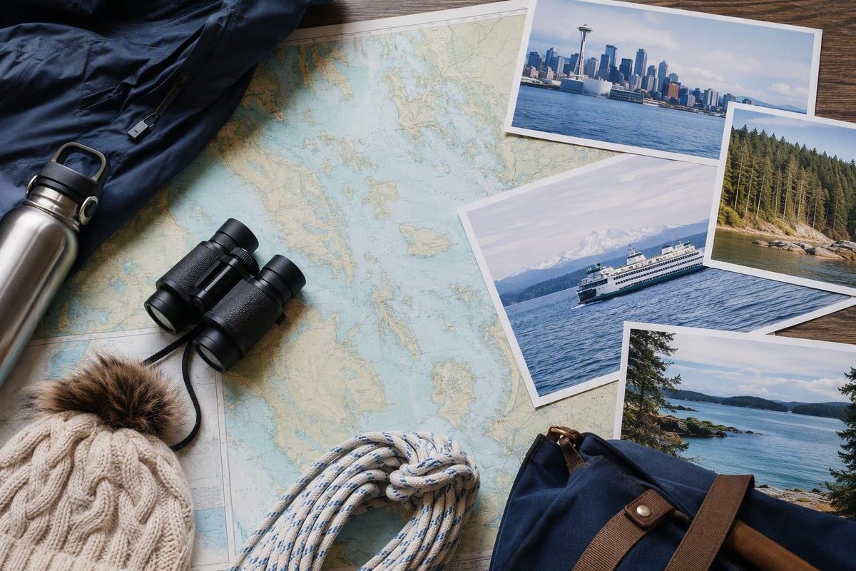
Puget Sound boating is not one uniform experience. A short outing from Seattle, a marine-park weekend from Tacoma, and a multi-day cruise from Everett can involve different distances, currents, traffic, services, and skill demands. The best first trip therefore begins with three choices: how you will access the water, where you will depart, and how much of the Sound you are realistically trying to cover.
For visitors and newer boaters, restraint is useful. Choose one region and one primary destination that suit the least-experienced person aboard. Treat additional stops as optional. Before departure, verify the plan against current nautical charts, marine forecasts, tide and current predictions, navigation notices, regulations, operator requirements, and facility updates from the responsible authorities.
This guide offers destination inspiration and a framework for narrowing your choices. It is not a navigation plan, legal guide, weather forecast, complete safety checklist, or substitute for on-water instruction.
Start by choosing what kind of boating day you want
First decide whether you want to ride as a passenger or participate in operating a recreational vessel. Those are different activities, even when both begin on Seattle’s waterfront.
A passenger-ferry outing is primarily a transportation and sightseeing day. You follow a published route and schedule while the ferry operator runs the vessel. A recreational excursion, lesson, charter, lease, or rental may instead put you on a smaller boat and involve anything from observing a professional operator to assuming responsibility for navigation and handling.
Seattle Know’s approach—one destination, one time buffer, one warm layer, and room for weather—is a useful nontechnical framework for keeping a waterfront day manageable. Its ferry material does not provide recreational-boating instruction, marina information, route planning, or navigation guidance. Seattle Know describes its editorial focus as practical travel planning around neighborhoods, ferries, and weather.
For a first experience, compare four entry points:
- Passenger-ferry day. Choose this if your goal is scenery, a crossing, and time ashore without operating a recreational boat. It can reveal the scale of Central Sound, but it does not provide hands-on experience with docking, route selection, traffic management, or vessel systems.
- Guided excursion or captained charter. A professional normally operates the vessel under this model. Depending on the provider and contract, passengers may observe local decision-making or perform limited tasks under direction. Confirm whether the outing is instructional rather than assuming that every captained trip includes training.
- Sailing or powerboating lesson. Choose instruction when skill development is the primary goal. A beginner lesson is generally easier to absorb when it concentrates on a defined set of tasks rather than attempting a long sightseeing itinerary at the same time.
- Qualified bareboat access. In a bareboat arrangement, an approved renter or charterer operates the vessel. Providers may evaluate qualifications, recent experience, local knowledge, or boat-handling ability and may require an orientation or checkout. A course certificate alone does not guarantee approval.
One regional provider distinguishes among lessons, guided excursions, captained charters, clubs, leases, and bareboat access, illustrating how much the models can differ. It says bareboat use generally depends on demonstrated competence and a checkout rather than interest alone. These are descriptions of that provider’s programs, not a market-wide rule. Puget Sound Sailing Institute outlines its advertised instruction and access options.
Avoid asking one day to serve three unrelated purposes. A beginner lesson, a long cruise, and several shore destinations compete for the same hours. Briefings, vessel orientations, docking, meals, weather delays, and walking ashore all take time. Choose one anchor:
- For sightseeing, make the crossing or cruise the anchor.
- For learning, make the lesson the anchor.
- For a bareboat outing, make competent operation and one nearby destination the anchor.
- For a captained trip, decide whether the priority is scenery, sailing, wildlife observation, or a meal ashore.
Keep a buffer before fixed evening commitments. Bring clothing suitable for a cooler or windier experience than expected on land. Retain a shore-based or passenger-ferry fallback if conditions, operator availability, or crew comfort do not support the recreational-boating plan.
The supplied evidence does not establish which operators are active now, what they charge, which vessels are available, or what requirements apply across the market. Confirm schedules, prices, qualifications, contracts, insurance terms, cancellation policies, and current availability directly before arranging travel or lodging around a booking.
Understand Puget Sound by region before choosing a destination
Treat South, Central, and North Puget Sound as practical trip-planning areas rather than interchangeable points on one destination list. These broad cruising groupings do not resolve every geographic question, but they help prevent a common mistake: choosing places scattered across the map without accounting for the passages between them.
A commercial cruising overview groups the area into South, Central, and North Puget Sound, followed by northern gateways through Skagit Bay toward Bellingham Bay. It presents a mix of cities, marinas, islands, anchorages, marine parks, museums, and shore attractions. That overview is useful for orientation, but it is promotional and does not supply the route-specific information required for navigation. Waggoner’s regional overview lists representative destinations in each area.
South Puget Sound includes Olympia, Case Inlet, Carr Inlet, and waters approached through Tacoma Narrows. Marine-park possibilities described in cruising accounts include Penrose Point, Joemma Beach, McMicken Island, Jarrell Cove, Eagle Island, and Hope Island. This region may appeal to someone interested in trails, camping, kayaking, or time away from a major urban waterfront. That does not mean every park is easy to approach or that conditions will be calm.
Central Puget Sound includes Gig Harbor, Tacoma, Vashon Island, Seattle, Bremerton, Poulsbo, Bainbridge Island, and Blake Island. It offers many ways to combine time on the water with a town, park, museum, meal, or walk ashore. It also puts recreational boaters near ferries, commercial traffic, and busy urban waterways. For a Seattle visitor, Central Sound may be the most obvious area to investigate, but “near Seattle” does not mean “quick in every vessel and every current.”
North Puget Sound and the northern gateways include Kingston, Edmonds, Everett, Port Ludlow, Port Townsend, Langley, Coupeville, and Oak Harbor. Continuing through northern passages brings La Conner, Deception Pass, Anacortes, and Bellingham into the broader planning picture. These destinations can fit longer cruises or boats based farther north, but their practicality depends on the departure point, route, vessel, crew, and conditions.
Generalized descriptions such as “calmer southern waters” should not be converted into forecasts or safety guarantees. The Waggoner overview also notes that the northern convergence zone can contribute to changing weather and sea conditions, but that broad observation cannot predict conditions for a particular route or time. Check the current marine forecast and route-specific conditions instead.
A destination that appears reasonable from Anacortes may require a much larger commitment from Seattle, Tacoma, or South Sound. Vessel speed does not settle the question by itself; route exposure, current timing, traffic, daylight, fuel or energy, and crew endurance also matter.
Choose the departure area before becoming attached to a particular island or town. Then identify destinations within a conservative range of that starting point. Reversing the usual wish-list approach produces a more realistic first outing.
Central Sound ideas for a Seattle-based outing
Blake Island, Bainbridge Island, Eagle Harbor and Winslow, Blakely Harbor, Elliott Bay, and Poulsbo can all inspire Central Sound plans. They should be treated as examples for comparison, not as a prescribed sequence.
A useful historical reference is a one-week family bareboat cruise published by SAIL Magazine in 2019. The account described a clockwise Central Sound itinerary involving Blake Island, Poulsbo, Eagle Harbor or Winslow, Blakely Harbor, Elliott Bay, and the Seattle area. It combined a marine state park, waterfront towns, docks or anchorages, and views around the city. The original SAIL Magazine account documents that 2019 itinerary and charter experience.
The article is a travel narrative, not a current navigation plan. Its observations came from one vessel, one crew, and one summer trip. Marina services, shoreline access, park facilities, restrictions, and charter availability may since have changed. The account should not be used to predict present wind, fuel consumption, mobile coverage, marina costs, or passage times.
It nevertheless illustrates several distinct trip styles:
- Blake Island: a park-centered concept combining boating with forest and shoreline time.
- Eagle Harbor or Winslow: a town-oriented stop associated with Bainbridge Island.
- Blakely Harbor: a quieter harbor concept rather than a full urban itinerary.
- Elliott Bay: a Seattle-facing experience in an urban setting.
- Poulsbo: a waterfront-town destination that may fit an overnight or longer plan better than a rushed first day, depending on the boat and departure point.
For a short outing, reduce the number of stops instead of compressing the schedule. One destination with adequate margin is generally more manageable than three places visited while watching the clock. Account for marina departure, vessel checks, conservative transit, maneuvering near traffic, docking or anchoring, securing the boat, time ashore, the return leg, and the final landing.
A one-week cruise can absorb a delayed departure or slower-than-expected leg more easily than a tightly scheduled day trip. On a short outing, currents, weather, traffic, docking attempts, and shore activities consume a larger share of the available window. Establish a turnaround time before departure and treat it as a decision point, not a target to negotiate away.
The 2019 account also illustrates why bareboat approval can involve more than presenting a certificate. The charter company reportedly evaluated the operator’s ability to use charts, navigate, dock, handle sails, anchor, use the radio, and operate the engine before approving the charter. That historical example does not establish any provider’s present requirements, but it demonstrates the scope of skills a checkout may examine.
Blake Island was reported in the account as a substantial marine state park with docks, moorings, campsites, showers, and trails. Treat those facilities as historical context only. Before building a trip around the island, confirm current docks and moorings, vessel limitations, camping, showers, closures, fees, and reservation requirements with the responsible park authority. Keep another destination or no-landing option available if the intended facility cannot be used.
South Sound ideas for marine parks and quieter shore time
South Sound can support a trip organized around marine parks rather than cities. A personal cruising account published in 2024 featured Penrose Point, Joemma Beach, McMicken Island, Jarrell Cove, Eagle Island, and Hope Island. The author described combinations of shore exploration, kayaking, trails, camping, protected coves, and low-service island stops. The 2024 South Sound account provides firsthand descriptions of the six locations.
The stops can be compared by the kind of experience described:
- Trails and shore exploration: Penrose Point and Hope Island were presented as places where walking ashore is central to the visit. Joemma Beach and McMicken Island were also associated with shorter trail or beach experiences.
- Kayaking: Several parks were described as bases for nearshore exploration by kayak. Adding a kayak also adds equipment, launch, handling, weather, and recovery questions that should be addressed through appropriate training and trip preparation.
- Camping: Some featured parks reportedly allowed camping, while not every island did. Never infer camping permission from the presence of a beach, dock, trail, or mooring.
- A more protected setting: Jarrell Cove was described as having protected waters and a mix of park and nearby marina services. “Protected” is relative and does not establish suitable approach, depth, wind, or available space for a particular trip.
- Minimal-service visits: Eagle Island and McMicken Island illustrate the appeal—and limitations—of stops where shore facilities or activities may be sparse.
The account reported different combinations of docks, mooring buoys, restrooms, showers, trails, camping, and nearby services. All such details are time-sensitive. Buoy counts, dock availability, vessel limits, pump-out status, anchoring permissions, camping rules, pet restrictions, and seasonal fuel, water, showers, power, or waste services can change.
Provision before traveling into remote park areas south of Tacoma Narrows. The author specifically recommended doing so because stores and restaurants may be limited. Carry water, food, medication, clothing, and vessel supplies appropriate to the planned duration, while allowing for a possible delay.
Tacoma Narrows is the central route-planning lesson for many South Sound trips. The personal account describes it as a constricted passage where current timing can materially affect progress. Do not derive a passage time or operating threshold from the blog’s historical observations. Use current official predictions for the relevant date and location, together with the vessel’s actual performance and the operator’s competence.
A conservative weekend concept might use one principal park and one fallback instead of attempting all six named stops. Decide whether the trip is mainly about hiking, kayaking, camping, or spending a night away. That decision determines what needs to be confirmed:
- For a dock plan, check transient access, dimensions, depth information, vessel limits, maximum stay, fees, and reservations.
- For a mooring plan, check availability, vessel limits, fees, and current rules.
- For anchoring, confirm that it is permitted and evaluate suitability using current nautical information and the vessel’s equipment.
- For camping, check access, reservations, closures, fire rules, sanitation, and pet restrictions.
- For a remote stop, do not assume the availability of fuel, potable water, groceries, power, mobile service, or waste disposal.
Keep enough flexibility to remain at the first stop, use the fallback, return early, or cancel the overnight portion.
Match your departure point, speed, and available time
“How far can I go?” has no useful answer without a departure point, vessel, date, route, and crew. Practical range depends on cruising speed through the water, tidal flow, weather, visibility, route restrictions, daylight, fuel or battery capacity, and the time required for docking and shore activities.
A 2019 forum discussion about boats based in Everett provides anecdotal evidence that vessels cruising at roughly 6 to 8 knots can still support local weekends and three-to-five-day trips. Participants discussed Hope or Skagit Island, Port Ludlow, Mystery Bay, Poulsbo, Port Madison, Oak Harbor, La Conner, Anacortes, Port Townsend, and Kingston. These were community suggestions, not verified itineraries or beginner endorsements. The Everett discussion shows how individual boaters weighed slower-boat range and destination choice.
Some of those destinations could consume much of a short trip in transit, especially in unfavorable conditions or currents. Others may involve current-sensitive passages or routes requiring more experience than a distance estimate suggests. A place mentioned in a forum is not automatically appropriate for your vessel, weather window, or crew.
Home-port choice creates an access-versus-range tradeoff. A northern base such as Everett, La Conner, or Anacortes may reduce the distance to northern destinations. Seattle or Tacoma may better suit Central or South Sound plans. But a theoretically ideal marina loses practical value if it is so inconvenient that the boat is rarely used.
A distant marina may improve access to marquee destinations while reducing ordinary practice days.
Faster boats can expand the apparent radius of a weekend, but speed is not a universal solution. The evidence does not establish a best cruising speed or boat type.
Use a planning worksheet instead of accepting a travel-time promise:
| Planning item | What to record |
|---|---|
| Departure point | Exact marina, ramp, dock, or harbor |
| Vessel speed | Conservative cruising speed, not advertised maximum |
| Route distance | Distance measured with a current nautical planning source |
| Sensitive passages | Narrows, passes, bridges, shallow areas, traffic areas, or restrictions needing closer review |
| Current effect | Official predictions for the relevant locations and times |
| Conditions | Marine forecast, visibility, precipitation, and possible changes |
| Daylight window | Usable departure and return window, with margin |
| Turnaround point | Time or location at which the return begins |
| Fuel or energy plan | Expected use and the margin selected for the specific vessel |
| Shore time | Docking, securing, meals, walking, loading, and departure preparation |
| Fallback | A verified alternative usable by the same vessel and crew |
| Change trigger | Conditions, equipment issues, or crew concerns that shorten or end the plan |
Google Maps, old forum calculations, and automatic app routes are not substitutes for nautical charts or route-specific navigation. A straight line can omit depths, hazards, restricted water, bridge constraints, traffic schemes, or current effects. Any generated marine route still requires checking against current charts, official predictions, navigation notices, restrictions, and the operator’s own planning.
For a day trip, select a destination that leaves an unhurried return window. For a weekend, count nights and usable transit periods rather than treating both calendar days as fully available. For a three-to-five-day cruise, preserve a delay margin instead of planning to spend every day moving farther from the home port.
Choose a beginner pathway: lesson, practice, charter, club, or lease
Independent operation should follow a progression rather than serve as the first step. The right pathway depends on whether you want a one-time visitor experience, long-term sailing skills, regular practice, or eventual bareboat cruising.
Puget Sound Sailing Institute describes a staged program beginning with ASA 101, followed by ASA 103 and ASA 104. According to the provider, ASA 101 addresses basic keelboat handling, safety, and sail trim; ASA 103 adds subjects including navigation, anchoring, docking, and onboard systems; and ASA 104 advances into route planning, provisioning, overnight operation, and decision-making for multi-day bareboat trips. The provider advertises instruction in Seattle, Tacoma, Des Moines, Olympia, and Anacortes, subject to confirmation of current scheduling and availability.
These are the provider’s own program descriptions, not an independent assessment of course quality or a guarantee of competence. The provider also says fundamentals may be introduced over a weekend or several sessions, while confidence requires repeated practice.
The main access models serve different purposes:
- Structured lessons teach defined skills with an instructor.
- Guided excursions prioritize an on-water experience directed by a professional.
- Captained charters normally place vessel operation with the hired captain, although participation and instruction vary by provider and contract.
- Clubs can provide recurring access, practice opportunities, and community, subject to membership rules and fleet availability.
- Fractional leases provide scheduled access under a contract to a specific boat or limited fleet.
- Bareboat charters or rentals place operation with an approved charterer or renter, subject to the agreement and applicable requirements.
- Ownership provides greater control over access while adding moorage, maintenance, insurance, and operating responsibilities.
Proximity deserves serious weight when comparing clubs and marinas. In a 2012 Lake Washington forum discussion, participants generally advised a novice to consider the closer option because easier access could produce more practice. The original poster later reported frequent outings after choosing the nearby club. The account is anecdotal and dated, but it illustrates a useful planning principle: a convenient boat used regularly may contribute more to skill development than a distant boat chosen only for access to open water. The SailNet discussion illustrates the proximity-versus-destination tradeoff.
Certification can document completion of a course, but it does not guarantee bareboat approval, insurance eligibility, or readiness for every vessel and route. Providers may consider recent experience, vessel size, local knowledge, docking ability, and other qualifications. They may require an orientation or checkout and can limit or decline approval.
One provider advertises fractional sailboat leases for qualified sailors in Seattle and Tacoma. Its supplied page says applicants typically need ASA 103 and ASA 104 or equivalent experience and may need a checkout sail. It also describes recurring access with moorage, insurance, and routine maintenance managed through the program. Rates, included sailing days, insurance scope, vessel availability, overnight access, scheduling priority, and checkout terms require direct confirmation before relying on them. The provider’s lease page describes its advertised qualification and access model.
A beginner progression might look like this:
- Take an introductory lesson or captained outing.
- Practice basic procedures and close-quarters handling repeatedly.
- Add navigation, docking, anchoring, systems, and radio instruction.
- Gain experience gradually in more complex local conditions.
- Complete advanced coursework relevant to the intended vessel and trip.
- Pass any provider-required checkout for the specific boat.
- Make the first independent outing shorter than the boat’s theoretical range.
The purpose is not to collect credentials quickly. It is to build judgment through instruction, repetition, and honest operating limits.
Plan for currents, weather, ferries, traffic, and cold water
The supplied cruising accounts repeatedly identify tides, strong currents, changing depths, ferries, cold water, restricted areas, and other traffic as material concerns on Puget Sound. A 2019 charter narrative specifically describes those issues and reports that adverse current in Rich Passage substantially reduced that vessel’s progress during one trip. The South Sound account similarly emphasizes current timing in Tacoma Narrows. These are illustrations, not current operating instructions.
Speed through the water and speed over the ground are not interchangeable. Tacoma Narrows and Rich Passage show why current can change passage progress, but the supplied evidence does not establish current gates, safe transit procedures, or route-specific thresholds. Obtain current official predictions and instruction appropriate to the passage.
Weather can also differ across the region. A land forecast for Seattle may not describe conditions along an entire marine route. A regional cruising overview notes that the northern convergence zone can contribute to changing weather and sea conditions, but it does not provide a deterministic seasonal rule. Check the marine forecast for the waters and time involved, and continue monitoring conditions.
Ferries and large commercial vessels require deliberate route preparation and room for plans to change. Informal forum discussions often reduce traffic-lane navigation to a slogan about crossing at a particular angle. That shorthand is not a complete statement of applicable navigation law. The same discussions contain personal interpretations of traffic schemes, ferry zones, radio use, and collision regulations that should not be treated as legal guidance. A Puget Sound traffic-lane forum thread illustrates both the concern and the limits of informal advice.
Before departure, obtain current information from the responsible official sources for:
- Nautical charts and corrections
- Marine forecasts, advisories, and warnings
- Tide and current predictions
- Notices to Mariners and local navigation notices
- Navigation rules and vessel-traffic restrictions
- Restricted or security areas
- State boating requirements
- Wildlife-protection requirements
- Park, port, marina, and launch status
- Emergency information relevant to the route
Because the supplied evidence pack does not contain current government guidance for those subjects, this article does not attempt to summarize the rules or provide official-source links. Readers should identify and consult the responsible federal, state, park, port, and marina authorities directly rather than relying on travel articles, commercial guides, or forums.
Automatic routing, AIS, radar, and chartplotters can be useful inputs when the operator knows how to use them. They do not, by themselves, establish that a route is legal or appropriate. Treat that as a planning limitation rather than a complete statement of equipment use; obtain qualified instruction for the systems installed on the vessel.
Before operating independently, consider whether you can address the following:
- Chart use: Identify depths, hazards, aids to navigation, route constraints, and alternatives.
- Route planning: Prepare a passage plan using current nautical and official information rather than straight-line distance.
- Docking: Depart and return in the anticipated conditions and know how to discontinue an approach.
- Anchoring: Select an appropriate location and use the vessel’s equipment correctly.
- Radio operation: Understand the installed equipment and obtain current, authoritative instruction on procedures.
- Vessel handling: Control the specific sailboat or powerboat at slow and normal operating speeds.
- Engine and systems checks: Follow the vessel’s procedures and recognize abnormal indications.
- Mechanical problem response: Know how to stop, stabilize the immediate situation, communicate, and seek qualified assistance.
- Crew management: Brief passengers and assign only tasks suited to their abilities.
- Plan changes: Be willing to wait, turn back, divert, shorten the route, or cancel.
The supplied evidence is insufficient for detailed legal instruction, VHF procedures, emergency protocols, cold-water survival guidance, or route-specific safety thresholds. Obtain appropriate training and current official information for those subjects. This section identifies questions to resolve; it is not a complete safety checklist.
Use a verification-first departure checklist
A destination list becomes useful only after the vessel, crew, route, and present conditions support it. Use this sequence to organize further research rather than as a substitute for a vessel-specific checklist or professional instruction.
-
Define the crew and vessel limits. Identify the least-experienced person aboard, relevant medical or mobility needs, operator qualifications, vessel capabilities, draft, fuel or energy range, and equipment limitations. Confirm that the provider and contract permit the intended route and use.
-
Choose one region. Select South, Central, or North Sound based on the departure point and available time. Avoid assembling a first trip from unrelated destinations in several regions.
-
Estimate a conservative route. Use current nautical planning information. Include departure procedures, actual navigable distance, maneuvering, docking or anchoring, time ashore, and the return leg.
-
Identify complex passages. Mark narrows, passes, shallow areas, bridges, traffic routes, ferry crossings, security zones, and locations where current or restrictions could alter the plan.
-
Check conditions and official information. Verify marine weather, visibility, tides, currents, charts and corrections, navigation notices, wildlife rules, operator requirements, traffic restrictions, and relevant emergency information. Repeat these checks close enough to departure to capture changes.
-
Confirm every service on which the trip depends. Contact the responsible marina, port, park, or operator as appropriate. Ask about transient space, reservations, dock limits, buoy availability, anchoring rules, pump-outs, fuel, potable water, electricity, showers, camping, groceries, pet rules, fees, and closures.
-
Provision for the actual trip. Bring warm and windproof layers, drinking water, food, medication, required safety equipment, navigation and communication tools, and supplies appropriate to the vessel and duration. Plans involving remote stops warrant additional preparation.
-
Retain a realistic fallback. Identify an alternate harbor, shorter route, delayed departure, or shore-based day. The fallback should suit the same vessel and crew rather than introduce a more difficult passage.
Responsible operation also includes minimizing environmental impact: avoid disturbing wildlife, use authorized sewage-disposal facilities, retain trash, prevent oil or other pollutants from entering the water, and follow current park and environmental rules. An older commercial overview discusses these themes, but its specific wildlife distances, speed provisions, operator-age rules, education exemptions, and sanitation thresholds should not be relied upon without current official verification. Boatsetter’s 2022 overview provides general environmental context but is not a current regulatory source.
Finish with an explicit decision: go, delay, shorten, or cancel. A reservation, social commitment, or attractive destination should not override current information or crew capability.
Can a beginner go boating on Puget Sound without owning a boat?
Yes. Options can include passenger ferries, guided excursions, captained charters, lessons, and clubs. Rentals, leases, or bareboat charters may become available after the operator meets the provider’s qualifications and checkout requirements.
For a first visit, a lesson or captained experience usually creates a clearer operating arrangement than independent use. Confirm current prices, contracts, insurance terms, availability, and participant requirements directly.
What are some popular Puget Sound boating destinations near Seattle?
Central Sound examples include Blake Island, Bainbridge Island, Eagle Harbor or Winslow, Blakely Harbor, Elliott Bay, Vashon Island, Bremerton, and Poulsbo. Gig Harbor and Tacoma may also enter the comparison depending on the departure point.
These are destination ideas, not guaranteed day trips. Choose one primary destination and verify a realistic fallback using current nautical and official information.
Is South Puget Sound suitable for a weekend marine-park trip?
It can inspire weekends organized around Penrose Point, Joemma Beach, McMicken Island, Jarrell Cove, Eagle Island, or Hope Island. The appropriate choice depends on the departure point, vessel, crew, current timing, conditions, and confirmed access.
Verify docks, buoys, anchoring, camping, sanitation, pet rules, fuel, water, and closures. A route involving Tacoma Narrows requires current official predictions and route-specific planning.
Do I need sailing certification to charter or lease a boat?
Requirements vary by provider, vessel, route, contract, and insurance arrangement. A provider may request certifications, equivalent experience, a boating résumé, or a checkout sail. A certificate does not guarantee approval.
Ask about qualifications for the specific vessel, local-experience expectations, checkout tasks, operating limits, and any separate approval for overnight or multi-day use.
What information should I check immediately before departure?
Check the current marine forecast, visibility, tide and current predictions, nautical charts and corrections, navigation notices, restrictions, wildlife rules, and applicable navigation requirements. Confirm the status of the vessel and every marina, park, dock, buoy, campsite, fuel stop, pump-out, or other service on which the trip depends.
Review the route, turnaround point, fallback, crew readiness, and relevant emergency information. If current information conflicts with the itinerary, change the itinerary.
For a first experience, make one manageable choice: select an access model, departure area, and primary destination that fit the least-experienced person in the group. Puget Sound rewards flexible planning, but orientation is not navigation. Verify current conditions, regulations, charts, currents, facilities, and operator requirements—and shorten, delay, or cancel when those checks do not support the plan.