
How to Plan the Skyline Loop Without Underestimating the Climb
The NPS planning estimate is approximately 4.5 hours for the standard 5.5-mile loop with about 1,700 feet of elevation gain.
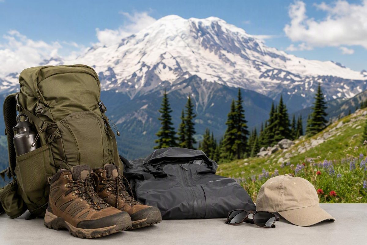
The Skyline Trail at Mount Rainier is more than a viewpoint walk from Paradise. It is a sustained mountain hike with significant elevation gain, exposed upper terrain, multiple junctions, and conditions that can change the sensible objective for the day.
Use the full Skyline Loop as a planning baseline—not an obligation. Depending on snow, visibility, daylight, fitness, and comfort on steep ground, a successful outing may instead end at Panorama Point, return through Golden Gate, or remain on the lower trail near Myrtle Falls.
Editorial note: This guide was reviewed September 3, 2026, using National Park Service route and permit guidance as the primary authority. That date does not confirm live trail, road, weather, parking, or facility conditions.
Skyline Trail at a glance: the official baseline and who it suits
According to the National Park Service Skyline Trail guide, the standard route is a 5.5-mile loop with about 1,700 feet of elevation gain and an estimated hiking time of approximately 4.5 hours.
Quick-planning baseline
- Location: Paradise, on Mount Rainier’s south side
- Standard route: Skyline Trail loop
- Distance: 5.5 miles
- Elevation gain: About 1,700 feet
- Estimated hiking time: Approximately 4.5 hours
- Starting point: Near the Jackson Visitor Center
- Best for: Hikers prepared for sustained climbing and changing mountain conditions
- Shorter choices: Panorama Point turnaround, Golden Gate shortcut, or Myrtle Falls
The trail begins near the entrance to the Jackson Visitor Center at Paradise, beside stone steps bearing a John Muir quotation. Although the opening is paved, it climbs immediately and should not be mistaken for an easy preview of the entire route.
The official time estimate is not a deadline or guarantee. Allow extra time for photographs, a meal or extended rest, busy viewpoints, route checking, or a deliberately slower group pace. Snow, fog, rough footing, heat, and downhill fatigue can also lengthen the day.
“Strenuous for many visitors” is more useful than assigning Skyline one universal difficulty rating. The challenge comes from the combination of:
- A steep opening climb
- Sustained elevation gain
- Limited shade on much of the upper route
- Rocky, uneven, or loose surfaces
- Exposure to wind and strong sun
- Possible snow or ice after lower trails have cleared
- A long descent after the main climb is complete
Published measurements differ because maps and GPS tracks do not always represent the same route. Washington Trails Association lists 5.5 miles with 1,450 feet of gain, while AllTrails lists 5.7 miles and 1,781 feet. Other route descriptions reach approximately 6.2 miles and 1,900 feet when they use different alignments or mapping methods.
These variations may reflect Glacier Vista, High Skyline, Golden Gate, connector trails, the exact starting point, optional detours, or GPS drift. One 6.2-mile route description illustrates why app totals should be compared only after confirming the exact track.
When visibility permits, Skyline can provide views of Mount Rainier, Nisqually Glacier, Panorama Point, waterfalls, subalpine meadows, and distant Cascade volcanoes. Clouds may conceal the mountain completely, while snow cover, wildflowers, fall color, and wildlife vary by season and year.
A concise suitability check:
- Plan the full loop if the complete route is safely passable and the group is ready for sustained climbing and a long descent.
- Turn around at Panorama Point if you want a major western-side objective without committing to the eastern half.
- Use Golden Gate if conditions permit and reducing distance matters more than avoiding a steep connector.
- Visit Myrtle Falls when time, weather, stamina, or mobility make the upper route a poor fit.
These shorter routes are legitimate Paradise outings, not failed versions of Skyline.
Choose your route: full loop, Panorama Point, Golden Gate, or Myrtle Falls
Make the route decision in this order:
- Current snow, closures, and ranger guidance
- Visibility and the weather trend
- Remaining daylight
- Group fitness and descent comfort
- Available water, food, and equipment
- Desired landmarks
| Route choice | Planning distance and effort | Best use | Main caution |
|---|---|---|---|
| Standard Skyline Loop | 5.5 miles, about 1,700 feet of gain, approximately 4.5 hours | The complete sequence of upper viewpoints, meadows, and waterfalls | Sustained climbing; upper and eastern sections may hold snow or hazardous footing |
| Panorama Point out-and-back | Panorama Point is approximately 2 miles from Paradise on the NPS clockwise description; full out-and-back totals vary | A substantial viewpoint hike without committing to the eastern half | The approach is still steep, exposed, and potentially snowy |
| Golden Gate shortcut | Saves roughly 1 mile from the longer loop alignment | Reduces total distance while reconnecting with the Skyline system | The connector is steep, so shorter does not necessarily mean easier |
| Myrtle Falls visit | Short, lower-commitment outing from Paradise | Limited time, uncertain weather, or a scenic stop without the upper loop | The paved opening is steep and does not represent the full route’s terrain |
The standard-loop figures and the approximately two-mile distance to Panorama Point are the NPS planning measurements cited above. A third-party route comparison also describes the Golden Gate variation as approximately 4.6 miles while warning that the connector is steeper than the longer alternative (Skyline route comparison).
Choose the standard loop when the entire route is open and safely passable, visibility supports navigation, and everyone has enough energy and time for both the climb and descent. The broadest route is not automatically the best route for a particular day.
Choose Panorama Point when you want a defined destination on the western side. It is a practical turnaround if the eastern section is questionable, the climb has taken longer than expected, or weather and visibility are deteriorating. Treat the NPS description of approximately two miles to the point as a route landmark rather than a guaranteed GPS result.
Choose Golden Gate when cutting roughly a mile is useful and the steep connector is appropriate for the group. Saving distance may reduce total time, but it does not remove steep grades or difficult footing.
Choose Myrtle Falls when the high route is unsuitable. This lower outing provides waterfall and meadow scenery close to Paradise without requiring the climb toward Panorama Point. The initial pavement can be misleading: the full loop later becomes unpaved, rocky, exposed, and potentially snow-covered.
Before trusting an app estimate, check whether the track includes Glacier Vista, High Skyline, Golden Gate, or another connector. Two routes labeled “Skyline Loop” may describe meaningfully different hikes.
A clockwise landmark guide from Paradise to Myrtle Falls
A clockwise hike begins in the Jackson Visitor Center area. Find the stone steps near the visitor-center entrance and follow the paved Skyline Trail uphill. The grade begins immediately, and the open terrain can make the first section feel harder than its mileage suggests.
Start at a sustainable pace. Moving too quickly here can create an energy problem later, especially when the descent is still several hours away.
Glacier Vista and the western junctions: The Paradise trail network contains several junctions and optional variations. Glacier Vista is a western-side detour associated with views toward Nisqually Glacier. Adding it may change the distance shown on a GPS device.
Carry a map or downloaded offline route, and read the sign at each junction. Do not assume every uphill trail is Skyline or that the people ahead have selected the same route.
Panorama Point: On the NPS clockwise description, Panorama Point is reached after approximately two miles. It is the principal western-side viewpoint, rest location, and decision point.
Before continuing, assess:
- Whether the intended route remains visible
- Wind and changing cloud cover
- Dry, loose, muddy, snowy, or icy footing
- Group fatigue and stability
- Remaining water
- Remaining daylight
- Current ranger or posted guidance
Beyond Panorama Point, use High Skyline where directed. Washington Trails Association describes a steep snowfield east of Panorama Point and notes that the high route provides an alternative before reconnecting with Skyline above the Golden Gate area (WTA Skyline Trail Loop guide). Follow current signs and official routing rather than an old GPS track or footprints across snow.
Turning around at Panorama Point keeps the party on an approach it has already assessed. If the upper route is obscured or the eastern section exceeds the group’s experience, return to Paradise rather than improvising a crossing.
High Skyline and the upper route: The landscape becomes more alpine, with less vegetation, greater exposure, rougher surfaces, and possible lingering snow. Footprints are not proof of a safe route; they can lead onto an old alignment, shortcut, or terrain traveled under different conditions.
Skyline is separate from routes toward Pebble Creek and Camp Muir. Continuing toward Camp Muir is not part of the ordinary loop. It is a longer, more demanding mountain objective with different terrain and planning requirements. Verify trail names at upper junctions.
Stevens–Van Trump Memorial and Paradise Glacier junction: After the upper traverse and reconnection, the clockwise route proceeds toward the Stevens–Van Trump Memorial and the Paradise Glacier Trail junction. Stay with the route selected for the day rather than adding an unplanned branch.
Paradise Valley and Sluiskin Falls: Sluiskin Falls is one of the notable water features. Descending does not mean all difficult terrain is over; surfaces may remain steep, rocky, wet, muddy, or snowy.
Myrtle Falls and the return to Paradise: Myrtle Falls lies near the lower portion of the clockwise loop, close to the developed Paradise area. It is often busy because it can also be reached as a short independent outing. Follow the signed path from the falls toward the visitor center and parking area.
On a clear day, the wider view may include Mount Adams, Mount St. Helens, or Mount Hood. Wildflowers, fall color, marmots, mountain goats, and glacier views are possibilities, not guaranteed itinerary items.
Clockwise or counterclockwise: choose by grade and descent comfort
Skyline can be hiked in either direction, and neither is universally superior. The practical difference is how each direction distributes the climb and descent.
Clockwise generally places the steeper sustained ascent early.
This direction also simplifies a western-side out-and-back. If the party decides at Panorama Point not to continue, it can return over the same terrain rather than enter the eastern half.
Counterclockwise generally begins with a more gradual ascent past Myrtle Falls and through the eastern side. The tradeoff is a steeper descent later, which may be less comfortable for hikers with sensitive knees or limited confidence on loose, wet, or snowy ground.
Direction decision
- Choose clockwise to tackle the steepest sustained climb while fresh and keep Panorama Point as a straightforward turnaround.
- Consider counterclockwise for a gentler opening if everyone is comfortable saving the steeper descent for later.
- Let conditions decide when snow, closures, visibility, or ranger guidance make one side unsuitable.
Do not select a direction based on promises of better light, guaranteed wildlife, fewer people, or superior views. Clouds and visitor patterns can change throughout the day, and wildlife moves independently of hiking plans.
Eastern-side snow can matter more than the normal grade profile. A gradual ascent offers little advantage when the trail is obscured, while a familiar descent is not safe if it crosses snow or ice beyond the group’s ability.
Snow, weather, and the best-season question
There is no dependable date on which Skyline becomes universally snow-free. Snow can remain well into summer, particularly around and beyond Panorama Point and on parts of the eastern side. Melt timing changes with winter snowpack, spring temperatures, storms, wind, exposure, and local shading.
“Best season” is therefore a conditions question rather than a fixed-month answer. Later summer may improve the likelihood of a mostly clear route, but it does not eliminate snow, smoke, rain, wind, heat, fog, or early cold storms. Early-season travel may be hazardous.
Use High Skyline when directed instead of following the hazardous lower alignment. An old track or visible line across snow does not establish the preferred current route.
Weather can make the same mileage substantially harder:
- Rain makes pavement, rock, and packed soil more slippery.
- Fog and low cloud can hide both views and trail alignment.
- Wind can affect balance and make exposed rest stops uncomfortable.
- Loose rock requires slower, deliberate foot placement.
- Mud slows travel and does not justify widening the trail.
- Wildfire smoke can reduce visibility and affect the wisdom of sustained exertion.
- Strong sun can increase water needs on terrain with limited shade.
Wildflowers and autumn foliage are seasonal possibilities rather than date-certain attractions. Clear conditions may reveal distant Cascade volcanoes, while cloud can conceal Mount Rainier even when the developed Paradise area remains relatively bright.
Pre-departure status check
Editorial checklist reviewed September 3, 2026; this is not a report of live conditions.
- Read the park’s current alerts and Mount Rainier conditions page.
- Check road and entrance status for the route you intend to drive.
- Review current Paradise and Skyline trail information.
- Check a mountain-specific forecast rather than relying on a Seattle forecast.
- Review current wildfire and smoke information.
- Verify temporary access, reservation, or corridor rules.
- Confirm visitor-center, food, water, and restroom operations.
- Ask about High Skyline, eastern-side snow, and current crossings when rangers are available.
- Repeat the check on the morning of departure.
Dated trip reports can illustrate variability but cannot establish current snow, parking, smoke, road, or trail conditions. A report from a similar month—or even a recent day—does not replace official information for the date of the hike.
Gear, navigation, and clear turnaround triggers
Pack for an exposed mountain day rather than an urban viewpoint walk. A practical baseline includes:
- Sturdy footwear suited to uneven ground
- Layers for wind, rain, and changing temperatures
- Sunscreen, sunglasses, and a hat
- Enough water for the intended route, plus a reserve
- Food for a longer-than-planned outing
- A paper map or downloaded offline map
- A charged phone that is not the only navigation tool
- Basic emergency supplies appropriate to the group and forecast
AllTrails reports poor cellular coverage as a concern on this route, while other visitor accounts vary. Treat coverage as inconsistent and plan as though calls, messages, map tiles, and live forecasts may not load.
Snow equipment must match current conditions. Traction devices, poles, snowshoes, or other equipment may be appropriate when snow remains, but carrying equipment does not create the judgment or experience required for steep snow travel. Turn around if the crossing, exposure, or runout exceeds the group’s ability.
Decide on turnaround conditions before leaving Paradise. Shorten the route or return if:
- The trail is obscured and its alignment cannot be confirmed.
- Snow or ice exceeds the party’s experience.
- Footing becomes unsafe for anyone.
- Visibility deteriorates enough to affect navigation.
- Wind, precipitation, smoke, or temperature is worsening.
- A hiker becomes unusually fatigued, unsteady, cold, or overheated.
- Water is running low.
- Progress is too slow for the available daylight.
- Ranger guidance conflicts with the planned route.
- The group no longer has a comfortable margin for the descent.
Natural water should be treated before drinking, and streams or seasonal flows are not substitutes for beginning with adequate water. The NPS also cautions hikers not to rely on untreated water along the route.
Difficulty changes during the day. The steep opening can make the hike feel harder than the mileage suggests, while tired legs and reduced stability may become more important during the descent.
There is no blanket rule for children, older adults, or people with medical or mobility concerns. Consider the actual party’s recent hiking experience, ability to manage steep grades, comfort with exposure, equipment, and the day’s conditions. When uncertainty is substantial, select a lower-commitment route before starting.
Paradise logistics: parking, admission, restrooms, and visitor services
The Skyline trailhead is in the developed Paradise area near the Jackson Visitor Center and associated parking. It is not a remote roadside trailhead.
Parking can be heavily used during peak periods. Arriving early may improve the chance of finding a legal space and preserves more daylight for route decisions, but no arrival time guarantees parking.
Create a contingency plan before driving to Paradise. That may mean choosing another outing if legal parking is unavailable, visiting on a different day, or shortening the hike if delays remove too much daylight. Do not assume that roadside parking or an overflow procedure exists unless current park guidance identifies it.
Ordinary individual day visitors generally must pay park admission or hold an accepted pass. A wilderness permit is not ordinarily required solely to complete Skyline as a day hike. The NPS permit and reservation guidance distinguishes a day visit from activities that carry additional requirements, including:
- Backcountry overnight camping
- Climbing above 10,000 feet
- Glacier travel
- Commercial activities
- Special events
- Certain organized or large-group activities
Do not rely on an old entrance-fee amount or assume that a previous timed-entry policy still applies—or does not apply. Fees, reservations, temporary corridor controls, and entrance procedures can change, so verify the requirements for the exact date and activity.
Carry essential supplies rather than making the hike dependent on a particular building, fountain, or food service being open.
A toilet is associated with the Panorama Point area, but it is seasonal. Washington Trails Association reports that it is normally closed from mid-October to mid-June. Verify its status and use the restroom before starting rather than making this facility essential to the plan.
Paradise is restricted to day use, and there are no wilderness camps on the Skyline route. Plan to finish with sufficient daylight rather than treating an unplanned overnight stay as a fallback.
Trail rules, meadow protection, and accessibility limits
Dogs and fires are prohibited on park trails. Paradise is day-use only, overnight camping is not permitted there, and no wilderness camps are located on the Skyline Loop, according to the official NPS route rules.
Stay on constructed trails to protect fragile subalpine vegetation. Meadows that look broad and durable can be damaged by repeated footsteps. Do not leave the path to avoid mud, reach a photograph location, approach wildlife, or create a private rest area. Wait for room on the trail rather than widening it.
The paved opening does not make the complete loop accessible. The initial route is steep, and upper portions become unpaved, rocky, exposed, and potentially snowy.
Wheelchair access on the lower route is limited. The WTA guide notes that manual-chair users may require assistance, particularly beyond the bench approximately halfway toward Myrtle Falls. Visitors seeking a lower-barrier outing should assess the Myrtle Falls approach separately rather than using the pavement near Paradise to judge the full Skyline Loop.
Observe wildlife from a respectful distance. Marmots, mountain goats, and other animals may appear, but sightings are not guaranteed and should never draw visitors away from the constructed trail.
Before leaving Paradise:
- Verify official conditions, roads, alerts, and access rules.
- Confirm the exact route and principal junctions.
- Select the full loop, Panorama Point, Golden Gate, or Myrtle Falls.
- Choose a turnaround time and objective in advance.
- Carry navigation, water, food, sun protection, and weather layers.
- Confirm that everyone is prepared for both climbing and descending.
- Stay on constructed trails and protect the meadows.
- Remain willing to shorten the outing.
Route flexibility is the central Skyline planning skill. Start the full loop only when the party, terrain, weather, and available time support it. Panorama Point, Golden Gate, and Myrtle Falls are deliberate alternatives, not consolation choices. A successful day respects changing mountain conditions, protects the meadows, and turns around before uncertainty becomes a hazard.
How long does it take to hike the Skyline Trail at Mount Rainier?
The NPS planning estimate is approximately 4.5 hours for the standard 5.5-mile loop with about 1,700 feet of elevation gain. Actual times vary with pace, stops, route variations, crowds, snow, and weather.
Allow additional time for photography, a meal or long rest, Glacier Vista, careful travel over rough ground, or a slower group pace.
Is Skyline Trail better clockwise or counterclockwise?
Neither direction is universally better.
Clockwise generally places the steeper sustained climb near the beginning and offers a more gradual descent later. It also reaches the western viewpoints earlier, making Panorama Point a straightforward turnaround.
Counterclockwise generally provides a gentler opening ascent but saves the steeper descent for later. Current snow, closures, and ranger guidance should override either preference.
Can I hike to Panorama Point without completing the full loop?
Yes. Panorama Point is a common turnaround and a substantial objective on its own. NPS places it approximately two miles from Paradise on the clockwise route description, although complete out-and-back recordings vary with connectors and the precise turnaround location.
Return from Panorama Point if visibility worsens, the climb consumes more time or energy than expected, or the route ahead is not safely passable.
Do I need a permit or reservation to hike Skyline Trail?
An ordinary Skyline day hike generally requires park admission or an accepted pass but not a wilderness permit. Backcountry camping, glacier travel, climbing above 10,000 feet, commercial activities, special events, and some organized activities have additional requirements.
Reservation and access policies can change. Check the current NPS permits and reservations guidance cited above for the exact date and activity.
Are dogs allowed on the Skyline Trail?
No. Dogs are not allowed on the Skyline Trail. Pets are prohibited on park trails under the NPS rules for this route.