
Explore Southeast Seattle From Mount Baker to Rainier Beach
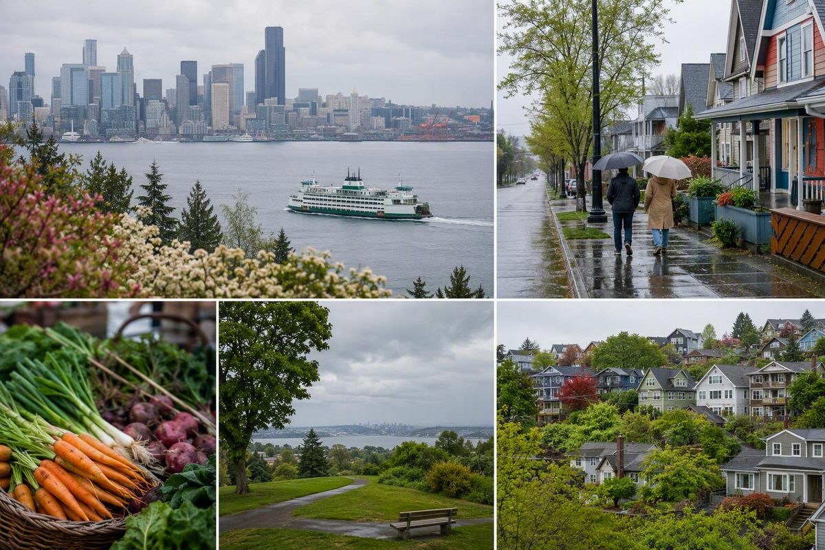
Rainier Valley is easier to understand as a connected chain of southeast Seattle communities than as one uniform neighborhood. Rainier Avenue South and Martin Luther King Jr. Way South form its main geographic spines, while Link light rail gives visitors a practical way to move among several station areas.
For trip planning, picture a north-to-south corridor running roughly from Mount Baker through Columbia City and Othello to Rainier Beach. That is a useful visitor framework, not a definitive boundary. Neighborhood names overlap, and the terms used by residents, businesses, historians, transit agencies, and travel guides do not always match.
The simplest approach is not to “do Rainier Valley” all at once. Choose one Link station, one dependable anchor such as a garden or commercial district, and one flexible meal, arts, or indoor stop. Add a second station area only if time, weather, and mobility allow.
Rainier Valley at a Glance: A Corridor, Not One Uniform Neighborhood
Rainier Valley sits in southeast Seattle and forms part of the city’s broader South End. Although it is often called a neighborhood, that label can be misleading for visitors: the name covers or is associated with multiple communities extending along a long valley rather than one compact district.
Published descriptions use qualitative and sometimes differing boundaries. Some place Rainier Valley east of Beacon Hill and west of Mount Baker, Seward Park, and Leschi. Broader descriptions may include the eastern rise of Beacon Hill and the western slope near Lakewood or Seward Park under the term “Greater Rainier Valley.” These conventions illustrate why surrounding slopes and neighborhoods may be included or excluded depending on the map or guide being used (Rainier Valley boundary overview).
For a first visit, Mount Baker to Rainier Beach is the most useful north-to-south frame. It corresponds with a clear sequence of Link stations and keeps the trip understandable. It should not be read as a ruling that every block around those endpoints falls within Rainier Valley.
A practical mental map looks like this:
- North: Mount Baker and the area historically associated with Garlic Gulch
- Middle-north: Genesee and Columbia City
- Middle-south: Hillman City, Brighton, Dunlap, and Othello
- South: Rainier Beach
- West: Beacon Hill and its eastern slope
- East: areas toward Lake Washington, including Mount Baker and Seward Park, depending on the boundary convention
This is why “Rainier Valley,” “Columbia City,” and “Rainier Beach” are not interchangeable. Columbia City is a prominent commercial and cultural district within the larger corridor. Rainier Beach is a distinct neighborhood at its southern end. Rainier Vista is a specific housing community near the northern part of the valley, not another name for Rainier Valley as a whole.
Guides labeled “Columbia City and Rainier Valley” or “Rainier Valley and Rainier Beach” may be useful for planning, but those pairings do not necessarily define where one district ends and another begins.
Finally, Rainier Valley is unrelated to a visit to Mount Rainier National Park. The shared name can confuse first-time travelers, but this guide concerns an urban area inside Seattle.
A North-to-South Guide to Rainier Valley’s Communities
Neighborhood labels overlap throughout Rainier Valley. Some places have established business districts, some are organized around transit stations, and others survive primarily as historical or local place names. General visitor maps may emphasize Columbia City and Othello while omitting names such as Garlic Gulch, Brighton, or Dunlap.
The following sequence is an orientation tool rather than an official inventory.
Garlic Gulch and the Mount Baker area: Mount Baker provides the northern gateway to this visitor corridor. Garlic Gulch is a historical name associated with an Italian American district in this part of southeast Seattle. Visitors are more likely to see “Mount Baker” on current transit maps, while Garlic Gulch appears in historical accounts and local discussions.
Mount Baker also demonstrates the uncertainty surrounding boundaries. Some descriptions treat it as the head of Rainier Valley, while narrower descriptions position the valley beside or south of the Mount Baker neighborhood. For trip planning, the station is more useful as a gateway than as a boundary marker.
Genesee: Moving south, Genesee is commonly included in lists of Rainier Valley communities. It is not organized as a single station-centered visitor district, and the name can refer to somewhat different areas depending on the map.
Columbia City:
Its prominence should not turn it into shorthand for the entire valley. Columbia City is one community within a much longer corridor. It works well as a first-time base because several types of stops are grouped within a manageable area, not because it represents every part of Rainier Valley.
Hillman City: South of Columbia City, Hillman City is an established local name associated with Rainier Avenue South. General tourist maps can make the two districts look almost continuous, but they retain separate identities. If you are visiting a specific restaurant, shop, or event in Hillman City, map the address rather than assuming it is next to Columbia City Station.
Brighton: Brighton appears in historical and neighborhood lists but is less prominent on many visitor maps. It lies within the middle-to-southern portion of the practical corridor. Businesses in this area may use Rainier Valley, Brighton, Hillman City, Othello, or another nearby label depending on context.
Dunlap and Othello: Dunlap is an older neighborhood name, while Othello is frequently presented as a station-centered urban village. The labels may overlap in casual descriptions. For visitors, Othello Station is the clearest orientation point, but that does not erase Dunlap or the identities of surrounding communities.
Othello can support a focused food or neighborhood stop. There is no need to walk the full distance from Columbia City to appreciate the difference between the two areas; Link allows each station district to function as its own cluster.
Rainier Beach: Rainier Beach anchors the southern end of this visitor framework while remaining a distinct Seattle neighborhood. It should not be used as a proxy for the entire valley when discussing housing, public safety, demographics, or local character.
Rainier Beach Station can support a southern-valley outing, including a planned connection to Kubota Garden.
For a short visit, select one primary station area and one optional extension. Trying to cover Mount Baker, Columbia City, Othello, Rainier Beach, Kubota Garden, and Seward Park in one half-day creates more transfers than meaningful neighborhood time. There is no evidence-based “best” district for every traveler; the right choice depends on whether your priority is food, arts, gardens, recreation, history, or a compact walk.
How to Get Around by Link, Foot, Bike, and Car
Rainier Avenue South and Martin Luther King Jr. Way South are the valley’s two principal corridors. They pass through different parts of the street network and should not be treated as interchangeable.
For most visitors, the useful Link sequence from north to south is:
- Mount Baker
- Columbia City
- Othello
- Rainier Beach
A local car-free guide uses the same station sequence when describing a South End and Rainier Valley outing, although its individual business suggestions and route observations should be checked against current conditions (car-free Rainier Valley guide).
A car-free visit is feasible when Link is combined with localized walking and, where necessary, a bus or other connection. The important qualification is that the train does not place every attraction directly outside a station. A destination that looks close on a regional map may still involve hills, busy crossings, indirect streets, or a substantial final segment.
Using Link effectively
Treat each station as the center of a small outing rather than one stop in a race through the valley. Before departure:
- Check current Link alerts and planned service changes.
- Confirm the line, direction, and return route.
- Review elevator notices if step-free station access is essential.
- Map the route from the station exit to the exact destination.
- Verify any bus transfer with the current transit operator.
- Allow flexibility for unfamiliar platforms and street crossings.
Fixed travel-time estimates can quickly become outdated when service patterns or construction change, so build your plan around station order rather than a rigid minute-by-minute schedule.
Walking within station areas
Even there, “walkable” should not be interpreted as universally level, barrier-free, or effortless. Travelers using mobility devices or managing limited stamina should examine the specific route, crossings, curb ramps, and entrance conditions.
At Rainier Beach, in particular, do not assume that Kubota Garden or a lakefront destination belongs to an immediate station loop.
The Rainier Valley Neighborhood Greenway
The Rainier Valley Neighborhood Greenway supplies another north-to-south framework. Seattle describes it as a route of more than six miles between Mount Baker and Rainier Beach, connecting with destinations such as light rail, schools, parks, grocery stores, and business districts. Its features include crosswalks, curb ramps, speed humps, stop signs, pavement work, markings, and wayfinding. The South Walden Street and John Muir Elementary connection was completed in summer 2024 (Seattle Department of Transportation’s greenway project page).
Those improvements do not turn the full greenway into a protected trail or a uniformly easy recreational route. It follows local streets, so users still encounter turns, intersections, grades, and transitions. The city project page does not provide collision-outcome data, so the route is best described through its design and connections rather than an unverified claim that it produced a measurable safety result.
Cycling realities
A bicycle can be useful for linking station areas, but terrain and route continuity require attention. Southeast Seattle includes hills, and two routes that appear parallel on a map may differ considerably in grade and traffic exposure. Trails in the wider area may also contain gaps.
Before riding:
- Save the route rather than relying only on roadside signs.
- Examine elevation as well as distance.
- Identify street changes and busy crossings.
- Note any unprotected or discontinuous sections.
- Decide whether Link will form part of the trip.
- Keep a shorter alternative in case weather or fatigue changes the plan.
Driving
Driving offers flexibility for destinations that are not close to a station, but it does not eliminate the need for route planning. Parking conditions can vary by place and time, and moving a car between several short stops may create unnecessary backtracking.
A car is most useful when the main destination has an awkward first-mile or last-mile connection for your group. For a visit focused on one or two station areas, Link usually provides the clearer structure. Check destination-specific parking information before departure rather than assuming space will be available.
What to See: Gardens, Parks, Arts, and Community Spaces
Rainier Valley attractions fall into two broad categories. The first consists of durable public assets—gardens, parks, playfields, and community facilities. The second includes galleries, theaters, music rooms, businesses, and events whose schedules or operating status can change.
A resilient itinerary pairs one dependable public-space anchor with one currently verified food, shopping, or cultural stop.
Kubota Garden
Kubota Garden is a major southern-valley anchor and one of the clearest reasons to extend a trip toward Rainier Beach. It is a Japanese-style garden incorporating Pacific Northwest plants, and its outdoor landscape is better suited to unhurried exploration than a rushed photo stop (Visit Seattle’s Columbia City and Rainier Valley guide).
“Near Rainier Beach” does not mean “directly beside Rainier Beach Station.” Before visiting, check the current station-to-garden route, any connecting transit, walking terrain, entrance information, accessibility, weather, and return options. Current garden information should take priority over older travel posts.
Columbia City arts and performance spaces
Sources covering the corridor name Columbia City Gallery, Rainier Arts Center, Columbia City Theater, and the Royal Room as cultural venues. Treat those names as research leads rather than guarantees that a venue will be open or presenting a public program during your visit.
Check the venue’s first-party calendar and visitor information before making it an itinerary anchor. A gallery may have limited opening days, a performance venue may open only for scheduled events, and an arts center may host programs that are not available for casual drop-in visits.
Parks, playfields, and community facilities
Examples of public recreation assets associated with the corridor include:
- Genesee Park and Playfield
- Othello Playground
- Rainier Playfield
- Rainier Beach Community Center
These spaces primarily serve neighborhood recreation and community needs rather than operating solely as tourist attractions. Visitors should observe posted rules, avoid disrupting scheduled activities, and remember that a playfield or community center may be occupied by local programs. A local neighborhood overview identifies these facilities, but current amenities, closures, and program access should be confirmed with the relevant public operator (Rainier Valley recreation overview).
Seward Park as a nearby side trip
Seward Park is often paired with Rainier Valley itineraries, but its geographic relationship to the valley depends on the boundary convention being used. The clearest visitor description is that Seward Park is nearby and commonly combined with a Rainier Valley visit, not that it falls definitively within every definition of the valley.
The park provides a forest-and-shoreline contrast to the commercial districts along Rainier Avenue. Visitor coverage describes old-growth forest, a swimming beach, eagle nests, and Audubon educational programming such as birding workshops and guided nature walks.
Swimming conditions, wildlife sightings, programs, and facility access are not guaranteed. Check current park notices and event information, and allow more time than you would for a compact station-area walk.
Building a dependable attraction plan
In fair weather, use Kubota Garden, Seward Park, or a neighborhood park as the main outdoor anchor, then add a meal or cultural stop after confirming its schedule. In wet weather, shorten the outdoor portion and emphasize a currently operating gallery, café, shop, performance, or community-facing program.
This structure prevents a common planning failure: arriving for a closed business and discovering that every alternative is in another station area. The public-space anchor gives the day a stable center; the flexible food or cultural stop adds variety without making the itinerary fragile.
Food, Independent Businesses, and Cultural Life
Tourism and editorial coverage repeatedly associates Rainier Valley with international dining, immigrant-owned businesses, independent retail, arts groups, and community organizations. The useful visitor takeaway is not to compile a checklist of cuisines. It is to slow down in one business district and recognize that the valley’s cultural life belongs to living communities rather than a themed attraction.
That landscape reflects multiple periods of migration and community building. One documented strand began after the end of the Vietnam War in 1975, when Vietnamese immigrants established businesses along Martin Luther King Jr. Way South (historical overview of Rainier Valley). This is one part of a much broader history and should not be used to reduce the valley to a single migration story.
Columbia City receives considerable visitor coverage because it groups several businesses and cultural spaces within a compact district. Othello and other parts of the valley provide additional clusters, but their destinations may be distributed differently. For a short trip, choosing one area for a meal and a walk is usually more coherent than traveling from one end of the valley to the other for unrelated food stops.
Visit Seattle has previously named these businesses in its combined Columbia City and Rainier Valley coverage:
- Geraldine’s Counter
- Redwing Cafe
- The Flour Box
- Kebena Ethiopian Restaurant
- Safari Njema Restaurant
- Andaluz
- Ashanti
- Gather Consignment
- Chrysanthemum
These are examples from a tourism guide, not guaranteed current recommendations. Restaurants and shops may close, relocate, alter hours, change reservation practices, or modify accessibility. Verify the current address and operating information through each business’s first-party website or social profile before traveling.
Avoid treating labels such as “best,” “most famous,” or “authentic” as objective facts. A more useful selection process is:
- Choose Columbia City, Othello, or another compact area.
- Find two currently operating meal possibilities.
- Check hours for the specific day.
- Confirm whether reservations are required.
- Verify dietary and accessibility needs directly.
- Keep one nearby café or indoor alternative.
The same principle applies to community organizations. Attend public events when invited and follow posted visitor information, but do not assume that facilities providing social services are open for casual sightseeing.
How Transportation and Migration Shaped the Valley
Rainier Valley’s present form makes more sense when viewed through a sequence of transportation, housing, and migration periods. This is not a complete neighborhood history, but it explains why commercial districts, housing communities, and transit nodes appear where they do.
The Rainier Valley and Renton Railroad connected downtown Seattle with Columbia City in 1892, later extended to Renton, and was removed in 1937. Columbia City had developed as a separate town before becoming part of Seattle.
During World War II, Rainier Vista and Holly Park were constructed to house workers connected with Boeing and the shipyards. These developments added another important layer to the valley’s housing geography. Their later histories are more complex than a visitor guide can cover, but their wartime origin helps explain why large housing communities became significant local landmarks.
Migration continued to shape commercial life after the war. The post-1975 establishment of Vietnamese businesses along Martin Luther King Jr. Way South is one documented example among many community histories that contributed to the valley’s present cultural landscape.
Transportation changed the corridor again when Link light rail was built along Martin Luther King Jr. Way South. The present station sequence echoes the older role of rail in connecting southeast Seattle with the rest of the city, even though the technology, alignment, and development context differ.
It would be too simple to say that light rail single-handedly “revitalized” Rainier Valley. Rail improved regional access and focused attention on station areas, but development has not occurred uniformly. Columbia City, Othello, and Rainier Beach have followed different paths, and transportation investment interacts with housing policy, land use, business conditions, and community advocacy.
Neither transportation system alone explains the valley’s cultural life or economic change.
Housing, Growth, and Displacement: What the Evidence Supports
Rainier Valley has a varied housing landscape, but the available evidence does not establish a current valley-wide median sale price, rent, affordability judgment, or market trend. Boundaries, property types, and subareas vary too much for a small selection of listings or a figure from one neighborhood to represent the whole corridor.
People considering a move should separate three questions:
- What types of housing exist in a particular subarea?
- What is currently available to rent or buy?
- What eligibility rules apply to a particular subsidized property?
Those questions require different sources and cannot be answered through the Rainier Valley label alone.
Rainier Vista as a focused example
Rainier Vista illustrates one part of the housing landscape. The Seattle Housing Authority identifies it as a public-housing property at the north end of Rainier Valley and describes it within a broader mixed-income community containing open spaces, gardens, an urban farm, parks, playgrounds, youth facilities, and resident services. The authority also identifies walking access to Columbia City businesses and Columbia City Link Station (Seattle Housing Authority’s Rainier Vista information).
That description applies to Rainier Vista, not to every part of Rainier Valley. Its facilities, eligibility requirements, policies, availability, and waiting conditions cannot be generalized to nearby private rentals, home sales, or other subsidized properties.
Prospective applicants should consult the Seattle Housing Authority directly for current eligibility, application procedures, restrictions, and wait information.
What marketplace listings can and cannot show
A captured Zillow page labeled “Rainier Valley” displayed properties in several ZIP codes with widely varying asking prices. Although the page reported a larger result set, only nine listings were visible in the supplied excerpt. That snapshot illustrates variation in property size, location, and asking price, but it cannot establish a typical value, affordability level, inventory trend, demand, appreciation rate, or sales speed (captured Zillow Rainier Valley search).
Marketplace boundaries may also differ from neighborhood definitions used by residents, public agencies, or historians. A listing platform’s use of “Rainier Valley” does not prove that every displayed property falls within the same geographic area.
Renters and buyers should consult current listings alongside official property records, inspection information, financing terms, and subarea-specific research. Asking prices are not final sale prices, and a visible selection is not a market analysis.
Growth and displacement
Local editorial coverage has documented concern about development and displacement around Rainier Valley station areas. These concerns matter where new construction, housing costs, and commercial change may affect longtime residents and businesses. The supplied evidence, however, does not quantify one valley-wide outcome or establish that Link alone caused displacement.
Seattle Met has discussed both real-estate attention and the question of whether Rainier Beach could develop without displacing residents, while noting that its development pattern differed from those around some other stations (Seattle Met’s Rainier Valley and Rainier Beach guide).
That tension is more informative than a sweeping verdict. Transit access can provide value while station-area growth raises questions about who benefits, who can remain, and which businesses and institutions receive support. Answering those questions requires current, subarea-specific housing and demographic data.
Undated population, poverty, rent, and home-value figures should not be presented as current facts. Rainier Beach statistics should not be projected across the entire valley, and neither promotional affordability claims nor individual resident reviews determine whether the area is affordable for a particular household.
A Flexible Half-Day Car-Free Itinerary
The most reliable half-day plan uses one primary station area and one optional extension. That leaves time for an actual neighborhood experience and makes it easier to adjust for weather, closures, fatigue, or transit disruptions.
This structure follows Seattle Know’s broader recommendation to choose a neighborhood base and one anchor activity rather than creating a day dominated by backtracking.
It also reflects the publication’s stated goal of providing travelers with a clear route and a practical backup.
Primary plan: Columbia City
1. Take Link to Columbia City Station. Check current service alerts and station access before leaving. Save the return route and note any planned service changes.
2. Walk toward the business and cultural district. Use a current pedestrian map rather than following the neighborhood name alone. Select a route suited to your group’s mobility needs.
3. Choose one verified food or cultural stop. Select a currently operating café, restaurant, gallery, shop, performance venue, or public program. Confirm hours for that day and check ticket or reservation requirements where relevant.
4. Leave time to explore. Walk a few blocks, notice the relationship between the commercial district and surrounding residential streets, and pause instead of treating Columbia City only as a transfer point.
5. Decide whether to stop or add one extension. Columbia City alone can fill a relaxed half-day, particularly when the plan includes a meal, gallery visit, or performance.
Outdoor extension: Kubota Garden
If weather, daylight, and energy permit, continue south toward Rainier Beach. Before committing to the extension, confirm:
- Current garden opening information
- The route from Rainier Beach Station
- Any connecting transit
- Walking distance and terrain
- Entrance and accessibility details
- Weather conditions
- The return trip
The station-to-garden connection is part of the itinerary, not an incidental final step. If it does not suit your schedule or mobility needs, make Kubota Garden a separate outing.
Once there, treat the landscape as the main activity. Avoid compressing the garden between multiple meals and venues elsewhere in the valley.
Alternative nature plan: Mount Baker or Columbia City plus Seward Park
For a forest-and-shoreline emphasis, combine a Mount Baker or Columbia City stop with Seward Park. Describe the park as nearby rather than definitively inside Rainier Valley.
Check the current local connection, park notices, accessibility, and return timing. If an educational program is the anchor, confirm it directly with the program operator.
Avoid combining Seward Park and Kubota Garden in the same half-day unless transportation and timing have been carefully checked. Both work better as substantial anchors than rushed add-ons.
Rain plan
When sustained rain makes a long outdoor segment unappealing:
- Keep Columbia City as the primary station area.
- Shorten the neighborhood walk.
- Choose a currently operating gallery, venue, café, restaurant, shop, or public-facing program.
- Confirm that it will be open during your visit.
- Keep one backup within the same cluster.
Columbia City Gallery, Rainier Arts Center, Columbia City Theater, and the Royal Room may provide possibilities, but current first-party schedules must determine whether any of them fits a particular day.
Bike option
Cyclists can use relevant portions of the Rainier Valley Neighborhood Greenway to connect parts of the corridor. Review the route beforehand, including hills, local-street turns, crossings, and any gap between the greenway and the destination.
Do not assume that it is a continuous separated trail or automatically suitable for every new rider. Combining cycling with Link can provide flexibility when current bicycle rules, train capacity, and service conditions allow.
Day-of-travel checklist
Before departure, confirm:
- Link alerts and station access
- Transfers and return routing
- The exact walking or cycling route
- Garden information if visiting Kubota Garden
- Park notices if visiting Seward Park
- Venue and business operating status
- Reservations or ticket requirements
- Accessibility at essential stops
- Weather and appropriate clothing
- One nearby indoor alternative
The goal is a coherent half-day, not maximum coverage.
Frequently Asked Questions
Is Rainier Valley one Seattle neighborhood or several neighborhoods?
It is best understood as a broad southeast Seattle corridor containing or associated with several distinct communities. Common names include Garlic Gulch or Mount Baker, Genesee, Columbia City, Hillman City, Brighton, Dunlap or Othello, and Rainier Beach.
Boundaries vary by source, and “Greater Rainier Valley” may include adjacent slopes or areas excluded by narrower descriptions. Columbia City and Rainier Beach are distinct communities, not synonyms for the whole valley.
Which Link light-rail stations serve Rainier Valley?
The practical north-to-south sequence is Mount Baker, Columbia City, Othello, and Rainier Beach. Mount Baker functions as a northern gateway in this visitor framework, while Rainier Beach anchors the southern end.
Check current service, accessibility notices, transfers, and the route from the station to your destination. Not every attraction is immediately beside the train.
Can you visit Rainier Valley without a car?
Yes. Link combined with localized walking can support a straightforward car-free visit, particularly around Columbia City. Othello and Rainier Beach are also accessible by rail, although some destinations require a longer walk or an additional connection.
A bicycle can expand the range, but hills, crossings, street changes, and route gaps make advance map review important.
Are Kubota Garden and Seward Park both in Rainier Valley?
Kubota Garden is commonly treated as a major southern Rainier Valley or Rainier Beach destination. Seward Park is often paired with Rainier Valley visits but occupies a boundary-sensitive position and may be treated as its own neighborhood or as a nearby part of Greater Rainier Valley.
Both can complement a valley itinerary. For visitors, the practical route, terrain, accessibility, current opening information, and return transportation matter more than forcing either place into a rigid geographic label.
Is Rainier Valley affordable or safe?
The available evidence does not support a simple valley-wide answer to either question.
Affordability depends on the subarea, housing type, household needs, eligibility for assistance, and current market conditions. A small set of sale listings or figures for Rainier Beach cannot establish typical costs throughout Rainier Valley.
Safety perceptions also vary. Old crime figures, proprietary neighborhood grades, and individual reviews do not provide a reliable current assessment for the full corridor. Visitors should consult recent official information relevant to their destination, use ordinary urban awareness, and arrange nighttime transportation in advance when needed.
Plan a Focused Rainier Valley Visit
Rainier Valley is connected by roads, rail, history, businesses, parks, and community institutions, but its districts are not interchangeable. A successful visit does not require covering the entire corridor.
Build the day around one Link station, one durable anchor—such as Columbia City’s commercial and cultural district or Kubota Garden—and one flexible food or indoor stop. Before departure, verify transit alerts, walking routes, accessibility, venue hours, destination information, business status, and the trip home.