
Find the Right Map for Exploring Puget Sound
Start with the public-domain USGS overview, compare water-body, watershed and Salish Sea layers, or explore selected shoreline places.
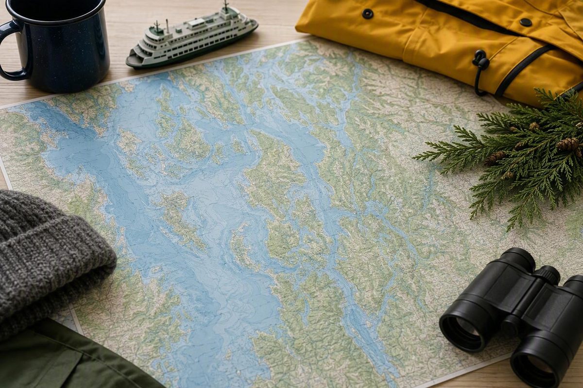
By Seattle Know editors. Last reviewed August 23, 2026. Ferry operations, access restrictions, and nautical-chart status should always be rechecked with the responsible provider.
Puget Sound map finder: choose by purpose
| Purpose | Provider and format | Best use | Coverage and useful features | Authority level | Principal limitation |
|---|---|---|---|---|---|
| General orientation | U.S. Geological Survey; static GIF in original and smaller versions | Locating Puget Sound and obtaining a basic overview | Downloadable image; labeled public domain | Official U.S. government resource | Supplied metadata does not establish scale, publication date, detailed legend, precise boundary method, or currentness |
| Boundary or watershed research | Encyclopedia of Puget Sound; interactive Google My Maps interface | Comparing the water body, watershed, Salish Sea, bioregion, and related drainage or circulation boundaries | Full-screen view, search, printing, embedding, KML download, and Google Earth viewing | Regional reference compiling separately credited layers | The layers answer different geographic questions and are not interchangeable |
| Shoreline exploration | Puget Sound Shoreline Mapping Project; Esri-powered interactive map | Exploring selected shoreline locations and their environmental or cultural context | Five displayed groupings: South Sound, Mid Sound, North Sound, Hood Canal, and Strait of Juan de Fuca | Project presented by the Washington Department of Ecology and Earthviews partners | Selective featured sites, not complete shoreline coverage |
| Ferry planning | Third-party interactive map for orientation; official ferry providers for operations | Seeing terminals, route lines, islands, and peninsula connections | Clickable ports and routes; official tools provide changing schedules and terminal information | Third party for visual orientation; official operator for live information | A route map alone cannot establish current schedules, alerts, fares, reservations, queues, or terminal conditions |
| Printed or decorative display | Commercial retailers and artists; paper, waterproof, satellite, watercolor, terrain, or wood formats | Classroom display, trip memories, home décor, or broad regional reference | Numerous styles and coverage choices, sometimes extending to Hood Canal, Whidbey Island, the San Juan Islands, or the Olympic Peninsula | Commercial product information only | Product titles and nautical styling do not establish geographic authority or navigational suitability |
For a free starting point, open the USGS Map of Puget Sound. The Washington Water Science Center supplies an original GIF plus thumbnail and medium versions, and the page labels the image public domain. It is a practical government-provided overview, but the available metadata does not establish that it is current or technically complete.
For questions such as “Is this creek in the Puget Sound watershed?” or “How does Puget Sound differ from the Salish Sea?”, use the interactive Puget Sound and Salish Sea boundary map. Its separate layers and export tools make it the strongest supplied option for comparing geographic definitions.
The Puget Sound Shoreline Mapping Project is better for investigating selected coastal places. It connects mapped segments with ecological, cultural, tribal, industrial, recreational, and historical descriptions. It should not be read as an inventory of every shoreline segment, access point, or current restriction.
Ferry maps serve a different purpose. Use one to understand which shores a route connects, then verify operations with Washington State Ferries or the relevant passenger-ferry operator. Commercial and decorative maps also have a valid role, but they remain display or general-reference products unless their publishers establish another use.
Where Puget Sound is in Washington
Puget Sound is an estuarine system in northwestern Washington and part of the larger Salish Sea. A useful approximate reference point is 47.6° N, 122.4° W. It extends roughly 100 miles from the area of Deception Pass south toward Olympia. Admiralty Inlet is its principal connection to the Strait of Juan de Fuca, while Deception Pass and Swinomish Channel provide smaller connections, according to a geographic overview of Puget Sound.
Start reading a regional map with five city anchors:
- Everett is on the eastern side of the northern Sound, near Possession Sound.
- Seattle is on the eastern shore of the central Sound.
- Bremerton is west across the water from Seattle on the Kitsap Peninsula.
- Tacoma anchors the central-to-southern area.
- Olympia lies near the southern end.
At the north end, Deception Pass forms a narrow connection toward waters leading to the strait.
A map covering only Seattle and the central basin may therefore omit much of Hood Canal even when using “Puget Sound” in its title.
This geography explains why the region can initially appear confusing. Puget Sound is not a simple oval bay. It is a branched system of basins, inlets, passages, islands, and peninsulas.
The term itself also requires care. “Puget Sound” can refer to the body of water. In less precise regional usage, it can describe the surrounding population center or a wider part of western Washington. A map of the “Puget Sound region” may consequently emphasize cities, counties, roads, or drainage areas rather than the shoreline of the water body.
Why Puget Sound boundaries change from map to map
No single line answers every question because “Puget Sound” is used for several related but distinct geographic ideas:
- The water body — the marine estuarine system and its connected basins, inlets, and passages.
- The watershed or basin — land from which water drains toward Puget Sound.
- A scientific study unit — a boundary designed for a particular monitoring, modeling, or research program.
- The wider Puget Sound region — an informal geographic, ecological, economic, or metropolitan label.
- The Salish Sea — the larger marine system of which Puget Sound is one part.
These categories overlap, but they are not substitutes for one another. A watershed boundary follows drainage. A water-body boundary follows marine geography. A bioregion can reflect ecological relationships across land and water. A circulation-influence area may include places whose water affects the estuary even when those places fall outside a narrower named water body.
A USGS definition summarized in the cited geographic overview includes Hood Canal, Admiralty Inlet, Possession Sound, and Saratoga Passage in Puget Sound while excluding Bellingham Bay, San Juan Islands waters, and areas farther north. The same overview notes that broader NOAA or informal usage may extend farther north or encompass parts of adjacent straits. Two professionally prepared maps can therefore differ because they are mapping different concepts, not necessarily because either is defective.
The distinction also prevents a common numerical error. The water body has a cited surface area of approximately 1,020 square miles in the geographic overview. By contrast, the USGS National Water Quality Assessment study unit covers 13,700 square miles draining to Puget Sound and adjacent marine waters, according to the USGS map and related basin information. The larger figure describes a water-quality study area that includes land drainage and adjacent waters; it is not the surface area of Puget Sound.
Before relying on any map, inspect its title, legend, notes, layer names, and metadata. Then run this scope check:
- Does it include Hood Canal?
- Does it show all of Whidbey Island, and where does it draw the boundary?
- Does it include or exclude Bellingham Bay?
- Does it include San Juan Islands waters, or merely show the islands as surrounding context?
- Does it extend into the Strait of Juan de Fuca?
- Is the shaded area water, land drainage, a scientific study region, or a broader bioregion?
- Are adjacent features shown for orientation but excluded from the map’s stated subject?
A place appearing inside the rectangular frame does not mean the mapmaker considers it part of Puget Sound. The legend and stated scope determine what the lines, colors, and shading represent.
Best authoritative and interactive map resources
USGS Map of Puget Sound
The USGS resource should be the first stop when the need is a simple, downloadable government overview. The Washington Water Science Center provides the original GIF and smaller image versions, and the page identifies the image as public domain.
That public-domain statement concerns the supplied USGS image. It does not establish a publication date, coordinate system, detailed legend, update cycle, precise boundary method, navigational suitability, or technical completeness. Inspect the image before deciding whether it meets a classroom, publication, or research need.
Good editorial practice still matters when reusing public-domain material. Preserve source identification and avoid modifications that could change the map’s meaning. If a page also contains third-party base maps, interfaces, photographs, or other components, check those elements separately rather than assuming the entire page has the same status.
Interactive Puget Sound and Salish Sea boundary map
The layered boundary map is the better tool when the question concerns scope rather than simple location. Its interface supports:
- Full-screen viewing
- Place search
- Printing
- Embedding
- KML download
- Opening the data in Google Earth
Its layers distinguish Puget Sound, the Puget Sound watershed, the Salish Sea, the Salish Sea bioregion, and areas whose water drains to the estuary or influences circulation. It also displays boundary lines credited to different sources.
The interface page says it was published on April 8, 2022, but that date should not be treated as the update date for every geographic layer. Anyone using the map for current technical work should inspect the documentation for the individual layer being used.
The essential discipline is to toggle layers rather than merge them mentally. A point can be outside one water-body boundary while remaining inside a watershed, bioregion, or circulation-influence area. If you download KML, preserve each layer’s name and description so those distinctions are not lost in another application.
This is best described as a regional reference that compiles separately credited layers. It is useful for exploration, comparison, and framing a research question, but the interface does not turn every displayed layer into one official or universally accepted definition.
Puget Sound Shoreline Mapping Project
The Puget Sound Shoreline Mapping Project is an Esri-powered resource presented by the Washington Department of Ecology, Earthviews Conservations Society, and EarthViews.com. It organizes selected locations into five displayed groupings: South Sound, Mid Sound, North Sound, Hood Canal, and Strait of Juan de Fuca.
Its strength is contextual exploration. Rather than showing only a boundary, it helps readers examine how shoreline geography intersects with estuaries, habitat, tribal connections, ports, mills, bridges, recreation, and settlement history. Its limitation is equally important: the supplied project page does not provide complete shoreline coverage, full layer metadata, a comprehensive list of restrictions, or a map scale suitable for every use.
Editorial implementation note: Any publication embedding one of these maps should also provide a direct text link, a short explanation of scope, and a text-based list of important places. Do not reproduce map images until licensing, attribution, embedding, and accessibility requirements have been checked. An interactive map should never be the only way a reader can obtain the core geographic information.
Explore the shoreline by region
The shoreline project divides its featured material into five browsing groups. These categories help organize selected stories and locations; they are not a definitive partition of every Puget Sound shoreline.
South Sound
Representative South Sound entries include Capitol Lake Dam, Woodard Bay Natural Area, Hammersley Inlet, Shelton Lumber Mill, and Mud Bay. Together, they demonstrate how many kinds of shore can appear within one regional label: altered river outlets, protected areas, narrow inlets, industrial waterfronts, and tidal estuaries.
For a first-time visitor or student, begin with the branching waterways around Olympia and Shelton. Compare them with the more continuous central basin around Seattle.
Mid Sound
Featured Mid Sound places include the Nisqually River mouth, Tacoma Narrows Bridge, Port of Tacoma, Seattle Waterfront, and Blake Island. The selection moves among a river delta, a narrow tidal passage, an industrial port, a dense urban shoreline, and an island landscape.
The project states that recreational boating is prohibited within Billy Frank Jr. Nisqually National Wildlife Refuge to protect the ecosystem. Because that is a time-sensitive access restriction, treat it as an example reported by the project rather than a complete or permanently current statement. Verify current boundaries, closures, and permitted activities with the responsible refuge authority before entering or launching near the area.
North Sound
Representative entries include Deception Pass, La Conner, Skagit Bay, Bellingham Bay, Lummi Island, and Point Roberts. Their presence demonstrates how a project may use “Puget Sound” broadly for regional storytelling even when a narrower water-body definition excludes some northern waters.
This is a useful group for practicing boundary awareness. Deception Pass is a geographic connection associated with Puget Sound, while Bellingham Bay, Lummi Island, and Point Roberts lie in a broader northern Salish Sea context under narrower definitions. Inclusion in a project menu does not settle the definitional question.
Hood Canal
The Hood Canal grouping includes locations such as the Skokomish Estuary, Hamma Hamma Estuary, and Hood Canal Bridge. On a regional map, Hood Canal lies west of the Kitsap Peninsula and east of the Olympic Peninsula. Its long, narrow shape makes it one of the easiest major features to recognize.
This group is useful for comparing river mouths and estuaries with transportation infrastructure. It also shows why a road, terrain, or watershed map may reveal relationships that a minimal map of open water does not.
Strait of Juan de Fuca
Featured Strait locations include Fort Worden Lighthouse, Dungeness Spit, the Elwha River, and Neah Bay.
Their inclusion gives the shoreline project a broader regional frame. It does not mean every mapmaker defines the Strait of Juan de Fuca as part of Puget Sound. Instead, the grouping lets users follow connected shorelines and investigate places relevant to the wider inland marine system.
Across all five groups, the project’s value comes from joining location with ecological, cultural, tribal, industrial, recreational, and historical context. Its featured places remain examples rather than a comprehensive shoreline inventory.
Using a Puget Sound ferry map for trip planning
A practical ferry map should show four things clearly:
- Terminal locations
- Route lines
- Destination islands or peninsulas
- The relationship between Seattle and communities across the water
For broad orientation, look for these major connections:
- Seattle–Bainbridge Island
- Seattle–Bremerton
- Fauntleroy–Vashon
- Point Defiance–Tahlequah
- Edmonds–Kingston
- Mukilteo–Clinton
- Port Townsend–Coupeville
Approximate crossing times help convey the scale of a trip. A Washington tourism guide lists about 35 minutes for Seattle–Bainbridge Island, one hour for Seattle–Bremerton, 20 minutes for Fauntleroy–Vashon, and 15 minutes for Point Defiance–Tahlequah. These figures exclude terminal waits, vehicle queues, loading, weather disruptions, and delays; consult the Washington ferry route guide for its route summaries and links to operators.
The Washington State Ferries routes listed above carry vehicles and passengers. The cited Kitsap Transit fast-ferry connections between Seattle and Bremerton, Kingston, and Southworth are passenger-only. That distinction affects terminal access, boarding, destination transportation, and whether a vehicle will be available after arrival.
A third-party interactive Puget Sound ferry map can be convenient for clicking ports and route lines. It is an orientation tool, not an authoritative source for current schedules, fares, alerts, reservation rules, cancellations, or terminal conditions.
Check the relevant passenger-ferry operator separately when using a fast ferry. A screenshot or itinerary saved several days earlier may no longer reflect current service.
For a simple Seattle ferry day, choose one destination and make the crossing the anchor rather than an errand between several distant stops. Seattle Know’s neighborhood-base guidance recommends choosing lodging and daily plans according to how you will move, while the site’s broader method is to use one anchor activity, leave a buffer, and keep a weather-ready fallback. The Seattle Know homepage presents that approach across neighborhood, ferry-day, and rainy-day planning, and its editorial description emphasizes a clear route and practical backup plan.
That method generally produces a more manageable day than combining Bainbridge Island, Bremerton, Tacoma, and a distant park merely because they all appear on the same regional map.
Maps for boating, terrain, roads, satellite views, and wall display
Specialized maps differ in both content and intended use:
- Official nautical charts are made for marine-navigation use within defined coverage and scale. For any real voyage, verify that the chart applies to the exact operating area and that its status and corrections are current.
-
Waterproof maps describe physical construction, not authority. A waterproof sheet may still be only a recreational or general-reference product.
-
Arterial or road maps prioritize highways, streets, and land connections. They are useful for seeing how waterways force indirect driving routes.
-
Watercolor maps prioritize visual expression and display.
- Three-dimensional wood charts use layered or carved materials to represent shorelines or depths.
Choose by intended task and actual geographic extent, not merely because a product title includes “Puget Sound.” Commercial coverage may extend into Hood Canal, Whidbey Island, the San Juan Islands, the Olympic Peninsula, or nearby national parks. That can be desirable for wall display while being too broad—or too selective—for another purpose.
A commercial Puget Sound map collection illustrates the range: nautical charts, waterproof charts, terrain and arterial maps, topographic products, satellite imagery, watercolor art, and three-dimensional wood charts. The retailer is useful for comparing formats, not for resolving official boundaries or certifying navigational suitability. Prices, sizes, shipping terms, and availability can change.
For display, dimensions and construction may matter more than cartographic detail. A Woodchart.com Puget Sound product is seller-listed at 24.5 by 31 inches and described as using laser-cut wood layers informed by NOAA nautical survey data. Those are seller-provided specifications, not an independent assessment of accuracy or fitness for navigation.
A Bella Maps Puget Sound product is seller-listed at 31 by 24.5 by 2 inches, framed with Plexiglass, and supplied with rear hanging hardware. Its listing describes laser-carved water depths but does not identify the underlying data source, scale, depth units, or data date.
A reference to NOAA data or carved depth layers does not by itself show that decorative art is current, corrected, complete, or suitable for navigation. Neither seller listing establishes the product as a navigational chart.
For boating, the conservative approach is to obtain an official nautical chart for the exact operating area and verify:
- Publication and edition status
- Geographic limits
- Scale
- Depth units and datum
- Correction status
- Whether a larger-scale chart is needed for a harbor, inlet, or narrow passage
- Current notices and locally applicable restrictions
Do not substitute a decorative wood chart, tourism map, retailer listing, or waterproof general-reference map for a chart verified for the intended marine use. Words such as “nautical,” “bathymetric,” and “waterproof” can describe styling, subject matter, or construction without establishing safety suitability.
A checklist for evaluating any Puget Sound map
Use this checklist before downloading, printing, embedding, purchasing, or navigating with a map.
1. Define the purpose
State the decision the map needs to support:
- General geographic orientation
- Watershed or basin research
- Shoreline exploration
- Ferry route planning
- Road travel
- Terrain study
- Marine bathymetry
- Navigation
- Classroom printing
- Decorative display
A map can be excellent for one purpose and unreliable for another.
2. Identify what is actually being mapped
Determine whether the subject is:
- The Puget Sound water body
- The Puget Sound watershed or basin
- A scientific study unit
- A regional or metropolitan boundary
- The Salish Sea
- Shoreline features
- Ferry terminals and routes
- Roads
- Terrain or topography
- Bathymetry
Do not rely on the title alone. Read the legend and description.
3. Check geographic extent explicitly
Confirm whether the map includes or excludes:
- Hood Canal
- Whidbey Island
- Bellingham Bay
- The San Juan Islands
- The Strait of Juan de Fuca
Also determine whether those features are part of the mapped definition or merely visible as context.
4. Evaluate the provider
Use a purpose-specific authority hierarchy:
- Government or agency-associated resources for official references and public programs
- Official transportation providers for changing ferry operations
- Third-party maps for convenient visualization and trip discovery
- Commercial sellers for product dimensions, materials, formats, and availability
Authority in one field does not automatically transfer to another. A ferry operator may be authoritative about current service but not ecological boundaries. A retailer may accurately list a frame size while providing no basis for navigational use.
5. Inspect scale and legend
The legend should explain colors, boundary lines, symbols, depth shading, roads, terminals, and other marks.
If scale or legend information is missing, disclose that limitation instead of filling the gap with assumptions.
6. Find the publication or update date
An interactive interface is not proof of current data. Check the date of the page, each underlying layer, and any operational feed. If no date is supplied, describe currentness as unknown.
7. Trace the underlying data
Look for named agencies, surveys, datasets, and methods. Then ask what the attribution actually proves. A decorative map’s reference to a government dataset may identify source material without showing that the finished product preserves every feature, update, correction, or safety element.
8. Review export and technical formats
Decide whether you need an image, printable page, PDF, KML file, GIS layer, or interactive embed. KML may be convenient for Google Earth, while a static image may work better for a handout.
9. Confirm licensing and attribution
Check whether copying, modification, screenshots, embedding, and commercial republication are permitted.
10. Provide accessible alternatives
Accompany an embedded map with a text link, a concise explanation of scope, and a place list describing relative positions. Do not make color shading, zooming, or pointer interaction the only way to understand the information.
11. Assess navigation suitability separately
Do not infer navigational suitability from blue depth contours, nautical symbols, waterproof paper, or a chart-like title. Verify that the chart is intended and current for the exact operating area.
Quick recommendation matrix
| Need | Best choice |
|---|---|
| Basic downloadable government overview | USGS Map of Puget Sound |
| Watershed, boundary, or Salish Sea comparison | Layered Puget Sound and Salish Sea boundary map |
| Selected coastal features and contextual learning | Puget Sound Shoreline Mapping Project |
| Current ferry schedules and terminal operations | Live official ferry-provider tools |
| Boating and marine navigation | Verified official nautical chart for the exact area |
| Wall art or a tactile regional display | Commercial product selected by coverage, dimensions, and style—not navigation claims |
A useful Puget Sound map is one matched to the question. Use the public-domain USGS image for a basic overview, the layered boundary map to compare the water body with its watershed and the Salish Sea, and the shoreline project to investigate selected coastal places. When operations or safety matter, move from orientation maps to official ferry or nautical resources.
For a Seattle visit, use the map to choose one geographic anchor—a waterfront district, Bainbridge Island, Bremerton, or another ferry destination—and build a compact day around it. Puget Sound is a large, branched region, not a single attraction that fits comfortably into one itinerary.
Frequently asked questions
What is the best free map of Puget Sound?
For a basic downloadable overview, the USGS map is the strongest free option in this guide because it is government-provided and labeled public domain. Its page offers original and smaller image versions. The supplied metadata, however, does not establish the map’s publication date, scale, detailed legend, precise boundaries, or currentness.
For boundary research, the free interactive Puget Sound and Salish Sea map is more useful because it separates the water body, watershed, bioregion, and broader marine-region layers and supports printing and KML export.
Is Puget Sound the same as the Salish Sea?
No. Puget Sound is part of the larger Salish Sea. Maps of the Salish Sea generally cover a broader marine system, while maps labeled “Puget Sound” may depict a narrower water body, a U.S.-focused watershed, a scientific study area, or a wider informal region.
Does Puget Sound include Hood Canal and the San Juan Islands?
Under the cited USGS definition summarized in the geographic overview, Hood Canal is included, while San Juan Islands waters are excluded. Other maps may apply broader regional, ecological, or informal definitions, so inspect the legend and scope rather than assuming every map uses the same boundary.
Where can I find a map of Puget Sound ferry routes?
A third-party interactive ferry map can help you see clickable ports and route lines. For current routes, schedules, alerts, terminal information, standby estimates, fares, and reservation rules, use the official Washington State Ferries tools or the relevant passenger-ferry operator.
Can a decorative or waterproof Puget Sound map be used for boating?
Not unless it has been independently established as a current and suitable nautical chart for the exact operating area. Decorative, waterproof, wooden, bathymetric, or nautical-style maps may be useful for display or broad orientation, but those labels do not prove that the map contains current editions, corrections, hazards, depth references, or other information needed for marine navigation.