
What It Really Takes to Reach the Top of Rainier
Columbia Crest is the true 14,410-foot high point—not merely the crater rim—with guided vs. independent options, technical skills and turnaround criteria.
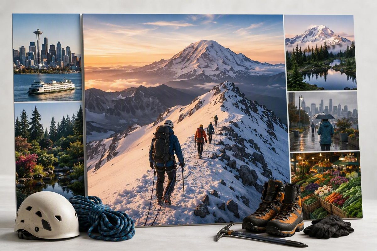
Updated September 1, 2026. This guide is general planning information, not technical mountaineering instruction or current route clearance. It was edited from National Park Service guidance, climbing-ranger reports, and clearly attributed guide-service material. Official NPS rules and the latest ranger information control whenever details differ or conditions change.
First, understand what “summiting Rainier” means
This article is about climbing to the Mount Rainier summit—not sightseeing, day hiking, or visiting viewpoints elsewhere in Mount Rainier National Park. The distinction matters because the upper mountain is not reached by an ordinary trail.
The National Park Service lists Mount Rainier as a 14,410-foot active volcano and the most heavily glaciated peak in the contiguous United States. Every summit route involves more than 9,000 vertical feet of gain and more than 10 miles of travel, and climbers need excellent conditioning, preparation, and technical glacier-travel rope skills to ascend and descend safely. Rainier is therefore a technical glacier climb, not a walk-up peak or conventional hiking objective. Review the NPS climbing overview and regulations.
“Summit” also has a precise meaning here. Columbia Crest is the mountain’s true high point. A climber may reach the crater rim yet still need to cross the broad summit crater to Columbia Crest. Register Rock is another landmark in the summit area, but reaching the crater rim or Register Rock does not by itself establish that someone stood on the true high point.
That distinction can become consequential after a long ascent. Crossing the crater adds time and distance at maximum altitude, and the team must still preserve enough energy, time, and concentration for the entire descent. Columbia Crest may be the geographic goal, but conditions and pre-agreed turnaround criteria—not emotional investment—should determine whether the team continues across the crater.
This guide explains what the customary route looks like, how guided and independent attempts differ, what authorization may be required, and how to assess readiness and turnaround decisions. It cannot replace hands-on instruction, current information from climbing rangers, or judgment tailored to a particular team, route, and day. Seattle Know does not claim guiding, rescue, medical, or firsthand Rainier summit authority.
The standard journey from Paradise to Columbia Crest
Most first-time summit itineraries use the Muir corridor from Paradise. The customary journey begins around 5,400 feet at Paradise and climbs roughly 4.5 miles to Camp Muir, near 10,080 feet. Those figures are useful planning estimates rather than exact survey measurements.
Above Camp Muir, the character of the climb changes decisively. Climbers cross the Cowlitz Glacier, pass through Cathedral Gap, and continue toward the Ingraham Glacier and upper mountain. Depending on how the glaciers and seasonal route have developed, the summit corridor may follow Ingraham Direct or transition onto Disappointment Cleaver.
| Stage | Approximate elevation | Terrain | Planning significance |
|---|---|---|---|
| Paradise | 5,400 feet | Developed trailhead and lower alpine terrain | Starting point for the standard Muir approach; the summit remains more than 9,000 vertical feet above |
| Paradise to Camp Muir | 10,080 feet at camp | Trail, snowfield, and increasingly alpine conditions | A major loaded ascent that can expose pacing, pack, footwear, fueling, or team problems early |
| Camp Muir to Cowlitz Glacier | Around 10,000 feet and above | Glaciated terrain | Rope-team travel and glacier competence become central |
| Cowlitz Glacier to Cathedral Gap | Roughly 10,000–11,000 feet | Glacier crossing, rocky gap, and exposed alpine terrain | Timing, changing conditions, and efficient transitions matter |
| Ingraham area | Around 11,000 feet, depending on camp and line | Active glacier and possible high camp | Some itineraries sleep here; others launch from Camp Muir |
| Ingraham Direct or Disappointment Cleaver corridor | Roughly 11,000–13,000-plus feet | Crevassed glacier, snow, ice, and rocky cleaver terrain | The active line can change during the season and may include detours or temporary crossings |
| Summit crater | Near 14,410 feet | Broad volcanic crater, snow, wind exposure, and altitude | Entering the crater is not necessarily the same as reaching the true summit |
| Columbia Crest | 14,410 feet | True high point on the crater rim | Reached only if timing, conditions, and team reserves support continuing |
| Columbia Crest to Paradise | Approximately 9,000 feet of descent | Reverse passage through glacier and alpine terrain | A long, consequential descent requiring physical and mental reserve |
Route-profile elevations and the approximate Paradise-to-Muir distance are based on RMI’s staged itinerary; the active route, camp placement, distance, and travel time can vary. See RMI’s route description.
Teams commonly leave high camp before dawn, sometimes around midnight. This is a typical itinerary pattern, not a universal departure prescription. Exact timing depends on the route, camp, season, forecast, team pace, and the judgment of the guides or competent independent team responsible for that attempt.
Reaching the crater is not necessarily the end of the ascent. If circumstances permit, climbers cross toward Columbia Crest. That crossing may appear modest compared with the preceding climb, but it occurs at the highest altitude of the day and consumes part of the team’s remaining margin.
Nor is Columbia Crest the end of the objective. Climbers must reverse the upper route, descend through the Ingraham and Cowlitz glacier systems, return to Camp Muir, and continue to Paradise—approximately 9,000 feet below the summit. The descent deserves equal weight in training, pacing, and turnaround decisions.
Published standard-route distances vary because camps, switchbacks, traverses, crevasse crossings, and reroutes can alter the active line. Treat mileage as an estimate, not a promise about the route that will be underfoot on a particular day.
Routes and seasons change with the mountain
The customary first-route corridor is generally described as Disappointment Cleaver–Ingraham Direct, approached from Paradise through Camp Muir. These are not two permanently marked tracks. Ingraham Direct may be used while its glacier line is viable; Disappointment Cleaver may become the practical alternative as conditions evolve. The exact alignment within either route can also move repeatedly.
The NPS provides official briefs for Disappointment Cleaver–Ingraham Direct, Emmons–Winthrop, Kautz Glacier, and Liberty Ridge. Those names should not be treated as a simple menu differentiated only by scenery. Each route has distinct terrain, access, hazards, and skill demands, so selection must match the team’s demonstrated experience and current conditions. The same NPS material lists May 1 through September 15 as the peak climbing season while emphasizing that route conditions and access vary. Check the NPS route, season, and climbing information.
Broad seasonal patterns are useful, but they do not establish a universally best month. Later conditions can bring exposed blue ice, widening crevasses, weakening snow bridges, rockfall, or more complicated crossings. The relevant question is not simply “Which month is best?” but “What are this route’s current conditions, and are they appropriate for this team?”
A dated ranger report shows how much can change within one season. On August 26, 2026, climbing rangers described blue ice, ladder crossings, a reroute, steep penitentes, rockfall concerns, old tracks that had misled parties, and a Camp Muir public-shelter closure. These observations describe that report date; they are not clearance for a later climb. Read the permanent August 26, 2026 route update.
Temporary route aids require the same caution. Old boot tracks can diverge from the current line. Ladders, handlines, and fixed pickets can be adjusted, damaged, or removed, and guide-installed equipment is not guaranteed or maintained by NPS. A busy track is not proof of a safe route, and a downloaded GPS recording is not proof that yesterday’s crossing remains viable.
Route planning therefore has two layers:
- Choose a corridor appropriate for the team’s actual skills.
- Verify and continuously reassess the viable line immediately before and during the climb.
The route name is durable planning information. The exact track, bridge, ladder, shelter status, and hazard exposure are temporary facts.
Guided climb or independent rope team?
Fitness and technical qualification are different. A strong hiker may have the physical potential to complete a guided instructional climb without being qualified to lead—or safely participate in—an independent Rainier rope team.
Some commercial programs accept physically strong beginners with substantial hiking or backpacking backgrounds and teach foundational movement and glacier skills before the summit attempt. That makes the program instructional; it does not make Mount Rainier beginner terrain. A short period of instruction under guide supervision is not equivalent to independent mastery.
An independent climber should arrive with functional competence in:
- Crampon use on the terrain expected
- Ice-axe arrest
- Roped glacier travel
- Mountain navigation in darkness and poor visibility
- Crevasse-rescue systems and team response
- Hazard assessment and conservative decision-making
These are operational skills, not concepts to learn from an article immediately before departure. Independent teams also need enough shared practice to function while cold, tired, and under time pressure.
A practical decision framework is:
- No glacier-rope or crevasse-rescue competence: Choose a guided instructional program or obtain hands-on training before considering the summit.
- Individual skills but no proven team practice: Train and climb together on suitable objectives before Rainier.
- A competent, practiced rope team: Consider an independent attempt only after verifying permits, route status, weather, camp arrangements, navigation, communication, and turnaround rules.
- Uncertain which category applies: Treat that uncertainty as a reason to seek instruction, not as evidence of readiness.
NPS lists three recurring authorized multi-day summit providers: Alpine Ascents International, International Mountain Guides, and Rainier Mountaineering. This is not a ranking, and it does not mean every provider offers the same itinerary, prerequisites, inclusions, dates, or client obligations.
The available program structures illustrate meaningful differences. RMI advertises a four-day climb combining orientation, training, an ascent to Camp Muir, and a summit attempt. Its listed price is $2,595, but prices, deposits, schedules, lodging obligations, and inclusions can change and must be reconfirmed with the operator. Review RMI’s current four-day program.
Alpine Ascents advertises a three-day instructional Muir climb that includes transportation between Seattle and Mount Rainier and lists a 2:1 guide-to-client ratio. Its itinerary includes instruction followed by a staged climb through Camp Muir and an Ingraham-area camp. These are provider-specific details, not a complete comparison of authorized services. Review Alpine Ascents’ current program and prerequisites.
Duration alone does not determine safety or program quality:
| Structure | Potential planning advantages | Potential tradeoffs |
|---|---|---|
| Two days | Less time away and a simpler calendar | Compressed rest and instruction; substantial work on consecutive days; less acclimatization opportunity |
| Three days | May allow instruction and movement to a higher camp before the summit attempt | Additional camp movement and pack carrying; still limited sleep before summit day |
| Four days | May provide more orientation and training time before the summit attempt | More time and expense; the detailed itinerary still determines actual rest and acclimatization |
Camp placement can matter as much as the itinerary’s day count. Also compare instruction time, sleep, pack load, acclimatization opportunity, summit-day length, and the reserve likely to remain for descent. No duration is universally safer or more successful, and a guide cannot eliminate weather, altitude, crevasses, rockfall, icefall, or route failure.
Permits, fees, party rules, and registration
NPS requires a permit for travel on a glacier or above the mountain’s normal climbing high camps, approximately 10,000 feet. Depending on the date and itinerary, a climb may involve climbing registration, a wilderness permit or reservation, and a solo permit.
Applicants must be at least 18 years old or have permission from a parent or legal guardian. Parties ordinarily must include at least two people unless a climber receives specific solo authorization; unauthorized solo climbing is prohibited. These requirements come from NPS, and current terminology and procedures should be verified before applying. Use the current NPS climbing and permit process.
Dated logistics snapshot — verify before applying
The NPS climbing page updated July 8, 2026 listed:
- An $82 climbing registration fee per person
- A $12 per-person, per-night wilderness-permit fee from May 1 through September 15
- That wilderness fee as applying during the stated period even to a single-push climb without camping
- Approximately half of summer camp and wilderness-zone capacity held for walk-ups available within 24 hours of a climb
Walk-up capacity is not guaranteed. Fees, dates, definitions, availability, and procedures can change.
Official material contains overlapping seasonal windows and some retained historical fee information. Do not turn the dated snapshot into a permanent checklist. Follow the current NPS application path and resolve any conflicting language with the park before travel.
In practical terms, confirm all of the following rather than assuming that one payment or “climbing permit” covers everything:
- Whether each climber has completed the required registration
- Whether the itinerary requires a wilderness reservation or permit
- Whether the intended camp or wilderness zone has capacity
- Whether a single-push itinerary incurs a wilderness fee
- Whether the party meets minimum-size and age requirements
- Whether solo authorization is required and approved
- Where and when in-person registration or permit pickup occurs
- Whether procedures have changed since the official page was last updated
Guided clients should not assume how an operator handles registration, park fees, or permits. Ask the provider what it arranges, what each client must complete, and which documents or payments are required.
A realistic readiness test: fitness, skills, and descent capacity
Readiness has four distinct components: aerobic endurance, loaded uphill movement, downhill durability, and technical glacier competence. Strength in one does not erase a deficit in another.
Aerobic endurance
The climb requires sustained work at altitude rather than one short burst of effort. Training should establish a broad endurance base through regular hiking, running, cycling, uphill treadmill work, or comparable activity. The practical goal is to move steadily for hours while continuing to eat, drink, think clearly, and function as part of a team.
Long efforts should be introduced progressively. Summit days can involve 10 to 14 or more hours of movement, sometimes after limited sleep. RMI’s preparation guidance recommends progressively longer mountain efforts and back-to-back training days to expose the climber to accumulated fatigue. See RMI’s Rainier preparation framework.
Loaded uphill movement
Training should gradually add pack carries, vertical gain, uneven terrain, longer days, and consecutive outings.
One operator-proposed benchmark is completing about 4,000 vertical feet with a roughly 40-pound pack while retaining energy. That is a useful training reference, not a universal qualification test. Terrain, pace, body size, itinerary, and actual carried load all affect what the benchmark means.
Some guided programs expect climbers to carry approximately 35 to 40 pounds. Alpine Ascents states an expectation of sustaining roughly 1,000 vertical feet per hour and warns that a participant who cannot maintain the necessary pace to Camp Muir may not continue to the summit attempt. That is an attributed commercial-program standard, not a rule for every route or team. See the operator’s stated fitness and pace expectations.
A useful progression is:
- Consistent weekly endurance work
- Moderate uphill days without a heavy pack
- Gradually heavier pack carries
- Longer days with meaningful vertical gain
- Back-to-back outings that expose recovery weaknesses
- A taper that allows arrival rested rather than depleted
Avoid making one heroic training day the entire plan.
Downhill durability
From Columbia Crest, the team still faces approximately 9,000 feet of downhill travel to Paradise.
Controlled step-downs and lunges are practical examples, alongside progressively longer descents on varied terrain. A specialist outdoor account of an independent Rainier climb likewise emphasizes targeted downhill preparation and identifies the descent as a major challenge. Read the descent-focused preparation discussion.
Descent readiness also means building habits that remain reliable under fatigue:
- Maintain regular fueling and hydration.
- Preserve attention for controlled movement and team coordination.
- Deal with developing comfort or footwear problems early.
- Use a pace the whole team can sustain.
- Retain enough mental energy for navigation.
- Treat Camp Muir as an intermediate point, not the finish line.
A turnaround time must reflect descent capacity. If continuing to Columbia Crest would leave too little reserve for a controlled return, summit ambition has already exceeded the team’s margin.
Technical glacier competence
For independent teams, technical readiness must be functional under realistic conditions. Knowing vocabulary is not enough. Team members need practiced competence in crampon use, ice-axe arrest, roped glacier movement, navigation, and crevasse rescue before arriving.
Guided clients still benefit from prior familiarity and practice, but the program’s prerequisites and teaching scope determine what is expected. Ask exactly what experience is required and what the pre-climb instruction does—and does not—cover.
Altitude is a separate variable
RMI’s preparation material identifies headache, nausea, dizziness, and fatigue as possible altitude-related symptoms. Fitness should not be treated as immunity, and an online guide should not be used to diagnose symptoms or determine whether they are safe to ignore. Review the operator’s altitude-preparation discussion.
Anyone with personal health concerns, previous altitude problems, or questions about prevention or medication should seek qualified medical guidance before climbing. On the mountain, worsening symptoms and changes in a team member’s condition belong in a conservative turnaround decision.
Hazards, turnaround decisions, and the meaning of success
Rainier combines objective hazards with human limits. Principal concerns include crevasses, deteriorating snow bridges, rockfall, icefall, seracs, avalanches, whiteouts, strong wind, cold, thunderstorms, altitude effects, navigation errors, and accumulated fatigue.
Glacier movement can reroute a standard line or make it temporarily impassable. The correct response is not always to find a way through. Depending on the problem and the team’s competence, the appropriate choice may be to retreat, await professional route work, choose a different suitable objective, or go home.
The following table is a planning framework, not technical rescue instruction:
| Observable problem | Conservative planning response |
|---|---|
| Team is behind its pre-agreed timing | Apply the turnaround rule rather than taking time away from the descent |
| One member cannot sustain the necessary pace | Keep the team together and end the attempt rather than pressuring someone to conceal fatigue |
| Weather is deteriorating faster than expected | Reassess immediately and prioritize retreat while the team can still navigate effectively |
| Visibility is collapsing | Do not assume boot tracks identify the active route; reassess position and the viability of retreat |
| Altitude symptoms are worsening | Do not let summit proximity outweigh the affected climber’s condition; descend and obtain appropriate help |
| A snow bridge or crossing no longer matches expectations | Do not treat old tracks or a stored GPS line as proof that passage remains viable |
| Rockfall, icefall, serac, or avalanche exposure becomes unacceptable | End the attempt rather than prolonging exposure for the sake of the summit |
| Fixed equipment appears damaged, moved, or absent | Treat it as unavailable and do not improvise beyond the team’s training |
| Team members are making repeated errors | Recognize fatigue as a safety problem before the descent becomes less controlled |
| Route damage prevents reasonable passage | Retreat rather than turning a planned climb into an unfamiliar technical problem |
These responses express a conservative decision boundary rather than prescribing maneuvers in consequential terrain. The ranger-maintained conditions blog warns that its reports are only a baseline, that routes change, that old tracks can mislead climbers, and that temporary fixed equipment is not maintained by NPS. Check the latest dated climbing-ranger reports.
Common reasons to end an attempt include missed timing, inadequate pace, deteriorating weather, poor visibility, worsening altitude symptoms, team fatigue, route damage, and unacceptable avalanche, rockfall, or icefall exposure. None requires an accident to validate the decision.
A June 2022 first-person account provides a bounded example. Following an avalanche, the lead guide canceled the summit attempt after considering the reported serac, snow, warming hazards, and absence of a route the guide considered safe. It was one team’s experience on one date—not a general route report—but it illustrates why a prepared expedition may correctly stop below the summit. Read the climber’s account of the June 2022 turnaround.
That account uses “summit fever” informally to describe the pressure to continue because of money, training time, travel, or emotional investment. Those investments are real, but none improves a snow bridge, clears the weather, restores a fatigued teammate, or adds time for the descent.
A safe turnaround is successful risk management. The most important decision may be made below the crater, at high camp, or before leaving Paradise. Defining success only as touching Columbia Crest creates an incentive to discount the rest of the route.
Reaching the true summit is only halfway through the physical objective. Every decision above high camp must account for the return through consequential terrain. The mountain does not become safer because the summit photo has been taken.
The final verification checklist before departure
Use this checklist in the final days before leaving, then repeat the time-sensitive checks as close to departure as practical.
Official authorization and access
- [ ] Complete the current NPS climbing-registration process.
- [ ] Confirm whether the itinerary requires a wilderness reservation or permit.
- [ ] Verify party size, age eligibility, and any solo authorization.
- [ ] Confirm camp or wilderness-zone arrangements.
- [ ] Check current park alerts, closures, and operating conditions.
- [ ] Verify road, gate, trailhead, and approach access.
- [ ] Confirm permit pickup location, office hours, identification requirements, and payment status.
Weather, snow, and route
- [ ] Review a relevant mountain forecast, not only a low-elevation city forecast.
- [ ] Check avalanche information when the season and terrain make it relevant.
- [ ] Read the newest ranger route report and note its publication date.
- [ ] Identify what has changed since earlier reports.
- [ ] Verify whether reported camps, shelters, crossings, or temporary aids remain applicable.
- [ ] Define turnaround times and weather, pace, visibility, route, and team-condition triggers before starting.
The primary sources are the NPS climbing pages and the climbing-ranger conditions blog. A ranger report documents observations at a particular time; it does not promise that the route will remain in that state.
For guided clients
Confirm directly with the operator:
- [ ] Meeting location and time
- [ ] Whether transportation is included
- [ ] Required pre-climb and post-climb lodging
- [ ] Personal equipment, rentals, and group equipment
- [ ] Meals and food the client must supply
- [ ] Fitness, pace, and pack-carry expectations
- [ ] Insurance limitations, including mountaineering exclusions
- [ ] Permit, fee, and registration responsibilities
- [ ] End-of-trip timing and a realistic onward-travel buffer
Do not book a tight flight or irreversible Seattle itinerary immediately after the anticipated return. Weather, route conditions, team pace, or a turnaround can change the schedule.
For independent teams
Confirm together:
- [ ] The selected route matches every member’s experience.
- [ ] Glacier-travel and rescue skills have been practiced, not merely discussed.
- [ ] The team has a navigation plan for darkness and poor visibility.
- [ ] Everyone understands the communication and emergency plan.
- [ ] Turnaround criteria are explicit and shared.
- [ ] Camp or shelter assumptions have been verified.
- [ ] Each member understands the expected duration, load, pace, and descent.
- [ ] No essential part of the plan depends on finding a ladder, handline, flag line, boot track, or open shelter.
Downloaded tracks are directional aids, not certification that a recorded line remains usable. Visible boot tracks can be wrong. Temporary fixed equipment may be changed or missing and is not guaranteed or maintained by NPS.
Visitors using Seattle as a base should leave flexibility before and after the climb. Rainier is not an attraction that fits reliably between a morning reservation and an evening flight. Weather, permits, route status, fatigue, or a conservative turnaround can alter the broader trip.
This checklist remains general planning information. It is not current route clearance, a complete equipment prescription, or a substitute for hands-on glacier instruction and team-specific judgment.
Frequently asked questions
Can a fit beginner reach the Mount Rainier summit with a guide?
Potentially. Some commercial instructional programs accept physically strong beginners with prior hiking or backpacking experience and provide foundational instruction within the guided program.
That does not make Rainier beginner terrain, and fitness does not guarantee continuation or a summit. A participant must satisfy the operator’s prerequisites, carry the expected load, sustain the required pace, learn efficiently, and function as part of the team. Weather, altitude, route conditions, and hazards can still force a turnaround.
How high is Mount Rainier, and is the crater rim the summit?
NPS lists Mount Rainier at 14,410 feet. Columbia Crest is the true high point. Entering the summit crater does not necessarily mean a climber has reached Columbia Crest; depending on the point of arrival and current conditions, the team may still need to cross the crater. Register Rock is a summit-area landmark, not an alternative definition of the true summit. See the summit and route-planning context.
How many days does a Mount Rainier summit climb usually take?
NPS describes a typical climb as approximately three to four days, although duration varies by route, season, conditions, and itinerary. Commercial examples include three- and four-day programs, while independent teams may use other schedules.
The shortest schedule is not automatically the best. Compare instruction, camp placement, sleep, pack load, acclimatization opportunity, accumulated fatigue, and descent margin.
Can someone climb Mount Rainier without a guide or alone?
A competent team can climb independently, but its members need strong conditioning and functional glacier-travel, rope-team, navigation, crampon, ice-axe, and crevasse-rescue skills before the attempt.
Solo climbing requires specific NPS authorization. Parties ordinarily need at least two people, and unauthorized solo climbing is prohibited. Independent does not mean unregulated, and having a partner does not compensate for missing glacier competence.
What are the chances of reaching the summit?
There is no responsible mountain-wide percentage that can predict an individual climber’s chance. Commercial operators sometimes publish results for their own teams or selected periods, but those figures can use different methods, routes, participant groups, and conditions. They should not be converted into a personal probability.
Practical determinants include fitness, pace, altitude response, team function, weather, visibility, route viability, glacier conditions, and willingness to turn around. Preparation can improve readiness, but it cannot guarantee a summit.
A Mount Rainier summit attempt should proceed only when fitness, glacier skills or appropriate guide support, permits, team composition, weather, and current route conditions align. Columbia Crest is optional; returning safely is not. Keep the plan flexible, agree on turnaround criteria before starting, and verify every time-sensitive detail with NPS, climbing rangers, and any selected guide immediately before departure.