
Find the Seattle Base and Neighborhood Clusters That Fit Your Trip
Seattle's hills, irregular neighborhood boundaries and uneven transit coverage can make two stays labeled as the same area produce very different trips.
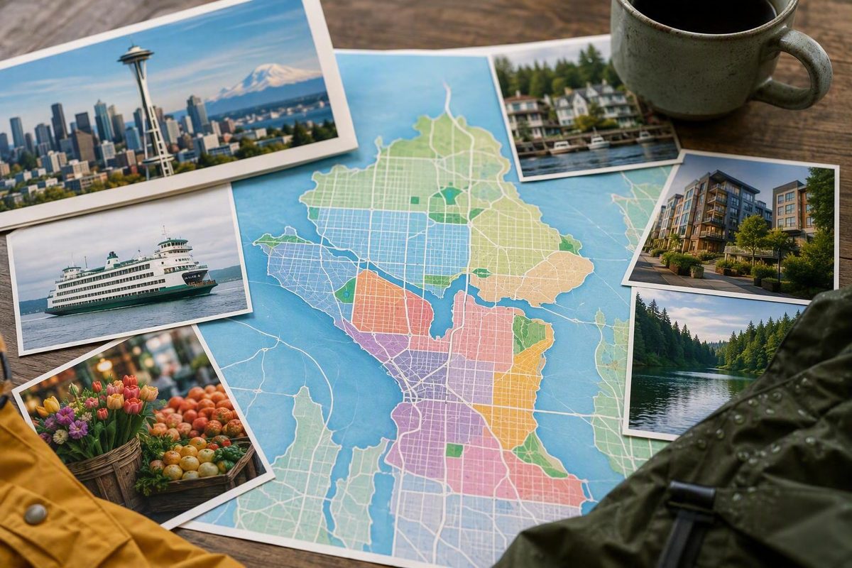
Seattle is easier to understand as a collection of connected neighborhood clusters than as a checklist of attractions. The practical question is not “Which Seattle neighborhood is best?” but “Which base puts my main activity, preferred evenings, and most useful transportation within easy reach?”
For many first-time visitors, that points toward Downtown, the Waterfront, or Belltown. Travelers focused on nightlife and neighborhood dining may prefer Capitol Hill. Seattle Center visitors should look closely at Lower Queen Anne/Uptown, while Ballard can suit a slower trip built around maritime character, restaurants, and breweries.
Whatever label appears in a hotel or rental listing, check the exact address. Seattle’s hills, irregular neighborhood boundaries, and uneven transit coverage mean that two properties advertised as being in the same area can produce very different trips.
How Seattle’s Neighborhood Map Works—and Why Maps Disagree
Seattle neighborhood names and borders are informal. They can overlap, change through common usage, and vary among city maps, tourism publications, residents, businesses, and real-estate guides. A street that one source places in Fremont might be assigned to Wallingford by another; a lodging listing may use the best-known nearby name rather than the most precise one.
This guide uses the City of Seattle’s Neighborhood Map Atlas as its geographic reference. The municipal dataset contains 94 mapped records, groups smaller areas into larger districts, and includes alternate names. Those records should not be interpreted as 94 legally defined neighborhoods. They provide a consistent mapping framework, not a final ruling on local identity or every disputed boundary. The dataset associates Uptown and Seattle Center with Lower Queen Anne and lists Meridian, Tangle Town, and Northlake among Wallingford’s alternate names.Explore the City of Seattle Neighborhood Map Atlas
Neighborhood identities developed over time around former settlements, independent towns, trolley stops, plats, transportation routes, and civic or community institutions. Some names survived annexation and transportation changes; others faded, narrowed, or began overlapping. Read an overview of Seattle neighborhood formation and boundary ambiguity
This guide uses four practical terms:
- District: A larger geographic grouping that may contain several smaller neighborhood areas.
- Neighborhood: A commonly recognized area, even when its edges are informal.
- Subarea: A smaller part that may feel or function differently from the larger label. Alki within West Seattle and Lower Queen Anne within Queen Anne are useful examples.
- Commercial or visitor center: The concentration of restaurants, shops, venues, parks, or attractions that visitors usually mean when they say they are “going to” a neighborhood.
ZIP codes are mailing and administrative areas, not neighborhood boundaries. One ZIP code can include multiple neighborhoods, while one neighborhood may cross ZIP-code lines.
Alternate and overlapping names are normal. Lower Queen Anne and Uptown commonly refer to substantially the same visitor area, while “Seattle Center” can mean the attraction campus more specifically. Wallingford may appear alongside Meridian or Northlake, and some visitor guides combine Fremont and Wallingford even though they offer different experiences.
Also distinguish Seattle neighborhoods from regional destinations. Bellevue and Woodinville are independent Eastside cities. Bainbridge Island and Bremerton are separate Puget Sound destinations connected to Seattle by regional transportation. They may appear in Seattle tourism roundups, but they are not Seattle neighborhoods.
A schematic visitor map
The diagram below is for broad orientation only. It is not to scale and does not attempt to settle neighborhood boundaries.
                         NORTH

       Ballard — Fremont — Wallingford — University District
           |                    |                |
       West Seattle       Queen Anne       Capitol Hill
           |              Seattle Center         |
Elliott Bay — Waterfront — Downtown — Central District
                              |
                        Pioneer Square
                              |
                Chinatown–International District
                              |
                         Beacon Hill
                              |
                        Columbia City

                         SOUTH
Use any neighborhood map in four steps:
- Locate the area relative to Downtown, Elliott Bay, Lake Union, and the main north–south transit corridor.
- Identify the commercial, cultural, or visitor center you actually want to reach.
- Map the exact hotel or rental address rather than relying on the listing’s neighborhood label.
- Check the route to your main attraction, including elevation, walking conditions, and transfers.
A boundary tells you where an area is. It does not tell you whether a particular block is close to the station, nightlife, waterfront, or attraction you expect.
Seattle Neighborhoods at a Glance: Choose by Trip Goal
The right base depends on your primary anchor, desired evening atmosphere, tolerance for noise and hills, need for a conventional hotel, and willingness to spend part of each day in transit. An area can be rewarding to visit without being the most efficient place to sleep.
| Area | Relative location | Best-fit goal | Signature experiences | Useful transportation | Hotel availability | Main tradeoff |
|---|---|---|---|---|---|---|
| Downtown/Waterfront | Central core along Elliott Bay | First-trip sightseeing and ferry access | Pike Place area, museums, waterfront, central retail | Link, buses, ferries, monorail connection at Westlake | Broad selection | Busy visitor environment; hills rise east from the water |
| Belltown | North of Downtown, south of Seattle Center | Central base with nightlife | Restaurants, bars, dense urban streets | Buses and walking connections to adjacent central areas | Broad relative to outer neighborhoods | Evening noise and difficult or paid parking |
| Capitol Hill | East and northeast of Downtown | Dining, nightlife, independent businesses, LGBTQ+ culture | Commercial corridors, live music, shops, quieter residential streets | Link and buses | More limited than Downtown | Lively blocks can be noisy; exact station distance matters |
| Lower Queen Anne/Uptown | North of Belltown | Seattle Center attractions and arena events | Space Needle area, museums, performances | Monorail connection and buses | Useful selection near visitor attractions | Not equivalent to elevated Upper Queen Anne |
| Pioneer Square | South of Downtown | History, art, and stadium proximity | Brick architecture, galleries, visitor history attractions | Link, buses, regional rail nearby | Some options, with less breadth than Downtown | Event-day conditions and evening atmosphere vary |
| Ballard | Northwest Seattle | Maritime character, food, and breweries | Locks, Nordic heritage, waterfront parks | Buses | Fewer traditional hotels | More travel to Downtown and Link-served sights |
| Fremont | North of Lake Union | Arts-oriented neighborhood outing | Public art, independent businesses, waterside connections | Buses | Limited | Not on Link; requires more deliberate routing |
| University District | Northeast of Lake Union | University visits, performances, student-oriented activity | University of Washington, shopping, wetlands | Link and buses | Some hotels and other lodging | Less convenient for waterfront-first itineraries |
| Chinatown–International District | South and southeast of Downtown | Asian and Asian American history, culture, and businesses | Museums, community institutions, restaurants, shops | Link, buses, regional rail nearby | Limited compared with the central core | Best approached as a living community, not a theme district |
| Central District | East of Downtown | Black history and contemporary neighborhood culture | Community institutions, arts, restaurants, residential streets | Primarily buses | Relatively limited | Broad area with fewer conventional visitor services |
| Beacon Hill | South of Downtown | Diverse neighborhood businesses, parks, and rail access | Shops, restaurants, bars, parks, institutions | Link and buses | Limited | The neighborhood extends well beyond the station |
| Columbia City | Southeast Seattle in Rainier Valley | Independent cultural venues and neighborhood evenings | Cafes, bars, theaters, restaurants | Link and buses | Limited | Farther from the classic central sights |
| West Seattle | Across Elliott Bay, southwest of Downtown | Beaches and a more separated neighborhood outing | Alki, parks, waterfront views, commercial hubs | Buses and water taxi | Scattered and subarea-dependent | Large area; connections vary by destination and service pattern |
These are fit-based recommendations, not rankings. Downtown is well suited to a short sightseeing trip, but it may not provide the evening atmosphere someone wants from Capitol Hill. Ballard may be a satisfying place to stay for a repeat visitor, yet less efficient for a two-day itinerary centered on Pike Place Market, Seattle Center, and the ferries.
Visitor-oriented descriptions commonly associate Capitol Hill with nightlife, Ballard with maritime and dining experiences, Pioneer Square with history and art, and West Seattle with beaches. Those identities are useful starting points, but every large neighborhood contains quieter, busier, more residential, and more commercial pockets.Compare Seattle’s visitor-oriented neighborhood profiles
A simple rule helps: stay near the activity you will repeat; visit the character-rich area you need only once. If you expect to start at the waterfront on several mornings, a central hotel may save more time than an outer-neighborhood rental. If most evenings will be spent dining or hearing music on Capitol Hill, staying there may justify the extra daytime ride.
Downtown, Waterfront, Belltown, Pioneer Square, and Chinatown–International District
The Waterfront and Downtown form Seattle’s central visitor corridor. Belltown sits immediately north, connecting the Pike Place area with Seattle Center. Pioneer Square lies south of Downtown, with the Chinatown–International District to its south and southeast. Together, these areas form the most compact cluster for a first visit.
Downtown and the Waterfront
Downtown near Pike Place Market is a practical base for many first-time and short-trip travelers because it concentrates major attractions, conventional hotels, and transportation. Depending on the block, visitors can reach buses, Link light rail, ferries, and the monorail connection at Westlake without first crossing the city.
Its main strength is flexibility. A wet morning can shift toward a market or museum stop. A clear interval can be used for the waterfront. A ferry departure is easier to build into the day when the terminal is already nearby.
The tradeoff is that “Downtown” covers blocks with different elevations and atmospheres. A waterfront property may be close to the piers but below destinations farther east. A hotel near Westlake can be useful for rail and the monorail without being the shortest walk to every waterfront stop. Do not treat the entire central core as flat or interchangeable.
Belltown
Belltown occupies the connective zone between the Pike Place area and Seattle Center. It is well suited to visitors who want restaurants, bars, nightlife, hotels, and a central position without making either the market or Seattle Center their sole focus.
That convenience brings tradeoffs. Blocks near late-night activity may be noisy, particularly on busy evenings. Parking can be difficult and may require a paid garage. Travelers who value quiet should examine recent property-specific comments and ask where the room faces rather than accepting or rejecting the entire neighborhood.
Belltown also illustrates the difference between map distance and useful walking. A hotel may appear close to both Pike Place and Seattle Center, but repeated hills or poor weather can change how convenient the route feels. Even so, Belltown can work effectively as a bridge between major central clusters for travelers comfortable walking and using buses.
Traditional lodging is generally easier to find in Belltown and Downtown than in neighborhoods such as Ballard or Fremont. That difference matters for travelers who want full-service hotels rather than a small property or vacation rental.Compare the lodging tradeoffs among central and neighborhood bases
Pioneer Square
Pioneer Square is associated with Seattle’s early urban history, brick buildings, galleries, visitor history attractions, and proximity to Lumen Field and T-Mobile Park. It is also among the historic districts identified in the available Seattle neighborhood-history reference.Review Seattle’s historic-district and neighborhood context
Lodging advice here often conflicts because travelers are solving different problems. Pioneer Square may appeal to someone whose primary anchor is a game, a history activity, or a nearby event. Someone prioritizing a broader hotel selection, repeated access to Pike Place Market, or a different evening environment may prefer Downtown or Belltown and visit Pioneer Square during the day.
Neither approach makes Pioneer Square categorically good or bad as a base. Compare the exact property, event calendar, expected evening route, and number of times you plan to travel north.
Chinatown–International District
The Chinatown–International District has been an important center of Seattle’s Asian and Asian American communities for more than a century. Its cultural institutions, family businesses, shops, restaurants, gathering places, and community organizations are parts of a living neighborhood—not scenery for a themed stop.See the cultural and geographic neighborhood overview
A respectful visit can combine a cultural institution or historical site with time at local businesses while recognizing that the district contains multiple community histories rather than a single identity. It makes geographic sense to pair the area with Pioneer Square because they are adjacent, but they should not be collapsed into one neighborhood.
A compact central day
Choose one major anchor rather than turning the central corridor into an exhaustive checklist:
- Pike Place Market
- A waterfront attraction
- A history activity in Pioneer Square
- A museum or cultural institution in the Chinatown–International District
- A stadium event
Add one or two nearby stops, with an indoor option between walks. One workable pattern is Downtown in the morning, Pioneer Square after lunch, and the Chinatown–International District for a cultural or evening stop. Reverse the direction when a timed ticket or event makes that more practical.
Businesses, venue entry procedures, parking restrictions, transit service, construction, and event-day street conditions can change. Verify operational details close to the trip date.
Capitol Hill, the Central District, Beacon Hill, and Columbia City
These neighborhoods offer a different Seattle experience from the central visitor corridor. Capitol Hill can function as a base with strong evening activity, while the Central District, Beacon Hill, and Columbia City reward more deliberate neighborhood visits.
Capitol Hill
Capitol Hill is a large, internally varied area associated with restaurants, nightlife, live music, independent shops, LGBTQ+ culture, and busy commercial corridors. It also contains residential streets that can feel much quieter than its nightlife blocks.
Link service makes the area practical for many car-free visitors, but “in Capitol Hill” does not necessarily mean “near the station.” Check the route from the exact lodging address, especially if you expect to return late or carry luggage.
Compared with Downtown, Capitol Hill can offer a stronger neighborhood atmosphere after dinner. The tradeoff is lodging supply: visitor guides describe fewer traditional hotel options than in the central core. Smaller properties and vacation rentals may also use broad neighborhood labels, making an address check important.
Capitol Hill is particularly well suited to travelers who want evenings to be a primary part of the trip. It can stand alone as an evening anchor: arrive in the afternoon, explore a commercial corridor, choose one dining or performance plan, and avoid scheduling an unnecessarily complicated cross-city loop.
The Central District
The Central District has longstanding significance as a center of Seattle’s Black community. That history should remain central to any description of the neighborhood, alongside its present-day institutions, arts, businesses, restaurants, and residential life.
The area has also experienced gentrification. Describing change only as revitalization or improvement would flatten a more complicated history and present. Visitors can seek context through community institutions, public history, locally rooted businesses, and community-led events rather than treating the Central District simply as another dining zone.Read Seattle Met’s neighborhood snapshots and boundary caveat
Beacon Hill
Beacon Hill is culturally and culinarily diverse, with shops, restaurants, bars, parks, and community institutions. Link service makes the station area suitable for a bounded car-free outing, but the neighborhood extends well beyond that immediate zone.
Start with one station-area anchor and choose a manageable walking loop. Do not assume every Beacon Hill destination is close to rail simply because the neighborhood has a station.
Columbia City and Rainier Valley
Columbia City is a Link-served neighborhood with restaurants, cafes, bars, theaters, and independent cultural venues. It lies within the broader Rainier Valley, but the two labels are not interchangeable: Rainier Valley includes multiple neighborhoods and communities beyond Columbia City.
Beacon Hill and Columbia City work well as a separate south-end outing. Give the trip one anchor—a performance, cultural event, park, or meal—and use rail for the longer connection. Capitol Hill is better treated as a separate evening plan than as another item added merely because it appears on the same transit map.
Queen Anne, South Lake Union, and Seattle Center
Queen Anne is not one uniform visitor experience. Lower Queen Anne—also called Uptown in city data—contains or adjoins Seattle Center. Upper Queen Anne rises above it and is more residential. A property advertised simply as “Queen Anne” may therefore be highly convenient for Seattle Center or separated from it by a substantial hill.
Lower Queen Anne/Uptown and Seattle Center
Lower Queen Anne is a practical option for trips centered on the Space Needle, Museum of Pop Culture, Chihuly Garden and Glass, Climate Pledge Arena, and other Seattle Center venues. It works particularly well when a ticketed event is the trip’s main anchor or when several Seattle Center attractions will occupy more than one day.
The Seattle Center Monorail connects Seattle Center with Westlake Center Downtown. It can be useful for reaching the central shopping and transit core, but operating hours, ticketing, closures, and event adjustments can change. Consult the monorail’s current official information before relying on it for a timed connection.
Lower Queen Anne’s drawbacks are relative. It is convenient for Seattle Center but less direct for someone whose repeated priority is the ferry terminal or south-end neighborhoods. Arena events can also change pedestrian volumes, restaurant demand, traffic, and parking conditions.
Upper Queen Anne
Upper Queen Anne is associated with historic homes, shopping streets, parks, and viewpoints. It offers a more residential experience than the Seattle Center area, but convenience varies sharply by block.
Do not book an Upper Queen Anne address on the assumption that every Seattle Center attraction will be an effortless walk. The downhill journey and uphill return are not equivalent, particularly in rain or with luggage. Identify a genuinely useful bus connection rather than merely the nearest stop.
South Lake Union
South Lake Union was historically industrial and has been reshaped into a technology and biotechnology hub with newer mid-rise development near Lake Union. Its street pattern and atmosphere differ from both Downtown and Queen Anne.Compare the stable distinctions among Queen Anne, Seattle Center, and South Lake Union
The area can suit travelers with work or meetings nearby. For leisure visitors, it can also provide a connecting segment between Seattle Center and the lake, with value coming from an urban walk and lake-oriented pause rather than a long attraction checklist.
A practical Queen Anne–South Lake Union cluster includes:
- One Seattle Center anchor: a museum, observation visit, performance, or arena event.
- One shorter outdoor segment: a park, viewpoint, or walk toward Lake Union.
- One indoor fallback: another museum, a performance venue, or an unhurried meal.
Ballard, Fremont, Wallingford, Green Lake, and the University District
North Seattle contains several strong visitor neighborhoods, but they should not be compressed into one ambitious day. Choose either a Ballard–Fremont route or a University District–Wallingford/Green Lake route.
Ballard
Ballard’s maritime heritage remains central to its identity. Visitor anchors include the Ballard Locks, National Nordic Museum, Golden Gardens, restaurants, and a notable concentration of breweries.
It is well suited to travelers interested in maritime history, food, or brewery areas. The main tradeoff is geography: Ballard is generally less convenient for repeated Downtown sightseeing than central or Link-served neighborhoods. Bus travel is workable, but traffic, transfers, service changes, and the exact starting point make fixed travel-time promises unreliable.
Ballard can be a satisfying base for repeat visitors or anyone deliberately choosing a slower, neighborhood-led trip. It is less practical for travelers who expect to move among the Waterfront, Seattle Center, Capitol Hill, and the stadiums every day. Traditional hotel supply is also more limited than Downtown, so the exact lodging choice can determine whether the neighborhood works.
Fremont
Fremont is arts-oriented, eclectic, and associated with public art and independent businesses. It pairs naturally with Ballard because the areas offer complementary experiences: Fremont for arts and street-level wandering, Ballard for maritime sites, restaurants, and breweries.
That pairing still requires more travel from the center than a Downtown cluster. Choose one major Ballard attraction, one Fremont segment, and an indoor or food stop. Trying to cover the Locks, Golden Gardens, multiple brewery areas, all of Fremont, and a Downtown evening can turn the day into a transportation exercise.
Wallingford
Wallingford is distinct from Fremont even when visitor guides list them together. It is associated with residential streets, commercial stretches, and Gas Works Park above Lake Union.
The park can serve as an outdoor anchor, but the neighborhood’s slopes matter. A route toward the lake may require an uphill return. Wallingford works better within a deliberate north-of-Lake-Union day than as a quick detour between distant attractions.
Green Lake
Green Lake’s principal visitor appeal is its park and waterside walking path. It is a straightforward option for travelers who want an outdoor segment without building the day around multiple attractions.
Let the weather determine the order. Use the clearest interval for the lake, then move to a commercial or indoor stop. Consider the route from transit as well as the walk around the park.
University District
The University District surrounds the University of Washington and combines student-oriented activity with shopping, performance venues, cultural facilities, and wetlands. Link service makes it easier to integrate into a car-free trip than many northwestern neighborhoods.
The U District can work as a base for travelers with university business or a strong preference for rail access, but it is not as close to the Waterfront as Downtown. As an outing, it pairs more naturally with Wallingford or Green Lake than with Ballard.
Choose one of two realistic routes:
- Ballard–Fremont: Start with a maritime site, museum, park, or brewery-area anchor in Ballard, then add a shorter Fremont segment.
- University District–Wallingford/Green Lake: Begin with the university or a performance, then choose either Gas Works Park and Wallingford or a Green Lake walk.
Do not attempt all five areas in one compressed itinerary. Their proximity on a citywide map does not eliminate waiting, transferring, walking, and climbing.
West Seattle and the South-End Neighborhoods Beyond the Usual Visitor Core
West Seattle, Georgetown, and South Park offer experiences outside the most common visitor routes. They work best as intentional half-day or full-day outings rather than last-minute additions to a dense Downtown schedule.
West Seattle and Alki
West Seattle is a large area containing distinct subareas, including Alki. Waterfront Alki, commercial hubs, residential districts, and park-oriented areas can have different atmospheres and transportation needs.
The area is associated with beaches, parks, waterfront views, and a more residential feel in many subareas. Buses and the water taxi provide links with Downtown, but convenience depends on the exact destination, service pattern, season, and onward connection at the West Seattle end.
A water-taxi crossing is not automatically a complete Alki itinerary. Map how you will travel between the dock, beach, park, meal, and return departure. If the outing depends on a particular sailing or connecting route, verify current official schedules shortly before leaving.
Use a three-part planning model:
- Outdoor anchor: a beach, park, or waterfront walk
- Food or cultural stop: one commercial district or planned venue
- Weather-ready alternative: a covered stop, cafe interval, or shortened waterfront route
Georgetown
Treat the industrial landscape as a working environment rather than a decorative backdrop. Plan specific destinations and transportation instead of assuming the area supports effortless wandering.
South Park
South Park is a distinct Duwamish-area community and should not be folded into Georgetown for convenience.
Because the available visitor evidence is limited, approach South Park as a specific-purpose trip tied to a community event, business, cultural stop, or informed local recommendation. Check the route carefully, particularly for evenings and weekends.
Seattle neighborhoods versus ferry destinations
West Seattle is part of Seattle. Bainbridge Island and Bremerton are not. Both are separate Puget Sound destinations reached from Seattle by regional ferry service, so visiting them is a regional excursion rather than neighborhood hopping.
The distinction matters for planning. A West Seattle outing remains within the city transportation network, while a ferry day introduces terminal arrival, boarding, crossing, and return-schedule considerations. Neither should be treated as a quick add-on after a full day of central sightseeing.
How to Choose a Base and Explore Without a Car
Much of central and Link-served Seattle can be explored without renting a car. Walking, Link light rail, buses, the monorail, ferries, and the West Seattle water taxi serve different parts of a visitor itinerary. The important question is not whether transit exists somewhere in a neighborhood, but whether it connects your exact address to your primary anchor with a reasonable walk and number of transfers.
1. Name the trip’s primary anchor
Choose the activity or area you are least willing to compromise:
- Pike Place Market and the Waterfront
- A ferry departure
- Seattle Center
- A stadium event
- Capitol Hill evenings
- A university visit
- Ballard’s maritime sites or brewery areas
- West Seattle’s waterfront
If the trip has several anchors, prioritize the one you will visit repeatedly or the one with the least flexible timing.
2. Choose the most useful transportation corridor
Match the base to the mode that serves the trip rather than selecting a neighborhood first and solving transportation later.
A Link-served base can help with north–south movement among the University District, Capitol Hill, Downtown, Beacon Hill, and Columbia City. Downtown provides access to buses, rail, ferries, and the monorail connection. West Seattle requires closer attention to the specific bus or water-taxi connection.
Seattle’s car-free visitor guidance identifies Link, buses, the monorail, and water transportation as useful options while cautioning that distance and elevation affect the final part of a trip.Review Seattle’s car-free transportation overview
Do not treat published fares, frequencies, payment rules, airport journey times, or seasonal schedules as permanent. Check current information from Sound Transit, King County Metro, Seattle Center Monorail, Washington State Ferries, and King County Water Taxi immediately before travel.
3. Decide what evenings should feel like
Your base determines what happens after formal sightseeing ends.
- Choose Belltown for a central position with restaurants, bars, and nightlife.
- Choose Capitol Hill for a stronger neighborhood evening centered on dining, music, independent businesses, and LGBTQ+ culture.
- Choose Lower Queen Anne when a Seattle Center event is likely to define the evening.
- Choose Downtown/Waterfront when early sightseeing or ferry access matters more than neighborhood nightlife.
- Consider Ballard when the trip is meant to feel slower and neighborhood-led.
If sleep is important, inspect the property’s immediate block, room orientation, nearby venues, and recent noise comments. A neighborhood-wide label cannot answer that question reliably.
4. Check lodging supply and the exact address
Before booking, use this address-level checklist:
- What is the nearest useful transit stop?
- How many transfers are required to reach the main anchor?
- What is the walking grade in both directions?
- How far is the property from the neighborhood’s commercial or visitor center?
- Is the immediate block likely to have evening noise?
- Does the listing use an alternate, broad, or imprecise neighborhood name?
- Will rain, darkness, or luggage make the final walk substantially harder?
- Could an event or construction affect the route?
A short line on a map can conceal a steep walk. Likewise, calling an entire neighborhood “walkable” can mislead when a hotel sits at its edge, above a hill, or far from the commercial core.
5. Select one compatible cluster per day
Seattle Know’s first-party planning method is to choose a base, build the day around one anchor activity, cluster nearby stops, and retain a dry fallback. It is a planning framework rather than independent proof about any neighborhood.See Seattle Know’s neighborhood-and-weather planning approach
Three useful templates are:
Downtown–Pioneer Square
- Anchor: Pike Place Market, a waterfront attraction, history activity, or stadium event
- Nearby addition: one museum, gallery area, or Chinatown–International District stop
- Dry fallback: a museum, market, cultural institution, or extended meal
Lower Queen Anne–South Lake Union
- Anchor: a Seattle Center museum, observation visit, performance, or arena event
- Nearby addition: a lake-oriented walk or short outdoor segment
- Dry fallback: another Seattle Center venue or indoor meal break
Ballard–Fremont or Beacon Hill–Columbia City
- Ballard–Fremont works for maritime heritage, breweries, restaurants, and arts.
- Beacon Hill–Columbia City works for a Link-oriented outing involving neighborhood businesses, parks, institutions, and cultural venues.
- In either case, choose one major anchor rather than treating both neighborhoods as unlimited lists.
These are planning templates, not fixed itineraries. Weather, event times, energy, and current transportation should determine the final order.
Frequently Asked Questions
What is the best Seattle neighborhood for a first-time visitor?
There is no universally best neighborhood, but Downtown near Pike Place Market or the Waterfront is a practical option for many first-time visitors. It provides convenient access to major central attractions, ferries, buses, Link light rail, and the monorail connection at Westlake.
Belltown is also well suited to a first visit when the traveler wants a central position between the Pike Place area and Seattle Center, plus restaurants and nightlife. Lower Queen Anne may be a better fit when Seattle Center is the main focus, while Capitol Hill can suit visitors who prioritize neighborhood dining and evenings over maximum proximity to classic sights.
Choose according to the activity you expect to repeat most often.
Can I visit Seattle neighborhoods without renting a car?
Yes. Many central and Link-served neighborhoods can be visited using walking, Link light rail, buses, the monorail, ferries, and the West Seattle water taxi.
A car-free trip is easiest when the lodging is near a useful route and each day stays within one compatible cluster.
Check current schedules, fares, payment rules, closures, and station access with the relevant operators immediately before the trip.
How many neighborhoods does Seattle officially have?
There is no single legally definitive count that resolves all Seattle neighborhood names and borders. Names and boundaries are informal, can overlap, and vary by mapping system and common usage.
The City of Seattle Neighborhood Map Atlas contains 94 mapped records, including smaller areas that roll up into districts and records with alternate names. That does not mean Seattle has exactly 94 legally defined neighborhoods.Check the City of Seattle atlas records and structure
Other publications and commercial maps produce different counts because they combine, divide, rename, or omit areas differently. Use the city atlas as a consistent geographic reference rather than a final declaration of neighborhood identity.
Is Lower Queen Anne the same as Uptown, and how is it different from Upper Queen Anne?
Lower Queen Anne and Uptown are commonly used for substantially the same area around or adjoining Seattle Center; Uptown appears as an alternate name in city data. This is the practical visitor area for Seattle Center attractions and Climate Pledge Arena.
Upper Queen Anne is elevated and more residential, with historic homes, shopping streets, parks, and viewpoints. It is not equally convenient from every address. A listing labeled “Queen Anne” should therefore be checked carefully to determine whether it is in Lower Queen Anne/Uptown, Upper Queen Anne, or another part of the larger district.
Are Bainbridge Island, Bellevue, Bremerton, and Woodinville Seattle neighborhoods?
No. Bellevue and Woodinville are independent Eastside cities. Bainbridge Island and Bremerton are separate Puget Sound destinations connected to Seattle by regional transportation.
They may be grouped with Seattle in visitor guides because they are common excursions, but they should not be counted or compared as Seattle neighborhoods. Plan them as regional trips with their own transportation and timing requirements.
Choose the Base That Simplifies the Trip
The choice hierarchy is straightforward: pick the trip’s main anchor, choose a base that reduces repeated travel, verify the exact address and current transportation, and explore one compatible cluster at a time.
Neighborhood labels are useful starting points, not guarantees. The practical choice depends on the block, hills, transit connection, lodging supply, preferred evening atmosphere, and availability of a weather-ready alternative.
For the next booking step, use Seattle Know’s guide to choosing where to stay in Seattle to compare a short list by movement and daily priorities rather than searching for a universal winner.