
How to Explore the CD With Its Living History in View
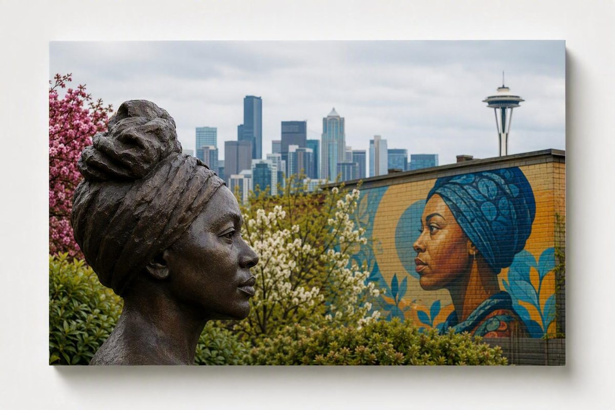
Seattle’s Central District is not best understood as a conventional attractions district. Also called the Central Area or the CD, it is a largely residential neighborhood shaped by overlapping communities, discriminatory housing systems, Black institution-building, civil-rights activism, displacement, and continuing cultural preservation.
For a first visit, begin with a place that supplies historical context—especially the Northwest African American Museum—rather than treating landmarks as isolated photo stops. Pair it with adjacent Jimi Hendrix Park, then add only a few related places: public art, a park, a community institution, or a food or coffee stop whose current status you have verified.
This is a historical and planning guide, not a live directory. Venue hours, admission, accessibility, public access, seasonal facilities, business ownership, and operating status can change. Confirm those details through current official channels before relying on any recommendation.
Central District at a Glance: Location, Names, and Boundaries
The Central District is a largely residential Seattle neighborhood east of downtown and south of Capitol Hill. Central District, Central Area, and CD are commonly used names for the area.
Its edges are less straightforward than the name suggests. Seattle neighborhood boundaries are often informal and overlapping, so maps, residents, cultural organizations, real-estate guides, and tourism sources may define the CD differently. Places near Madrona, Leschi, Cherry Hill, and Judkins Park are particularly likely to be classified differently depending on the source.
For a practical working definition, HistoryLink places East Madison Street on the north, 12th Avenue on the west, South Jackson Street on the south, and Martin Luther King Jr. Way on the east. These are useful planning boundaries, not proof of one universally accepted official border. HistoryLink also provides a Central District self-guided-tour overview based on its interpretation of the neighborhood’s geography and history.
Because changing the boundary changes the measured area, it is better not to describe the Central District as covering an exact number of square miles. A destination promoted as part of the broader Central Area may sit in what another map identifies as Madrona, Leschi, Cherry Hill, or Judkins Park.
Within those flexible edges, visitors encounter residential streets, churches, schools, cultural institutions, parks, public art, community organizations, and clusters of local businesses. That mixture matters. The CD is neither an open-air museum nor a concentrated entertainment zone; many historically significant places remain part of ordinary neighborhood life.
Mapping note: When creating a personal map or itinerary, label uncertain destinations as “near the Central District” or identify the adjacent neighborhood separately. Do not silently move a Madrona or Leschi business into the CD because it appears in a broader tourism guide.
The boundary question is more than cartographic trivia. A narrow definition can omit institutions that participate in Central Area cultural life, while a broad definition can blur the identities of neighboring communities. For visitors, the most useful approach is to choose one working map, acknowledge uncertainty, and focus on a compact group of historically related stops.
A Timeline of the Central District’s Multiracial History
Black history is central to the identity of the Central District, but it is not the neighborhood’s only history. Jewish, Italian, Japanese American, Black, and other communities have all shaped the area. These histories overlap and should not be told as though one population simply arrived, replaced another, and left no connections behind.
An important early milestone came in 1882, when William Grose purchased 12 acres in the Madison Valley area from Henry Yesler. Grose’s purchase helped establish a foothold for Black settlement, although a larger concentrated community developed over later decades. By the 1890s, Jackson Street and Yesler had become home to many Black residents, even as Black families still lived elsewhere in Seattle. The Black Washington project traces this history through segregation, institution-building, and contemporary preservation in its account of Seattle’s Central District.
Before World War I, HistoryLink describes the neighborhood as predominantly Jewish and Italian. By the 1930s, Japanese immigrants and Japanese Americans had become a prominent part of its community. Temple De Hirsch and the former synagogue now occupied by LANGSTON provide tangible links to Jewish history, although those buildings do not represent the community’s complete surviving record.
World War II disrupted this multiracial neighborhood profoundly. Under Executive Order 9066, Japanese American residents were forcibly removed from their homes and incarcerated. Housing discrimination then sharply limited where many newcomers could rent or buy homes. A general neighborhood history documents the forced removal of Japanese residents and the subsequent growth of the Black community, although individual sites and family histories require more specialized archival research.
The postwar Central District became Seattle’s principal center of Black community life. Residents formed and sustained businesses, churches, arts groups, schools, youth organizations, and political networks. During the 1960s, the neighborhood played a major role in local civil-rights activity, including protests against racial discrimination. That decade was especially visible, but it did not mark either the beginning or the end of Black organizing in the CD.
Today, preservation efforts extend beyond individual buildings. They address cultural presence, community ownership, arts programming, entrepreneurship, education, and opportunities for displaced residents and families to return.
Compact chronology
- 1882 and the 1890s: William Grose’s land purchase becomes an important early milestone in Black settlement; in the following decade, Black residents increasingly settle near Jackson Street and Yesler.
- Before World War I: Jewish and Italian communities are prominent in the area.
- 1930s: Japanese immigrants and Japanese Americans form a significant neighborhood presence.
- World War II: Japanese American residents are forcibly removed and incarcerated; wartime migration brings significant numbers of Black Americans to the Pacific Northwest.
- 1960s: The Central District is a major center of Black business, culture, and civil-rights activity.
- Present: Cultural organizations, land trusts, artists, institutions, and businesses continue preservation and community-building work.
This chronology is best read as a set of connected layers rather than a series of clean breaks. Buildings changed uses. Families moved under both voluntary and coercive circumstances. Institutions adapted, merged, relocated, or disappeared. A useful neighborhood history keeps those complications visible.
How Housing Discrimination Shaped a Center of Black Seattle
The Central District became Seattle’s principal Black neighborhood partly because Black residents built strong institutions there—and partly because discriminatory systems restricted where they could live.
Several related mechanisms contributed to that restriction, but they were not interchangeable:
- Racial covenants were property restrictions intended to prevent homes from being sold, leased, or occupied by designated racial or ethnic groups.
- Redlining categorized certain areas as financially risky, helping lenders and real-estate institutions justify denying mortgage credit or imposing worse terms.
- Discriminatory lending included unequal access to loans and unfavorable treatment based on race or neighborhood.
- Residential segregation was the broader pattern produced and maintained by those practices, along with social exclusion and unequal economic opportunity.
The Mountaineers’ historical introduction to the neighborhood distinguishes racial covenants from redlining and connects both to the constrained housing choices facing Black and other minority residents in its guide to walking Seattle’s Central District.
It is tempting to reduce this history to a single policy or start date, but the reality was cumulative. The central point is that Black residents were increasingly excluded from predominantly White areas, while the Central District became one of the places where they could more readily find housing and establish community networks.
Those constraints helped concentrate Black residents, but discrimination alone does not explain what the community created. Residents developed churches, businesses, arts organizations, educational networks, newspapers, youth programs, mutual-support systems, and political organizations. Entrepreneurship and institution-building were active responses to exclusion, not incidental byproducts of it.
This history changes how a visitor reads the landscape. A church may represent generations of worship, organizing, and mutual aid. A former bank site can reveal both exclusion from mainstream finance and a community’s effort to create its own institution. A school can be part of a wider story involving education, athletics, music, activism, and neighborhood identity.
Housing discrimination also affected communities in different ways. Japanese American incarceration was a wartime act of forced removal and confinement, not another term for redlining. Racial covenants could target Black, Asian, Jewish, and other residents, while lending discrimination operated through financial institutions and risk classifications. Keeping these mechanisms distinct makes their interaction easier to understand.
Historical demographic figures may help explain particular periods, but they should not be used as shorthand for the current neighborhood. Old census percentages do not establish today’s racial composition, and shifting neighborhood boundaries complicate comparisons. The supported conclusion is narrower: discrimination helped concentrate Black Seattle in the Central District, where residents built institutions whose influence extended well beyond the neighborhood.
Black Institutions, Civil Rights, Music, and Community Life
The CD became a major center of Black business, religious life, arts, music, education, civil-rights work, and community organizing. Its importance comes from the relationships among those activities, not from any one landmark.
Mt. Zion Baptist Church is associated with the neighborhood’s religious and civic life. Garfield High School has long been more than a school in accounts of the Central District; the surrounding area remains a major point of community identity. LANGSTON and the Northwest African American Museum connect the neighborhood to arts, public history, and interpretation.
The 1960s brought especially visible civil-rights activity. Residents and organizations protested racial discrimination, challenged unequal systems, and built structures intended to serve the community directly. Yet viewing the CD only through that decade would miss a much longer arc of settlement, church and business networks, postwar migration, arts movements, educational leadership, and contemporary struggles over land and cultural continuity.
Liberty Bank is a particularly instructive example. It opened in 1967 and is described by the Washington State Historical Society collaboration as both Washington State’s first Black-owned bank and the Pacific Northwest’s first Black-owned bank. In the same historical account, Africatown Community Land Trust’s William Grose Center—opened in a repurposed fire station in 2022—shows how the neighborhood’s history is being connected to present-day entrepreneurship and leadership. Both developments appear in the Black Washington project’s account of Black institution-building and preservation.
Liberty Bank matters not merely because it was described as a “first.” The former bank site therefore connects economic history to contemporary questions about land, ownership, and preservation.
The People’s Wall links political organizing to the built environment. Painted by Dion Henderson in 1970, it is identified as the remaining physical trace of the Seattle Black Panther Party’s second headquarters. The wall allows visitors to connect broad issues—self-determination, policing, organizing, and community survival—to a specific neighborhood place.
Music offers another route into the CD’s history, but famous-name lists require care. Jackson Street is associated with a jazz scene whose venues hosted or drew musicians including Ray Charles and Duke Ellington. That association does not mean every musician linked to the corridor lived in the Central District or had the same relationship to it. Performance, residency, childhood, professional development, and later commemoration are different forms of connection.
Jimi Hendrix provides a more locally rooted point of entry. Other figures—including Quincy Jones, Bruce Lee, Ray Charles, and Duke Ellington—belong in more carefully differentiated stories rather than one flattened roll call of supposed CD residents.
The same care applies to institutions. Their significance is not confined to a completed historical period. When planning a visit, ask both “What happened here?” and “What cultural work is this place associated with?” Then verify any current programs or access directly rather than assuming a historically important institution functions as a drop-in attraction.
Cultural Landmarks to Center in a First Visit
For a first visit, the Northwest African American Museum is the strongest interpretive anchor in the available sources. Its regional focus can help place Seattle’s Black history within the larger history of African American life in the Pacific Northwest. Starting with interpretation gives meaning to later stops that might otherwise appear disconnected.
Jimi Hendrix Park is adjacent to the museum, making the two the clearest compact pairing in the neighborhood. Together they offer an indoor cultural anchor and an outdoor place connected to music, memory, landscape, and public commemoration. Their adjacency is documented in Visit Seattle’s Central District visitor overview.
Because this research does not establish live operating details, consult the museum’s current official channel for hours, admission, exhibits, accessibility, and visitor policies. Check Seattle Parks information separately for current park notices or restrictions. Do not infer that the museum is open merely because the park is accessible, or vice versa.
Beyond that pairing, choose selectively:
- LANGSTON is an arts institution housed in a former synagogue dating to 1915, connecting Jewish architectural history with the neighborhood’s Black cultural life. Check its current calendar rather than assuming a performance, film, exhibition, or tour is available.
- Garfield High School and the Garfield area are important to the CD’s educational and community history. Because Garfield is an active school environment, view it from public space unless a public event or visitor arrangement explicitly permits entry.
- Mt. Zion Baptist Church is a significant religious and civic institution. Historical importance does not imply unrestricted access, so attend only programs identified as public.
- The former Liberty Bank site connects Black entrepreneurship and financial self-determination to the physical landscape and to later debates about development and preservation.
- The People’s Wall provides a material link to Black political organizing and the Seattle Black Panther Party.
- The William Grose Center for Cultural Innovation and Enterprise connects the name of an early Black settler to later community ownership, entrepreneurship, and leadership.
- Temple De Hirsch and LANGSTON’s former synagogue building help make the neighborhood’s Jewish history visible, although neither should be treated as its complete architectural record.
These destinations need not form a single walking route. They are better understood as a menu from which to choose according to time, weather, access, and interest. Two or three closely related stops will usually produce a clearer historical narrative than a rushed attempt to visit everything.
HistoryLink’s self-guided tour is a useful starting resource for identifying additional sites. It should not be treated as proof of a particular trip duration, route difficulty, crossing condition, or accessibility level. Compare any historical route with current venue, street, transit, and accessibility information before leaving.
Before you go
Confirm the date of the latest official update, current address, hours, admission, event status, accessibility details, reservation requirements, and visitor-access rules. For schools, churches, and community facilities, verify that the activity you plan to attend is open to the public.
Parks, Food, Coffee, Art, and Shopping Beyond the History Stops
The Central District offers more than formal historical sightseeing. Parks, murals, public art, restaurants, coffee shops, shops, and cultural programs can connect historical interpretation to everyday neighborhood life—provided visitors do not turn residents or active community spaces into scenery.
Pratt Park is a family-oriented green-space option. Visit Seattle identifies a children’s spray park operating during warmer months, but seasonal operation can be affected by weather, maintenance, and park schedules. Verify current conditions before building a family outing around that facility.
ARTE NOIR is a cultural and retail lead associated with products from Black makers. It is relevant to visitors interested in both creative work and cultural preservation, but this guide does not establish its present inventory, hours, exhibitions, or access. Check the organization’s latest official update before visiting.
Tourism and neighborhood guides also name the following food, coffee, and retail leads:
- Boon Boona
- Seattle Fish Guys
- L’Oursin
- Push Pull on Union
- Lowrider Cookie Co.
- Communion
- Carmelo’s Tacos
- Simply Soulful
- Jackson’s Catfish Corner
These are examples to investigate, not a comprehensive or independently tested “best of” list. Inclusion does not establish that a business is currently open, locally owned, Black-owned, operating at an older published address, or following the same schedule described by a previous guide.
Promotional terms such as “best,” “world-class,” or “revitalized” are not useful substitutes for current information. Choose a stop according to its latest menu or program, verified ownership when that matters to your purpose, location, access needs, and fit with the rest of the day.
Be especially attentive to geography. Some businesses included in broader Central District tourism material are explicitly located in nearby Madrona. They may be reasonable additions to a wider outing, but they should be labeled as Madrona stops rather than reassigned to the CD.
Before relying on a restaurant, café, shop, gallery, or event listing, check:
- The official website or official social account.
- The date of the latest update.
- Current opening hours and service days.
- Whether reservations, tickets, or appointments are required.
- Accessibility information relevant to your needs.
- The current address.
- Current ownership, if supporting Black-owned or locally rooted businesses is part of your purpose.
- Whether an event is one-time, seasonal, recurring, postponed, or discontinued.
This verification is more than defensive trip planning. It helps direct attention and spending toward organizations that are actually operating rather than toward an outdated version of the neighborhood.
Three Flexible Ways to Structure a Central District Visit
A reliable neighborhood day needs one anchor, a small number of related stops, and an alternative for rain, closures, or changing energy levels. Seattle Know’s published planning framework similarly recommends choosing one anchor activity and retaining a dry fallback, while its editorial description emphasizes giving travelers a clear plan, practical backup, and enough context to navigate.
1. A short cultural introduction
Begin with the Northwest African American Museum, subject to verified current admission and opening information. Allow its interpretation to establish regional and historical context rather than arriving with only a list of famous names.
Then visit Jimi Hendrix Park, adjacent to the museum. This creates a compact indoor-outdoor pairing without requiring a complicated route.
Finish with one food or coffee stop verified on the day of the visit. Choose it for current hours, location, and fit—not because an older list promises it is open or labels it the neighborhood’s best.
If the museum is unavailable, do not improvise entry into a church, school, or community facility. Substitute a confirmed public cultural program or reschedule the museum-centered portion of the visit.
2. A history-focused expansion
Use the museum and park as a starting point, then select two or three of the following:
- LANGSTON
- Garfield High School and the Garfield area
- Mt. Zion Baptist Church
- The former Liberty Bank site
- The People’s Wall
- The William Grose Center
This is a menu of landmarks, not a tested turn-by-turn walking route. Do not assume that the stops connect by a short, level, accessible, or comfortable path. Consult a current map and official transportation information, then reduce the number of destinations if the day begins to involve repeated backtracking.
Choose sites around a theme:
- Arts and architecture: LANGSTON, public art, and the museum.
- Education and community life: Garfield, the museum, and a nearby park.
- Business and self-determination: the former Liberty Bank site, the William Grose Center, and the People’s Wall.
- Faith and organizing: Mt. Zion, the People’s Wall, and a cultural institution.
Thematic selection produces a stronger visit than collecting photographs from unrelated stops.
3. Family and rainy-day variations
For a family-oriented outing, combine one confirmed museum or cultural stop with Pratt Park. Check museum admission and age-appropriate programming, and verify whether seasonal water facilities are operating. Keep a second indoor option available in case weather changes or the park is not practical.
For a rainy-day version, prioritize a confirmed indoor institution or scheduled public program. Treat Jimi Hendrix Park, the People’s Wall, and other outdoor landmarks as optional additions for workable weather windows rather than obligations.
In every variation, remember that historical significance does not guarantee casual entry. Churches may be holding services or private activities. Schools have student-safety requirements. Community centers may be hosting closed programs. Residential streets are not exhibition spaces.
On the day of travel, confirm:
- Venue hours and admission
- Event status
- Transit service
- Street or construction disruptions
- Accessibility
- Reservation requirements
- Weather and seasonal facility operation
Avoid relying on old bus numbers, generic parking advice, proprietary neighborhood scores, or unsupported estimates of walking time. Current official information is more useful than a route that was once precise but is no longer accurate.
Gentrification, Cultural Preservation, and Visiting Respectfully
The Central District’s present landscape cannot be separated from gentrification and displacement. The available evidence supports that broad pattern but does not provide reliable current percentages, rent increases, home-price changes, homeownership figures, or displacement counts.
Promotional accounts sometimes describe redevelopment as uncomplicated “revitalization.” That language may highlight new buildings, businesses, or investment while omitting who could no longer afford to remain, which institutions lost property, and how changes in ownership affected cultural continuity.
This does not mean every development or newcomer has the same effect. It means “improvement” should not be treated as neutral when costs and benefits are distributed unequally. A new business may add activity while replacing a legacy institution. A restored building may preserve architecture while severing its former community use. A public tribute to Black history may coexist with the displacement of Black residents.
Africatown Community Land Trust is documented as acquiring property and pursuing development intended to benefit community members, support Black entrepreneurship and leadership, and create opportunities for displaced Black residents and families to return. The William Grose Center is one visible example of connecting historical memory with economic and cultural work.
Wa Na Wari, ARTE NOIR, LANGSTON, and the Northwest African American Museum are also named in accounts of continuing cultural presence and preservation. Their missions and formats differ, but together they show that preservation is not limited to plaques or restored façades. It can involve art, interpretation, education, gathering space, entrepreneurship, and control of land.
Respectful tourism begins by recognizing the CD as a living residential community, not a themed historical district. That principle leads to practical behavior:
- Pay admission or donate when a cultural institution provides that option.
- Attend only events identified as public and follow the host’s rules.
- Purchase from businesses whose current operation and ownership you have verified.
- Ask permission before taking close photographs of people.
- Follow posted photography and access policies.
- Do not photograph students or enter school grounds without authorization.
- Treat churches as active houses of worship, not automatically open architectural attractions.
- Avoid blocking sidewalks, driveways, entrances, or transit stops.
- Keep voices and group sizes appropriate on residential blocks.
- Do not enter courtyards, community facilities, or private property because a map identifies them as historic.
- Credit artists when sharing photographs of public art if attribution is available.
Respect also requires intellectual care. Do not collapse Jewish, Italian, Japanese American, and Black histories into a generic story of “diversity.” Do not use Japanese American incarceration as another word for redlining. Do not describe every musician associated with Jackson Street as a resident. Do not present displacement as an inevitable or uncomplicated side effect of progress.
The Central District’s landmarks make more sense when visitors understand the forces that shaped them. Begin with one cultural anchor, add a limited number of related stops, verify changing details, and direct spending toward organizations and businesses sustaining the neighborhood’s cultural presence.
Frequently Asked Questions
Where is the Central District in Seattle, and what are its boundaries?
The Central District is east of downtown and south of Capitol Hill. It is also called the Central Area or the CD.
One useful working definition places East Madison Street to the north, 12th Avenue to the west, South Jackson Street to the south, and Martin Luther King Jr. Way to the east. Those are HistoryLink’s boundaries, not universally accepted official borders. Sources may classify places near Madrona, Leschi, Cherry Hill, or Judkins Park differently.
Choose one boundary definition for planning and label nearby destinations separately. Avoid relying on an exact area measurement because the result changes with the selected borders.
Why is the Central District known as Seattle’s historically Black neighborhood?
Black settlement in the area has roots in the late nineteenth century. Over later decades, racial covenants, redlining, discriminatory lending, and exclusion from predominantly White neighborhoods restricted housing choices and helped concentrate Black residents in the Central District.
Residents then built businesses, churches, arts organizations, youth programs, educational networks, financial institutions, and civil-rights organizations. That institution-building—not discrimination alone—made the CD a major center of Black Seattle.
What are the main things to see in Seattle’s Central District?
For a first visit, prioritize the Northwest African American Museum and adjacent Jimi Hendrix Park, provided you have confirmed current access. Other historically significant possibilities include LANGSTON, the Garfield area, Mt. Zion Baptist Church, the former Liberty Bank site, the People’s Wall, and the William Grose Center.
Pratt Park, public art, cultural programming, restaurants, cafés, and shops can broaden the day. Confirm current hours, admission, events, addresses, accessibility, and visitor policies before going.
Can visitors explore the Central District on foot?
Visitors can explore selected parts of the neighborhood on foot, but a list of landmarks should not be mistaken for a tested walking route. Distances, terrain, crossings, construction, weather, and individual accessibility needs can change the practicality of a plan.
Choose a compact cluster, use a current map, and consult official transit and accessibility information on the day of travel. A historical self-guided tour can help identify potential stops, but it does not replace current route checks.
How can visitors explore the Central District respectfully?
Treat the Central District as an active residential neighborhood. Begin with a cultural institution that provides context, follow posted access and photography rules, and do not assume schools, churches, or community facilities are open for casual entry.
Support community organizations through admission, donations, public events, and purchases from verified locally rooted businesses. Keep the itinerary compact, avoid intrusive photography, distinguish the CD from adjacent neighborhoods, and approach its landmarks as parts of a continuing community rather than relics of a finished past.