
What to Know Before Crossing Seattle’s Historic Drawbridge
Editorially updated: August 29, 2026. This is the publication review date, not a live check of bridge operations or a publication-date verification of Coast Guard notices.
Seattle’s Ballard Bridge is both a major north–south transportation connection and an operating drawbridge over the Lake Washington Ship Canal. A trip that appears straightforward on a map can therefore be interrupted by a marine opening, congestion, maintenance, construction, or a mechanical problem.
The key planning principle is to separate durable facts about the bridge from conditions that can change without warning. This guide explains where the bridge is, how openings work, what different travelers may encounter, what the completed 2025 corridor project changed, and what remains unresolved. It cannot confirm whether the bridge is open or delayed when you read it.
Ballard Bridge at a Glance: Location, Function and Connections
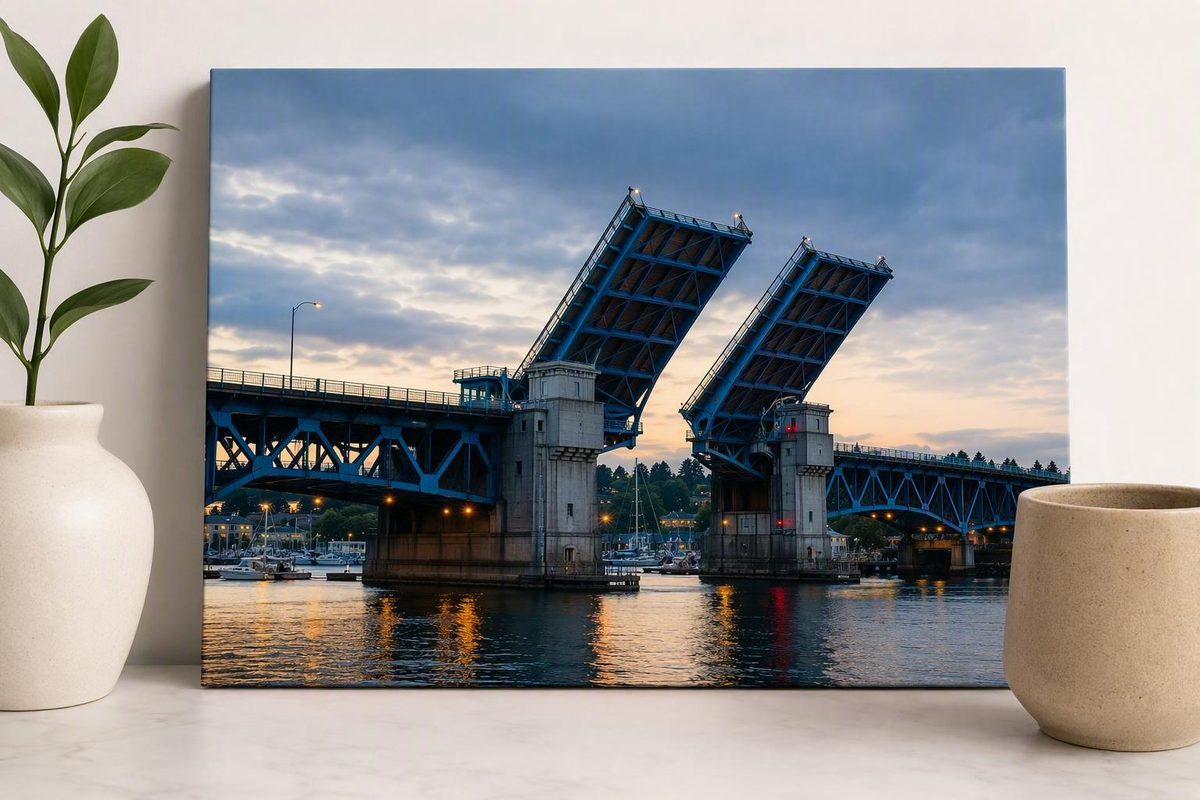
The Ballard Bridge—also called the 15th Avenue Bridge—is a double-leaf bascule bridge. In plain language, it is a movable drawbridge with two counterweighted roadway leaves that rise from the center so taller vessels can pass.
It carries 15th Avenue W/NW over Salmon Bay at the western end of the Lake Washington Ship Canal. The crossing directly connects Ballard on the north side with Interbay on the south. Through the larger 15th Avenue corridor, it also supports travel toward Magnolia and North Queen Anne.
The Seattle Department of Transportation, or SDOT, owns and operates the bridge. That clearance helps determine whether a vessel can travel beneath the closed span or needs an opening, although the vessel operator must account for actual conditions and configuration. These dimensions and operating responsibilities are listed in SDOT’s bridge-program information.
Several transportation networks meet at the bridge:
- Private vehicles use it as a direct connection between northwest Seattle and Interbay.
- Freight traffic uses the 15th Avenue corridor between industrial and commercial areas.
- King County Metro service travels along the corridor, so interruptions can affect riders who never drive across the bridge themselves.
- Pedestrians and cyclists use the bridge sidewalks, subject to current restrictions and temporary closures.
- Marine traffic uses the Ship Canal below, and vessels that cannot clear the closed bridge may request an opening.
The needs of these users do not always align. Keeping the roadway moving benefits drivers and buses, while opening the span preserves navigation for vessels. Construction can close the roadway while leaving the marine channel open, and work beneath the bridge does not necessarily affect its sidewalks or machinery.
Bridge terminology
- Movable bascule span: The center portion whose two counterweighted leaves rise for marine traffic.
- Fixed bridge portions: The roadway approaches and spans that do not rise during an opening.
- Leary Way structure: The structure associated with the bridge’s north end. SDOT materials sometimes refer to the “Leary Way Bridge,” so broad descriptions of “Ballard Bridge work” can be ambiguous.
- Paths beneath the bridge: Ground-level or waterside routes near and under the structure. These are separate from the bridge sidewalks above.
When reading a closure or construction notice, determine which element it covers. A “Ballard Bridge project” does not necessarily include the movable machinery, every approach, the Leary Way structure, and the paths below.
That distinction is especially important when interpreting the work completed in 2025 and plans for possible future seismic improvements.
How to Check Whether the Bridge Is Open Before You Go
Check timestamped official transportation information immediately before departure. This article cannot establish whether the Ballard Bridge is open, closed, delayed, or operating normally at your time of travel.
No dedicated live Ballard Bridge status feed has been verified for this guide. Start with current City of Seattle or SDOT travel information and look for a publication time, update time, incident time, or explicit statement that an alert has ended. If you are taking a bus, separately check current King County Metro service information because an incident can cause route detours, delayed trips, temporary stop closures, or replacement boarding locations.
Nearby traffic cameras can provide visual context. They may reveal queues, unusually light traffic, road work, or congestion approaching the bridge. They do not directly establish that the movable span is mechanically functional, fully lowered, or available to every mode.
Useful nearby camera locations include:
- 15th Avenue NW at NW Market Street
- 15th Avenue NW at NW 65th Street
- 15th Avenue NW at NW Leary Way
- 15th Avenue W at W Dravus Street, south of the bridge
A local Ballard traffic-camera directory identifies these views and advises readers to refresh the page. Treat every image as time-sensitive: a frozen, cached, or recently captured frame may not reflect conditions when you arrive.
Use this sequence before committing to the corridor:
- Look for a timestamped City or SDOT incident or closure notice.
- Check current Metro information if your trip involves a bus.
- Refresh nearby cameras to assess approach traffic.
- Allow for conditions to change between checking and arriving.
- Keep a backup route suitable for your mode.
Archived construction bulletins require particular care. SDOT published schedules for planned weekend closures during the 2025 corridor project, but those dates are historical. They explain how past construction was intended to operate; they do not show whether the bridge is closed today or prove that every scheduled closure occurred exactly as announced.
A past KIRO 7 report described an approximately two-hour closure attributed to a mechanical issue. SDOT was reportedly investigating whether heat was involved, but the visible report does not identify the year and does not confirm heat as the cause. It is evidence of a past incident, not a current condition or recurring failure pattern.
Nearby congestion, an undated news report, and an archived closure calendar are not substitutes for a current operational notice. If you cannot find a recent authoritative update, plan around the uncertainty rather than inferring the bridge’s status from incomplete information.
Why the Bridge Opens and How Long a Crossing Can Be Delayed
A bascule bridge works somewhat like a pair of counterweighted seesaws. The Ballard Bridge’s center leaves rotate upward while large counterweights move in the opposite direction. Raising the leaves clears the navigation channel for vessels too tall to pass beneath the closed bridge.
SDOT summarizes the operating framework as follows: movable bridges generally open on request from 7 AM to 11 PM. From 11 PM to 7 AM, an opening requires an advance appointment, generally requested at least one hour before the desired time. On weekdays, the Ballard, Fremont, and University bridges generally remain closed to marine openings during 7–9 AM and 4–6 PM, subject to SDOT’s listed holiday and large-vessel exceptions. Because federal requirements or Coast Guard notices can change operating conditions, boat operators should verify the applicable rules rather than treating this general schedule as permanent.
SDOT lists three ways to request an opening:
- VHF Marine Channel 13
- 206-386-4251
- A sound signal of one prolonged whistle blast followed by one short blast
The overnight appointment rule, request methods, opening hours, and commute restrictions appear in SDOT’s published movable-bridge procedures.
Not every vessel requires an opening. SDOT lists the closed bridge’s vessel clearance as 44 feet. Whether a particular vessel can safely pass depends on more than its nominal height, including water level, antennas or other equipment, loading, and the operator’s judgment. Road travelers should not attempt to make that navigation decision for boaters.
What happens during an opening
At a high level, an opening proceeds in this order:
- The operator checks the roadway and crossing area.
- Warning devices activate.
- Traffic gates lower in an interlocked sequence.
- The two movable leaves rise.
- The vessel passes through the navigation channel.
- The leaves return to the roadway position.
- The gates rise and street traffic resumes.
The interlocked controls are intended to stop road traffic before the span opens. Pedestrians and cyclists must obey the gates and operator instructions; someone entering or remaining in the controlled area can interrupt the sequence. SDOT’s direct bridge-operations video shows the operator checks, gate sequence, bridge movement, and restoration of road travel.
Four minutes or 10–15 minutes?
These figures describe different parts of the delay.
SDOT says an opening averages approximately four minutes from the stopping of street traffic until traffic resumes. That is an operating-sequence average, not a guarantee that an individual traveler will lose only four minutes.
A broader traveler-facing estimate can be longer. Seattle Met describes bascule-bridge roadway interruptions as commonly lasting 10–15 minutes and reports that the Ballard Bridge opened 2,969 times in 2025. The opening count is third-party reporting, not an independently confirmed SDOT statistic in this guide.
For trip planning, the distinction is practical. A driver several blocks behind the gates, a bus held in a queue, or a cyclist waiting for constrained sidewalk traffic may remain delayed after the bridge itself has returned to the roadway position.
Crossing by Car, Bus, Foot or Bicycle
The Ballard Bridge does not present the same conditions to every traveler. Plan for your specific mode rather than relying on a general statement that the bridge is “open.”
By car
For drivers, the routine variables are marine openings and corridor congestion. Even when the moving-span sequence is brief, queues can develop in both directions and take additional time to clear.
Before committing to 15th Avenue W/NW:
- Check current official transportation information.
- Refresh approach cameras.
- Leave adequate following distance in stop-and-go traffic.
- Do not enter a blocked intersection as a queue forms.
- Add a buffer if your arrival time is inflexible.
- Keep an alternate driving route in mind.
A raised bridge is not the only possible cause of delay. Collisions, disabled vehicles, construction, bus activity, weather, or an operational issue elsewhere in the corridor can also affect travel.
By bus
Multiple King County Metro routes use the 15th Avenue corridor. A routine marine opening may hold a bus in ordinary traffic, while a longer closure can lead to rerouting, extended travel times, temporary stop closures, or different boarding locations.
Check current Metro information shortly before departure and again if your bus does not arrive as expected. During a major closure, route-specific instructions are more useful than a generic map because services using the same corridor may be handled differently.
If you have a timed connection, appointment, ferry, train, or flight, do not assume the scheduled trip already accounts for an unexpected bridge interruption. Allow a margin appropriate to the consequence of missing the connection.
On foot
The supplied official materials document intended sidewalk access during specific 2025 vehicle closures, but they do not provide a publication-date assessment of present accessibility or every current pedestrian restriction. Travelers should therefore verify posted conditions on arrival and follow all gates, signs, and instructions.
The sidewalk experience is not equivalent to a wide urban walkway. Expect constrained passing space and exposure to nearby traffic. Avoid forcing a close pass at a narrow point. People using mobility devices, pushing strollers, carrying luggage, or traveling with children should account for the approaches as well as the central bridge span.
A temporary restriction may also apply differently to vehicles and sidewalk users. Never go around a gate simply because the roadway appears empty.
By bicycle
The available record documents bicycle use of the bridge sidewalks, but it does not establish that the crossing will be appropriate for every rider or that all historic dimensions remain unchanged. Riders should consider bicycle width, cargo, handling ability, comfort near traffic, wind, surface conditions, and current restrictions.
In 2017, Seattle Bike Blog described shared sidewalks of approximately three feet, concrete-pillar pinch points, low-curb exposure beside traffic, and difficult approaches. That article reflects advocacy reporting and conditions at the time; it is not a post-2025 engineering or accessibility survey. It is useful evidence of long-running concerns, not proof that every reported feature remains unchanged. The dated conditions are detailed in the 2017 bicycle-safety report.
Practical precautions include:
- Reduce speed where width or sightlines are constrained.
- Give people walking and oncoming riders room.
- Wait rather than attempting a tight pass.
- Secure panniers and loads that increase bicycle width.
- Dismount when posted or directed.
- Observe current wind, surface, approach, and construction conditions.
- Choose another route if the crossing does not suit your comfort or mobility needs.
No alternative is identified here as the universally safest bicycle route. Detours differ in grade, distance, traffic exposure, trail access, construction conditions, operating hours, and accessibility.
Do not confuse a path beneath the bridge with the sidewalks on it. In October 2023, SDOT announced weather-dependent plans to pave a bike-path section over railroad tracks along Shilshole Avenue NW beneath the bridge. The announcement did not itself confirm that the work was completed, and the project concerned the lower path rather than the bridge sidewalks above. SDOT described the proposed location and schedule in its 2023 path-paving announcement.
What the 2025 Paving and Safety Project Completed
Construction on the 15th Ave W/NW and Ballard Bridge Paving and Safety Project began July 8, 2024. SDOT subsequently reported that the project was complete in 2025, and the project page was updated November 18, 2025. The work covered the broader 15th Avenue W/NW corridor from W Emerson Street to NW 57th Street, including fixed portions of the Ballard Bridge and work associated with the Leary Way structure.
According to SDOT’s project completion page, completed quantities included:
- 1.1 miles of asphalt paving
- 22 expansion joints replaced across the Ballard and Leary Way bridges
- 3,050 feet of upgraded sidewalks
- 59 ADA-accessible curb ramps upgraded
- Eight columns reinforced
- 18 trees planted in the landscaped median
SDOT also reports that the eight reinforced columns used 250 cubic yards of material and 30 tons of rebar. Those figures describe construction quantities; they are not a seismic-performance rating for the entire movable bridge.
Transit-related work included red markings on an existing northbound bus lane and southbound transit lanes on portions of 15th Avenue NW. Other corridor work included median changes, refreshed striping, updated crossing signs, sidewalk and driveway repairs, drainage improvements, and lighting repairs near and beneath the bridge.
SDOT identified the new pedestrian and bicycle signal and crossing at NW 51st Street and 15th Avenue NW as the final major milestone.
Community input also formed part of the process. SDOT reported receiving more than 900 community-survey responses and emails from 40 community members. Those totals establish participation but do not prove that any single response directly caused a particular design decision.
It is important to distinguish completed construction from intended results. The project aimed to improve safety, accessibility, pavement condition, and transit reliability. The available project material does not provide a post-construction evaluation demonstrating measured changes in crashes, near misses, bus travel times, or total corridor performance.
The defensible conclusion is that SDOT completed substantial paving, fixed-structure, accessibility, transit, crossing, drainage, and lighting work. It was not a wholesale redesign of every user’s experience, and it did not remove the bridge’s need to open for marine traffic.
What Remains: Bascule-Span Seismic Work and Unanswered Questions
The completed 2025 project should not be described as a finished seismic retrofit of the movable Ballard Bridge bascule span.
SDOT separates the related work into different project categories. Its project table lists the 15th Ave NW/Leary Way Bridge seismic retrofit as being in design or construction, while the Ballard Bridge bascule seismic retrofit is separately listed as concept design for future evaluation. The distinction appears in the agency’s bridge-program table and in the corridor project’s description of work on fixed portions and the north-end structure.
Four types of work are particularly easy to conflate:
- Fixed-approach paving: Surface and related work on portions that do not move.
- Expansion-joint replacement: Work on identified joints across the Ballard and Leary Way structures.
- Leary Way column strengthening: Reinforcement associated with the north-end structure.
- Movable-span retrofit: Potential future work involving the bascule portion and its specialized structural and operating systems.
A statement such as “eight columns were reinforced during the completed corridor project” identifies a documented scope. A claim that “the movable bridge was fully seismically retrofitted” is not supported.
The available documentation does not establish a funded construction scope, start date, or completion date for a future bascule-span retrofit. It also does not answer several questions that residents and travelers may reasonably have:
- Is movable-span work funded beyond concept evaluation?
-
Which structural or mechanical components would be included?
-
What travel restrictions would major work require?
Advocacy materials from 2015 discussed replacement and retrofit concepts using estimates from that period. Those figures should not be presented as current budgets, engineering estimates, or proof that a specific project is proceeding.
Clear status language helps prevent confusion:
- Completed: SDOT reports the defined construction work finished.
- In design or construction: An agency lists an active phase, but the precise field status may still require confirmation.
- Under evaluation or concept design: Options are being studied; construction is not implied.
- Proposed: An agency, organization, or advocate has suggested the work.
- Unverified: Available official documentation does not answer the question.
Applied here, the 2025 paving and safety project is completed. Leary Way work must be described according to its specific project phase. A future movable bascule-span retrofit remains under evaluation, not completed.
Closures, Detours and Backup Plans
The appropriate response to a closure depends on whether you are driving, using transit, walking, cycling, or operating a vessel. A route intended for freight is not automatically appropriate for someone outside a vehicle.
An April 2025 SDOT bulletin provides a historical example of how planned construction closures were managed. For those closures, SDOT identified the Aurora Bridge on SR 99 as the most reliable detour for drivers and freight. It recommended the Fremont Bridge mainly for trips to Fremont or Westlake because that crossing has limited capacity.
The bulletin also warned that buses using the Ballard Bridge could be rerouted through Fremont, increasing travel times and temporarily changing stop locations. SDOT generally intended to maintain sidewalk access during the vehicle closures but said people could be asked to walk bicycles, switch sides, wait, or avoid the crossing when work made access unsafe.
Boat travel was expected to continue during those roadway closures. This illustrates why a notice that says the bridge is “closed” needs context: the roadway can be closed while the marine channel remains open and sidewalk access is conditionally maintained.
These arrangements are documented in SDOT’s April 2025 closure bulletin. Its dates are historical, weather-dependent plans—not current alerts or guarantees about how a future incident will be managed.
A simple contingency sequence
If you encounter or hear about a closure:
- Check timestamped official information. Determine whether the notice concerns the roadway, sidewalks, marine channel, one direction, or a nearby street.
- Check Metro information if using transit. Look for route numbers, temporary stops, and the stated detour.
- Refresh corridor cameras. Use them to estimate congestion, not to certify bridge mechanics.
- Choose a mode-appropriate alternative. A signed driving detour may not provide lawful or suitable pedestrian and bicycle access.
- Add a time buffer. Congestion can persist after the underlying incident ends.
- Recheck before committing. A secondary route can also become congested.
The Aurora Bridge recommendation should not be transferred to pedestrians or cyclists. SDOT’s historical guidance addressed drivers and freight during particular construction closures; this guide does not identify Aurora as a walking or cycling alternative.
From 1917 Landmark to Working Transportation Structure
The Ballard Bridge is historically significant because it continues to serve both road transportation and marine navigation more than a century after it was built.
1917: A new Ship Canal crossing
The bridge was constructed in 1917 as part of the era in which Seattle developed movable crossings over the Lake Washington Ship Canal. Its double-leaf bascule design allowed street traffic to cross Salmon Bay while preserving access for vessels moving through the canal system.
The original approaches used timber trestles, and the bridge once carried streetcars. Those features belonged to an earlier transportation network substantially different from the present 15th Avenue corridor. A historical summary records the construction date, timber approaches, former streetcar use, and subsequent reconstruction in its Ballard Bridge overview.
1939: Reconstruction for a changing corridor
In 1939, the bridge underwent substantial reconstruction. The timber approach spans were replaced, the deck was surfaced with concrete, and the streetcar rails were removed.
The work illustrates a recurring theme in the bridge’s history: it has remained functional because it has been modified and maintained rather than preserved unchanged in its original form.
1982: National recognition
The Ballard Bridge was added to the National Register of Historic Places on July 16, 1982. The available record supports that federal listing; it does not support describing the bridge as a designated Seattle city landmark. Its National Register date and identifying record are summarized in the same historical reference.
Part of Seattle’s bascule-bridge era
The Ballard Bridge belongs to Seattle’s group of early double-leaf bascule crossings over the Lake Washington Ship Canal. These structures addressed a defining transportation problem: streets needed to cross navigable water while the waterway remained available to working vessels.
That compromise is still visible whenever the traffic gates descend and the leaves rise. The bridge is not simply a preserved artifact or sightseeing feature. It continues to carry vehicles, freight, buses, pedestrians, and cyclists while opening for marine traffic.
Preservation through continued work
Historic recognition does not eliminate the need for intervention. Keeping an operating bridge in service involves inspections, maintenance, paving, expansion-joint replacement, structural repairs, movable-system upkeep, and evaluation of future seismic needs.
The 2025 corridor project and the separate consideration of bascule-span seismic work are therefore part of the bridge’s continuing history. The challenge is not merely to preserve an old structure, but to maintain a National Register-listed working bridge within a modern transportation network.
Frequently Asked Questions
Is the Ballard Bridge open right now?
This article cannot verify the bridge’s live status. Check recent, timestamped City or SDOT transportation information immediately before departure, and check current Metro information if taking a bus.
Refreshed cameras can help show congestion on the approaches, but they do not prove that the movable span is mechanically operational. Do not treat archived 2025 construction bulletins as current closure notices.
What times does the Ballard Bridge open for boats?
SDOT’s published general procedure says movable bridges open on request from 7 AM to 11 PM. Openings from 11 PM to 7 AM require an advance appointment, normally requested at least one hour beforehand.
On weekdays, the Ballard, Fremont, and University bridges generally do not open for marine traffic from 7–9 AM and 4–6 PM, subject to listed exceptions and any newer requirements. Requests may be made on VHF Marine Channel 13, by calling 206-386-4251, or with one prolonged whistle blast followed by one short blast. SDOT’s official operating video explains the request and gate sequence, although boat operators should verify current procedures before relying on older published material.
How long does a Ballard Bridge opening delay traffic?
SDOT describes the opening sequence as averaging about four minutes from the stopping of street traffic until traffic resumes. A traveler’s total delay can be longer because of warning time, queues, vessel movements, and post-opening traffic recovery.
Allow more than the mechanical opening time if you have a timed connection or are traveling during a busy period.
Can you walk or bike across the Ballard Bridge?
The available materials document pedestrian and bicycle use of the bridge sidewalks, including conditional access during planned 2025 vehicle closures. They do not provide a publication-date certification of present accessibility, sidewalk dimensions, or temporary restrictions.
Follow posted signs, gates, and operator instructions. Expect constrained passing space, allow others room, and be prepared to wait or dismount if directed. Older reports about narrow sidewalks and pinch points should not be assumed to describe every post-2025 condition.
Was the Ballard Bridge seismic retrofit completed in 2025?
Not for the movable bascule span. SDOT reported completion of a broader paving and safety project that included fixed bridge portions, expansion-joint replacement, reinforcement of eight columns, accessibility work, and improvements associated with the Leary Way structure.
SDOT separately lists a Ballard Bridge bascule seismic retrofit as concept design for future evaluation. The available record does not establish a funded construction scope or completion date for that future movable-span work.
Before You Cross: A Final Checklist
- Identify which bridge component or corridor segment a notice concerns.
- Check timestamped official transportation information before leaving.
- Consult current Metro information when riding transit.
- Allow extra time for a marine opening and queue recovery.
- Use refreshed cameras only as visual traffic context.
- Do not treat archived construction notices as current alerts.
- Choose detours according to your travel mode.
- Obey gates, signs, and operator or construction instructions.
The Ballard Bridge remains both a historic Seattle bridge and active transportation infrastructure. Its roadway, maritime operation, fixed structures, movable span, sidewalks, approaches, and future seismic needs are connected—but they are not the same issue.